- Home
- :
- All Communities
- :
- Products
- :
- ArcGIS Spatial Analyst
- :
- ArcGIS Spatial Analyst Questions
- :
- Overlay several rasters for comparison - What tool...
- Subscribe to RSS Feed
- Mark Topic as New
- Mark Topic as Read
- Float this Topic for Current User
- Bookmark
- Subscribe
- Mute
- Printer Friendly Page
Overlay several rasters for comparison - What tool can I use?
- Mark as New
- Bookmark
- Subscribe
- Mute
- Subscribe to RSS Feed
- Permalink
- Report Inappropriate Content
Hello everyone,
I have done a habitat suitability analysis for giant pandas in Wolong Nature Reserve in China. I also did a sensitivity analysis to see how different parameterisations of habitat characteristics would influence the output. This resulted in a lot of different maps like the ones below.
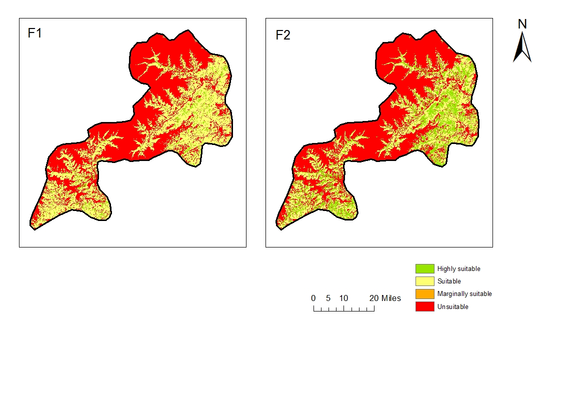
I am now wondering, if there is a way to overlay all these rasters with a tool that will kind of spatially illustrate the likelihood of one area to be highly suitable or suitable or marginally suitable etc. ... I would like to avoid tools that can only compare two maps at a time.
Does anybody have any ideas or suggestions? Thanks very much in advance for any help. 
Cheers,
Carina
- Mark as New
- Bookmark
- Subscribe
- Mute
- Subscribe to RSS Feed
- Permalink
- Report Inappropriate Content
Combine—Help | ArcGIS for Desktop is tool to use.
It produces a result which is the unique combinations of the classes used in each raster. The downside is, that you have to interpret these data in terms of what it is you are trying to show.
For instance, you may have 4 maps and 3 of the 4 maps show 'class 1' for a grouping of different attributesbut the one of the maps has a smattering of other combinations. You will then need to simplify the combine's classification scheme to make it more manageable. So in this example, I might boldly suggest that if 3 of the 4 show this combination, I will go with the majority.
The issue becomes, what is 'class 1' in the different layers. As an example you may have class 1 being suitable for agriculture on may 1... class 1 as low slope on a second map... and class 1 being, low acquisition cost on a 3rd. So putting that information together, I would produce a final map denoting class 1 as being ... cheap, flat land suitable for agriculture. So another class might be more expensive flat land suitable for agriculture, if the 3rd map had class 2 or 3 showing slightly more expensive acquisition costs.
Don't do what most people do... take 4 maps with 5 classes, use the combine tool then end up with a gazillion different classes which could have been simplified greatly but they were too lazy to bring human judgement into the interpretation.
Good luck
- Mark as New
- Bookmark
- Subscribe
- Mute
- Subscribe to RSS Feed
- Permalink
- Report Inappropriate Content
Dan, Are you sure about your link ?
Carina Zacharias, asking for several raster comparison , and your link is about Creating KML !
- Mark as New
- Bookmark
- Subscribe
- Mute
- Subscribe to RSS Feed
- Permalink
- Report Inappropriate Content
good catch!... link fixed, thanks