- Home
- :
- All Communities
- :
- Industries
- :
- Water Resources
- :
- Water Resources Questions
- :
- How do you delineate the watershed draining to a l...
- Subscribe to RSS Feed
- Mark Topic as New
- Mark Topic as Read
- Float this Topic for Current User
- Bookmark
- Subscribe
- Mute
- Printer Friendly Page
How do you delineate the watershed draining to a lake in deranged terrain?
- Mark as New
- Bookmark
- Subscribe
- Mute
- Subscribe to RSS Feed
- Permalink
- Report Inappropriate Content
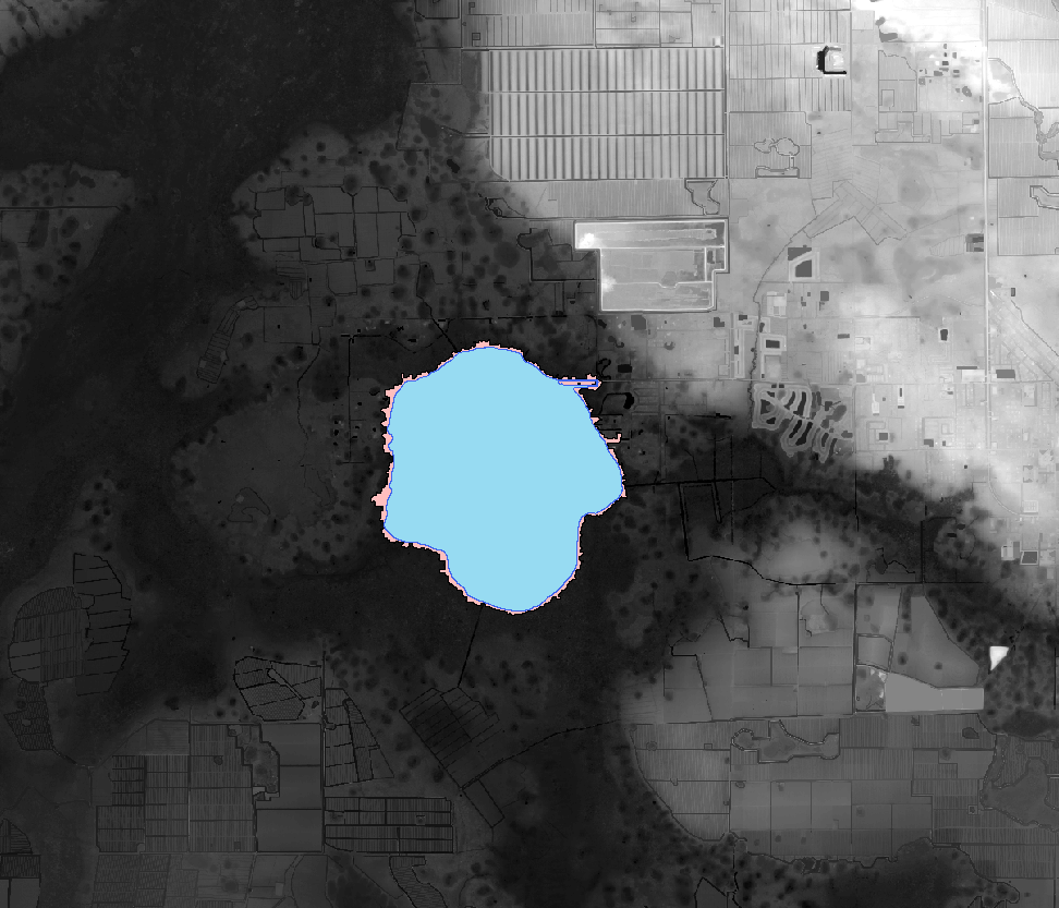
I am delineating a watershed for a lake in southwest Florida and would like to compare other methods and field observations to the output from Arc Hydro. I have never used Arc Hydro before so I am not familiar with the correct workflows for different conditions. I want to find all of the DEM cells that drain to the lake (i.e., everything upstream of the lake). When I use the Basic Deranged Terrain Processing workflow (model builder) and then try the batch watershed delineation for polygons, I only get a watershed that includes the sub-basins that are directly adjacent to the lake (see picture below; the lake is shown in blue and the batch watershed to polygon is shown in pink).
Could someone please help walk me through this starting with creating a project and adding the DEM? I am not confident that I can use the deranged processing workflow since there are some channels present in the watershed. I am not sure that I specified that this was a known sink properly.