- Home
- :
- All Communities
- :
- Products
- :
- ArcGIS Drone2Map
- :
- ArcGIS Drone2Map Questions
- :
- How do I create a 3D dataset?
- Subscribe to RSS Feed
- Mark Topic as New
- Mark Topic as Read
- Float this Topic for Current User
- Bookmark
- Subscribe
- Mute
- Printer Friendly Page
How do I create a 3D dataset?
- Mark as New
- Bookmark
- Subscribe
- Mute
- Subscribe to RSS Feed
- Permalink
- Report Inappropriate Content
Hi,
I've been following the quick start guides and using the 3D datasets found here. However, after Drone2Map finishes processing I'm left with only a 2D mosaic image and some Hillshading. The quick start guides seem to indicate it'll make me LAS data. Where is that? Also how do i then use that - In ArcGIS Pro? Is there a streamlined workflow for that?
- Mark as New
- Bookmark
- Subscribe
- Mute
- Subscribe to RSS Feed
- Permalink
- Report Inappropriate Content
If you select the Rapid project template you will only generate the Orthomosaic and the Digital Surface Model. By choosing the Mapping project template:
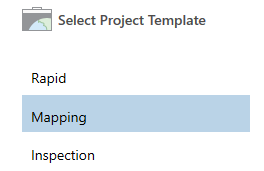
... you will be able to generate more products and products with a higher precision (including 3D Point Clouds and a 3D Textured Mesh).
Inside your project folder you will find a products folder and inside that folder there will be a folder called "3D" with the 3D products.
- Mark as New
- Bookmark
- Subscribe
- Mute
- Subscribe to RSS Feed
- Permalink
- Report Inappropriate Content
Hi Xander Bakker,
thanks for pointing me to that file location. However, can I not display the 3D content inside Drone2Map? Do i need to bring it into ArcGIS Pro?
Thanks
- Mark as New
- Bookmark
- Subscribe
- Mute
- Subscribe to RSS Feed
- Permalink
- Report Inappropriate Content
Hi Andrew Hargreaves ,
As far as I understand, the 3D products are not visualized in Drone2Map. You can use ArcGIS Pro, ArcScene, ArcGlobe or CityEngine (?) for this purpose. I believe that the 3D Mesh can be visualized in ArcGIS Pro (starting at version 1.3) and will be able to be published to ArcGIS Online.
- Mark as New
- Bookmark
- Subscribe
- Mute
- Subscribe to RSS Feed
- Permalink
- Report Inappropriate Content
Hi all,
Drone2Map v2 is based on the ArcGIS Pro core and can open Scenes and visualize 3D data in Scenes ... see here: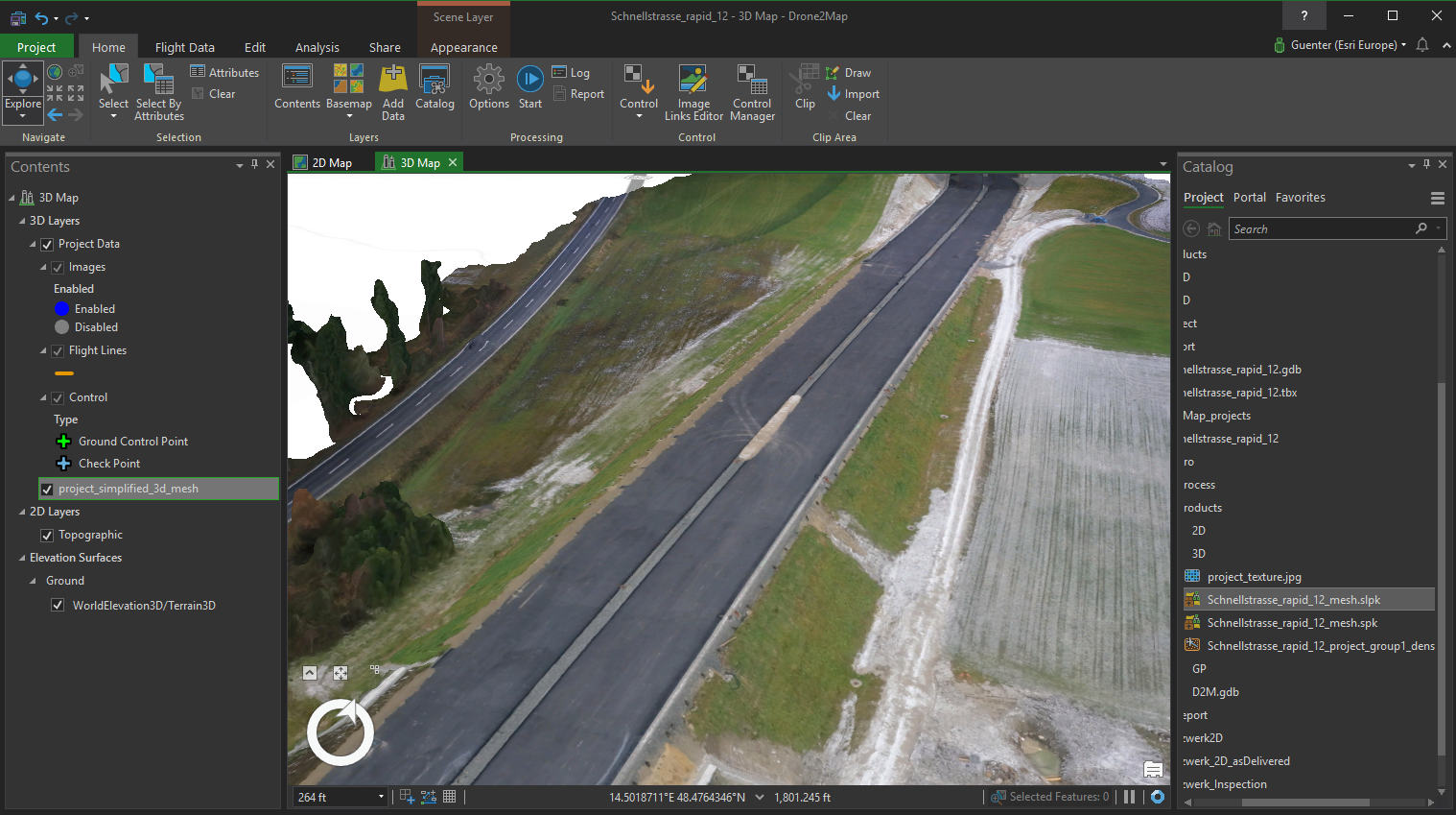
So check out the version 
Regards
Guenter