Turn on suggestions
Auto-suggest helps you quickly narrow down your search results by suggesting possible matches as you type.
Cancel
- Home
- :
- All Communities
- :
- Products
- :
- Mapping and Charting Solutions
- :
- Mapping and Charting Questions
- :
- ArcGIS Online World Imagery - Update Frequency
Options
- Subscribe to RSS Feed
- Mark Topic as New
- Mark Topic as Read
- Float this Topic for Current User
- Bookmark
- Subscribe
- Mute
- Printer Friendly Page
ArcGIS Online World Imagery - Update Frequency
Subscribe
2095
0
01-18-2016 09:57 AM
01-18-2016
09:57 AM
- Mark as New
- Bookmark
- Subscribe
- Mute
- Subscribe to RSS Feed
- Permalink
- Report Inappropriate Content
I appreciate Esri's ArcGIS Online World Imagery service, I just wish that it was updated as frequently as other services.
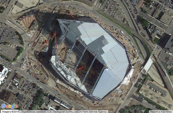
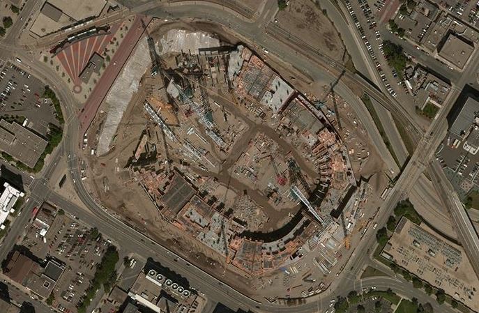
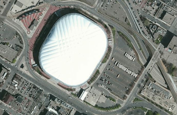
Examples of satellite imagery from various sources taken today.
Downtown Minneapolis, Minnesota – site of the new U.S. Bank Stadium under construction.
Google Satellite
(New stadium further along in construction)
Bing Satellite
(New stadium under construction)
HERE & ArcGIS Online Satellite
(The old Metrodome before being torn down for the new stadium. Demolition began 01/2014)
0 Replies