- Home
- :
- All Communities
- :
- Products
- :
- ArcGIS Spatial Analyst
- :
- ArcGIS Spatial Analyst Questions
- :
- Stream Order
- Subscribe to RSS Feed
- Mark Topic as New
- Mark Topic as Read
- Float this Topic for Current User
- Bookmark
- Subscribe
- Mute
- Printer Friendly Page
Stream Order
- Mark as New
- Bookmark
- Subscribe
- Mute
- Subscribe to RSS Feed
- Permalink
- Report Inappropriate Content
Hello. I am trying to create a layer that displays stream order but I'm having trouble. I have a stream layer with polylines. My stream layer does not contain any elevation or GPS start stop (node) information. I have a terrain layer with elevation data. I created a DEM with my terrain layer with terrain to raster. I then filled the DEM with Fill. Then I used Flow Direction with the filled elevation layer. At first I was following some other instructions and was created an Flow Accumulation layer and then using a conditional statement. Then I used Stream Order tool. This resulted in somewhat correct, but not actually correct stream order layer. First, the cell size of the stream order was too big so that my streams flowed out of one stream order value and into another at bends, etc. The stream order was also just not correct in some streams. I then made the cell size much smaller on all of the steps: Terrain to Raster, Fill, Flow Direction, Flow Accumulation, Stream Order. However, this resulted in a much worse stream order layer that was not accurate at all.
I also converted my stream layer to raster (Polyline to raster) but didn't know which feature to use (FID, Object ID, COMID, Date, resolution, Flow direction (1 or 0), name, length, type) so I used flow direction which resulted in a raster containing values of 0 and 1. Using this as the stream input for Stream Order Tool and using the filled Flow Direction for the flow direction input still did not give me an accurate stream order.
I then did the polyline to raster with smaller cells and used FID as my feature then created a conditional statement to say that everything with a value is 1 and everything with no value (nothing) is 0. This created a raster that outlined my streams pretty well.
However, again when I try to calculate stream order with this stream raster and with the small cell size filled flow direction, the stream order is completely wrong. A first order stream segment may start as 1st, change to 2nd, change back to 1st, change to 3rd, change back to 1st, etc.
Can anyone offer me some help?
- Mark as New
- Bookmark
- Subscribe
- Mute
- Subscribe to RSS Feed
- Permalink
- Report Inappropriate Content
You cannot create a stream order vector dataset from previously supplied streams. These could be digitized in any direction and do not contain any flow info. It sounds like the first approach you were following is the correct one. But the output will depend on your input DEM. This may not agree with you existing stream vectors. There are numerous reasons for this, data sources, resolution etc etc.
- Mark as New
- Bookmark
- Subscribe
- Mute
- Subscribe to RSS Feed
- Permalink
- Report Inappropriate Content
When I change symbology to include an arrow, the arrows are facing the correct way for my stream polylines. So there's no way I can use my current stream polyline file?
There are thousands of streams in this file but I only need a select few (~100) to display stream order).
If I can't use my current stream polyline layer, then why do I get completely incorrect stream orders when I make my cell size smaller for flow direction and flow accumulation?
- Mark as New
- Bookmark
- Subscribe
- Mute
- Subscribe to RSS Feed
- Permalink
- Report Inappropriate Content
I may not completely understand what you're after but if you have a stream with multiple polylines and you are trying to get them in a correct order you could go stream by stream and use Sort—Help | ArcGIS for Desktop to sort your streams, this method would require an advanced license
- Mark as New
- Bookmark
- Subscribe
- Mute
- Subscribe to RSS Feed
- Permalink
- Report Inappropriate Content
For folks who are curious about what stream ordering is, here's some information:
How Stream Order Works
Strahler number - Wikipedia, the free encyclopedia
Food for thought:
If one were to run the entire Mississippi River drainage, think about the value differences between the Shreve and Strahler ordering for the same segment of the Mississippi River near New Orleans. The Shreve system would result in a slightly higher value.... 
Chris Donohue, GISP
- Mark as New
- Bookmark
- Subscribe
- Mute
- Subscribe to RSS Feed
- Permalink
- Report Inappropriate Content
Minor request, but may help with troubleshooting - are you trying for a specific stream order system, like Shreve or Strahler?
order_method (Optional)
The method used for assigning stream order.
- STRAHLER — The method of stream ordering proposed by Strahler in 1952. Stream order only increases when streams of the same order intersect. Therefore, the intersection of a first-order and second-order link will remain a second-order link, rather than creating a third-order link. This is the default.
- SHREVE — The method of stream ordering by magnitude, proposed by Shreve in 1967. All links with no tributaries are assigned a magnitude (order) of one. Magnitudes are additive downslope. When two links intersect, their magnitudes are added and assigned to the downslope link.
Source: ArcGIS Help 10.1
Chris Donohue, GISP
- Mark as New
- Bookmark
- Subscribe
- Mute
- Subscribe to RSS Feed
- Permalink
- Report Inappropriate Content
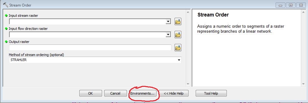
I'm using Strahler method.
- Mark as New
- Bookmark
- Subscribe
- Mute
- Subscribe to RSS Feed
- Permalink
- Report Inappropriate Content
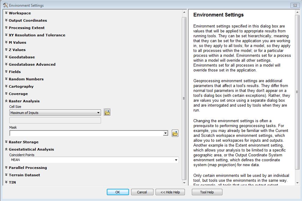
I wonder if the cell size is being defaulted too coarse as the data gets processed. Are you employing Environments Settings when running the tools? I would check these in any event, as they sometimes default to settings that cause unexpected results.
Chris Donohue, GISP