Turn on suggestions
Auto-suggest helps you quickly narrow down your search results by suggesting possible matches as you type.
Cancel
- Home
- :
- All Communities
- :
- Developers
- :
- JavaScript Maps SDK
- :
- JavaScript Maps SDK Questions
- :
- labels are stacked together on the same location
Options
- Subscribe to RSS Feed
- Mark Topic as New
- Mark Topic as Read
- Float this Topic for Current User
- Bookmark
- Subscribe
- Mute
- Printer Friendly Page
labels are stacked together on the same location
Subscribe
2774
2
12-03-2015 07:49 AM
12-03-2015
07:49 AM
- Mark as New
- Bookmark
- Subscribe
- Mute
- Subscribe to RSS Feed
- Permalink
- Report Inappropriate Content
Hi,
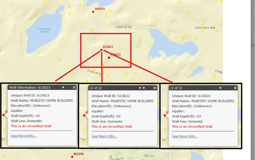
I have water well layer and some wells(say, 3 wells) fall on the same calculated location with different well id. In ArcMap the labels are shown separately, but in js API, they stack together. I checked the reference and I didn't find a right label placement for it. I might miss something. Is there a way to show them separately, or just change a custom label for the group of wells.
Any input is appreciated.
li
2 Replies
12-03-2015
07:59 AM
- Mark as New
- Bookmark
- Subscribe
- Mute
- Subscribe to RSS Feed
- Permalink
- Report Inappropriate Content
Can you post a screen shot of how it looks now?
12-03-2015
08:22 AM
- Mark as New
- Bookmark
- Subscribe
- Mute
- Subscribe to RSS Feed
- Permalink
- Report Inappropriate Content