- Home
- :
- All Communities
- :
- Products
- :
- Spatial Statistics
- :
- Spatial Statistics Questions
- :
- Spatial Statistics Script Tools (Spatial Autocorre...
- Subscribe to RSS Feed
- Mark Topic as New
- Mark Topic as Read
- Float this Topic for Current User
- Bookmark
- Subscribe
- Mute
- Printer Friendly Page
Spatial Statistics Script Tools (Spatial Autocorrelation)
- Mark as New
- Bookmark
- Subscribe
- Mute
- Subscribe to RSS Feed
- Permalink
- Report Inappropriate Content
Hello,
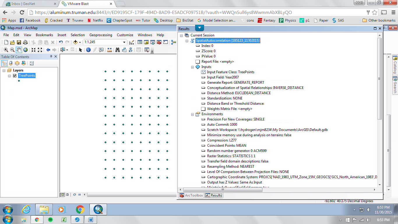
I've been trying to run spatial autocorrelation on an ordinal grid of count data in ArcGIS 10.1. (I have a little over 100 data points with associated count values). The test runs to completion almost instantly with no errors, except the output is completely empty - no Z-score, no P-value, and no report file. After experimenting further, I found that all of the script tools in the spatial statistics toolbox produced this same issue - no errors but zero output. Am I missing something? Is there any reason why script tools won't work for me, but regular tools will?
P.S. - I'm on a university network license. Both Python 2.7 and 3.4 are installed on the network. I can't successfully install further modules if needed because I don't have permissions on the network.
Thanks for your help!
Solved! Go to Solution.
Accepted Solutions
- Mark as New
- Bookmark
- Subscribe
- Mute
- Subscribe to RSS Feed
- Permalink
- Report Inappropriate Content
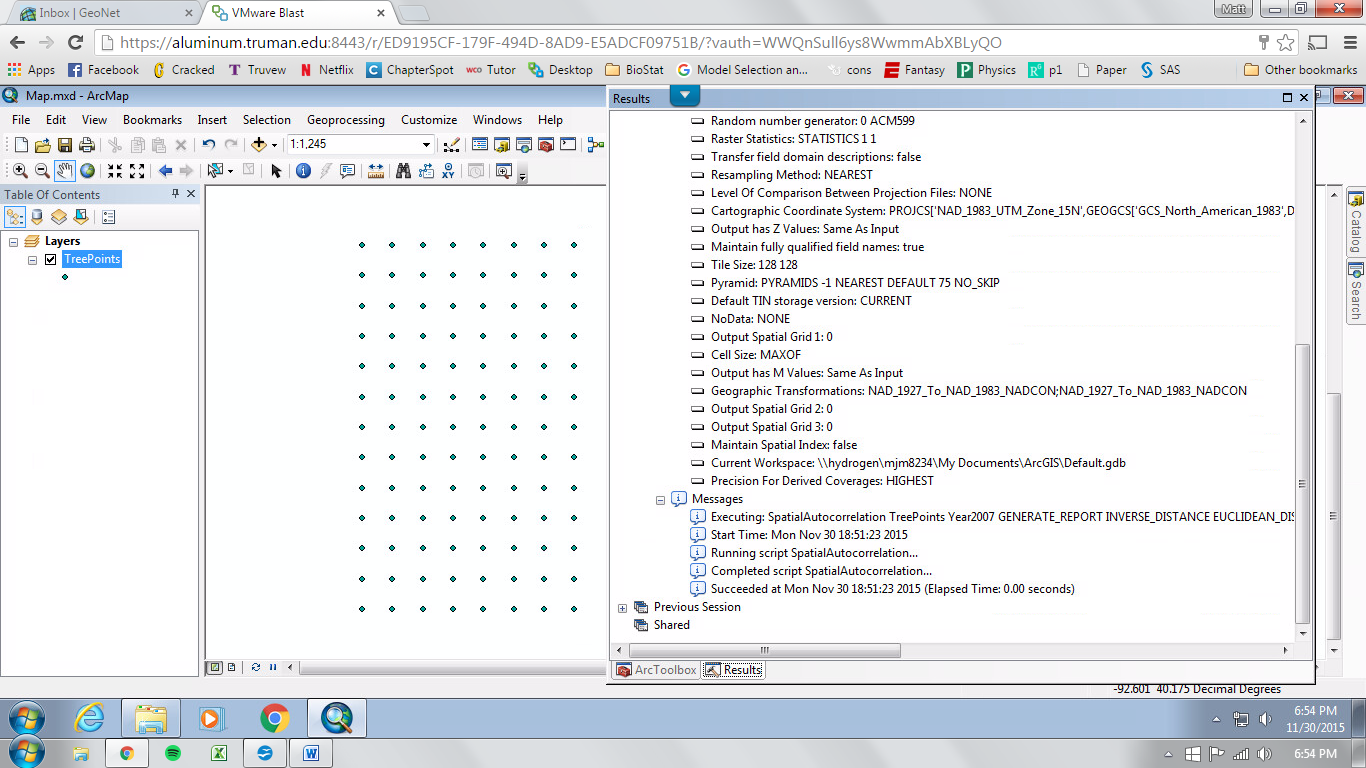
Your current and scratch workspace are going to geodatabases in a... My Documents ...blah blah folder (notice the space...). At this point I would suggest making a local folder like c:\mystuff copy the point file there, set everything to point to there and run the tool there. I couldn't catch the full results thing since you did a full screen grab rather than a grab of the results window.
- Mark as New
- Bookmark
- Subscribe
- Mute
- Subscribe to RSS Feed
- Permalink
- Report Inappropriate Content
Just to clarify... are you running the processes through the toolbox in arcmap and not as standalone scripts ? (the correct answer would be yes). If you are running the tools from the toolboxes, then you will have to provide more information because, things go bad, if you are ... loading/saving files from locations that contain spaces... are the sources and destinations on a local computer...not in some User folder....not on a USB drive... etc etc Most of the problems arise from file management issues.
- Mark as New
- Bookmark
- Subscribe
- Mute
- Subscribe to RSS Feed
- Permalink
- Report Inappropriate Content
Thanks for your quick feedback! I'll try to provide more information and hopefully something will jump out at you as the problem.
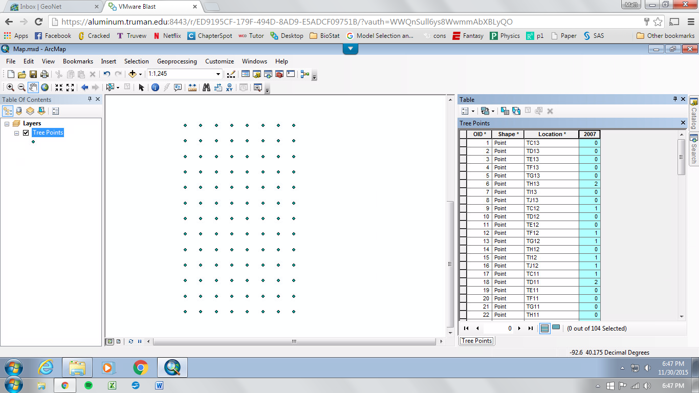
Yes, I am running the tools from the toolbox window in ArcMap and not as standalone scripts. My feature layer, the grid of points with associated values, doesn't have any spaces in the location name, and is located in the geodatabase which I've been using to create my map, which is stored on my university user (basically a local drive, except connected through the school network). The feature and map are both projected in NAD83 UTM Zone 15. I added the count data to the spatial points later as a new field using editor (type=double). Most points have a zero count, and the rest are positive integers (no null values in the data set).
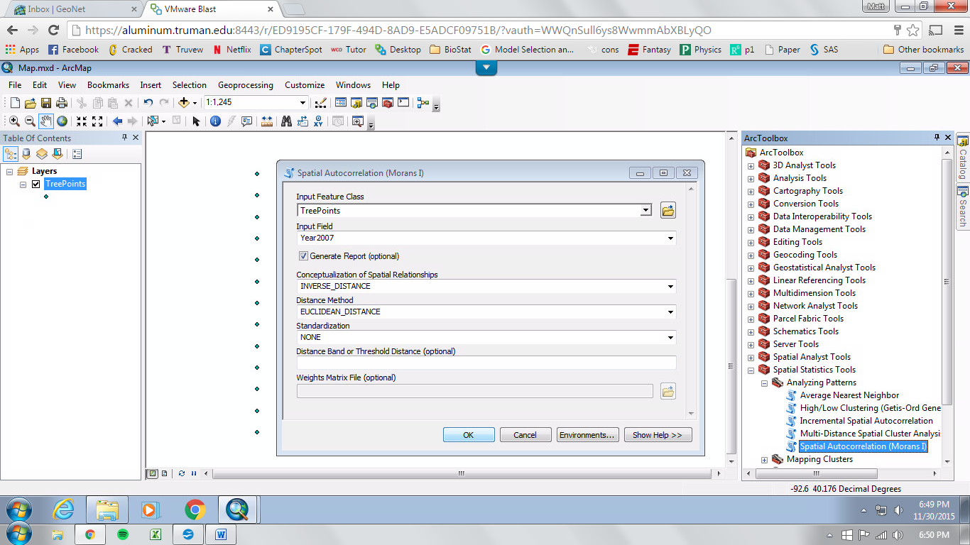
When I open the dialog box to run a spatial statistics script tool, my desired feature layer and field appear and are selectable without a hitch. The remaining dialog options haven't had an effect on the results no matter how much I play with them. When I click to run the script tool, the process finishes without errors almost instantly. I've included screenshots of the input and results window below. Sorry if they're a bit small and out of order. Does anything pop out as alarming?
Thanks so much for your help!
- Mark as New
- Bookmark
- Subscribe
- Mute
- Subscribe to RSS Feed
- Permalink
- Report Inappropriate Content
Your current and scratch workspace are going to geodatabases in a... My Documents ...blah blah folder (notice the space...). At this point I would suggest making a local folder like c:\mystuff copy the point file there, set everything to point to there and run the tool there. I couldn't catch the full results thing since you did a full screen grab rather than a grab of the results window.
- Mark as New
- Bookmark
- Subscribe
- Mute
- Subscribe to RSS Feed
- Permalink
- Report Inappropriate Content
Oh shoot! I can't believe I missed that.
After following your suggestion to create a different folder with no spaces in the location name, I'm ecstatic to say that it worked! Thank you so much for your help!