- Home
- :
- All Communities
- :
- User Groups
- :
- Cartography and Maps
- :
- Questions
- :
- Street Symbols - Custom Basemap
- Subscribe to RSS Feed
- Mark Topic as New
- Mark Topic as Read
- Float this Topic for Current User
- Bookmark
- Subscribe
- Mute
- Printer Friendly Page
- Mark as New
- Bookmark
- Subscribe
- Mute
- Subscribe to RSS Feed
- Permalink
- Report Inappropriate Content
Hi,
I am curretnly facing a problem with my street layer for a custom basemap. The problem is that the way in which the streets layer is drawn creates an overlap with other streets (see attached image). Is there a way to fix/remove this? 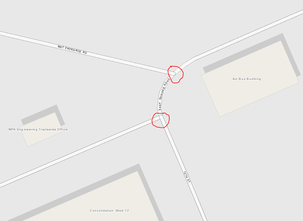
Solved! Go to Solution.
Accepted Solutions
- Mark as New
- Bookmark
- Subscribe
- Mute
- Subscribe to RSS Feed
- Permalink
- Report Inappropriate Content
Go to the ArcGIS Help and look up "symbol level drawing". By setting symbol levels you can "merge/order/remove" boundaries for lines that connect to each other.
- Mark as New
- Bookmark
- Subscribe
- Mute
- Subscribe to RSS Feed
- Permalink
- Report Inappropriate Content
Go to the ArcGIS Help and look up "symbol level drawing". By setting symbol levels you can "merge/order/remove" boundaries for lines that connect to each other.
- Mark as New
- Bookmark
- Subscribe
- Mute
- Subscribe to RSS Feed
- Permalink
- Report Inappropriate Content
My organization has also created a custom basemap with streets and using Symbol Levels with Join resolved the same issue you were having.
- Mark as New
- Bookmark
- Subscribe
- Mute
- Subscribe to RSS Feed
- Permalink
- Report Inappropriate Content
Thanks guys, I appreciate the feedback. This is my first time creating a custom basemap. I'm finding that working with centerline data is a huge task in itself. Any tips on grouping/sorting centerline data?
- Mark as New
- Bookmark
- Subscribe
- Mute
- Subscribe to RSS Feed
- Permalink
- Report Inappropriate Content
You want to keep the symbology simple for the basemap, but I do think you would want to differentiate primary roads (interstates, state roads, county roads) from secondary roads with at the least different colors such as a grey and white.