- Home
- :
- All Communities
- :
- Products
- :
- ArcGIS Spatial Analyst
- :
- ArcGIS Spatial Analyst Questions
- :
- Calculating standard deviations of elevation withi...
- Subscribe to RSS Feed
- Mark Topic as New
- Mark Topic as Read
- Float this Topic for Current User
- Bookmark
- Subscribe
- Mute
- Printer Friendly Page
Calculating standard deviations of elevation within specific buffers
- Mark as New
- Bookmark
- Subscribe
- Mute
- Subscribe to RSS Feed
- Permalink
- Report Inappropriate Content
I'm fairly new to GIS and I haven't been able to find much on this specific topic in the ESRI community.
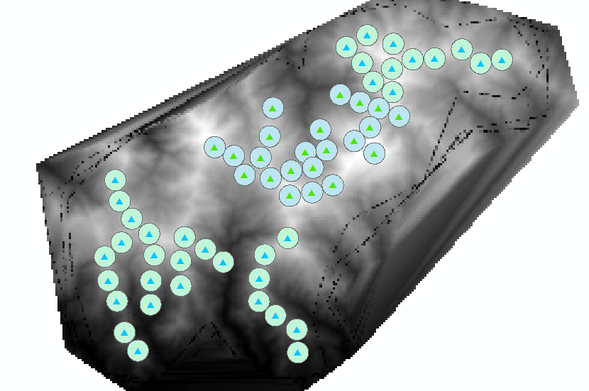
I would like to be able to calculate a "Terrain Ruggedness" index for each one of my sites in my study area and found a couple different suggestions, but I think calculating the standard deviation of elevation would give me useful values. The problem is I can't find how to calculate this within specific buffers. For example, I have made a TIN from a contour shapefile around my sites (Figure 1; edited with river shapefile) and then converted that to a Raster shapefile (Figure 2). I've made 500m buffers around each site and would like to calculate the standard deviation of elevation within those buffers for each site. OR really any kind of value that could measure "terrain ruggedness" within each buffer.
Are there any suggestions on how to do this?
Thanks!
Jess
Figure 1. TIN
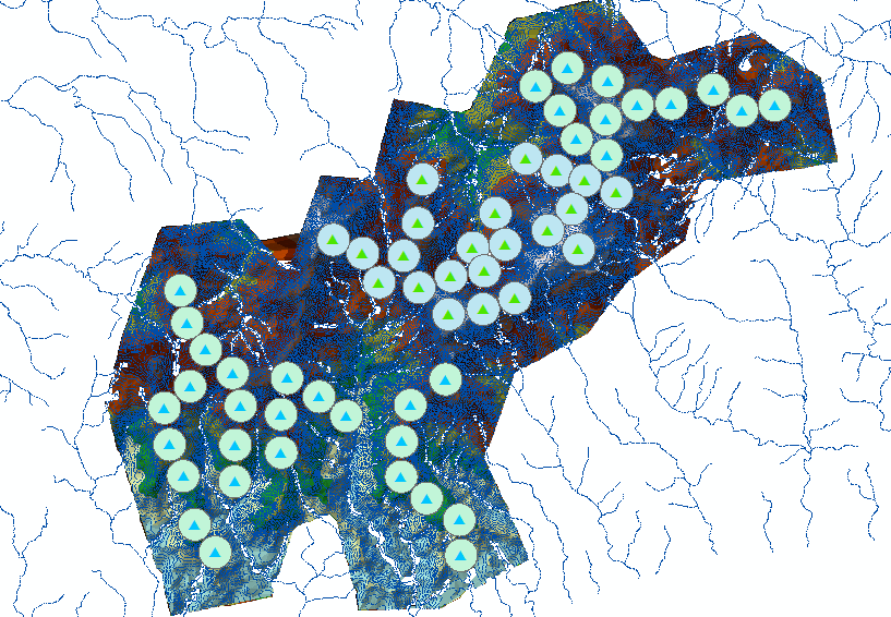
Figure 2. Raster
- Mark as New
- Bookmark
- Subscribe
- Mute
- Subscribe to RSS Feed
- Permalink
- Report Inappropriate Content
Since you marked this question "Assumed Answered" you might wish to share on how you did it should anyone come across this thread in a search for similar answers...otherwise this post will be ignored by many since it looks like you don't need any help ... which may or may not be the case
- Mark as New
- Bookmark
- Subscribe
- Mute
- Subscribe to RSS Feed
- Permalink
- Report Inappropriate Content
Thanks Dan. I actually accidentally marked the question "Assumed Answered" and now can't figure out how to erase or edit it. So I will repost and hope that people ignore this first one. Thanks!
- Mark as New
- Bookmark
- Subscribe
- Mute
- Subscribe to RSS Feed
- Permalink
- Report Inappropriate Content
Jessica - if what you want is simply the standard deviation of a DEM within a neighborhood (radius) you can simply use the Focal Statistics tool with the default circular neighborhood and radius of the distance you want, and the STD option.
Or if you want a terrain ruggedness index tool that already exists, there is a free toolbox for Geomorphometry and Gradient Metrics created by Jeff Evans which includes a Roughness tool that is based upon the Riley et al 1999 Terrain Ruggedness Index approach.
http://evansmurphy.wix.com/evansspatial#!arcgis-gradient-metrics-toolbox/crro
Steve
- Mark as New
- Bookmark
- Subscribe
- Mute
- Subscribe to RSS Feed
- Permalink
- Report Inappropriate Content
Thank you, I think I figured it out!
- Mark as New
- Bookmark
- Subscribe
- Mute
- Subscribe to RSS Feed
- Permalink
- Report Inappropriate Content
So do you actually have an answer to this question? If so, can you please share it? I'm trying to calculate the TRI from the standard deviation of elevation but with a 1 km distance from each cell. Where and how do I specify the 1 km? Thanks.