- Home
- :
- All Communities
- :
- Products
- :
- Mapping and Charting Solutions
- :
- Mapping and Charting Questions
- :
- Exclamation mark next to layers
- Subscribe to RSS Feed
- Mark Topic as New
- Mark Topic as Read
- Float this Topic for Current User
- Bookmark
- Subscribe
- Mute
- Printer Friendly Page
Exclamation mark next to layers
- Mark as New
- Bookmark
- Subscribe
- Mute
- Subscribe to RSS Feed
- Permalink
- Report Inappropriate Content
What does an exclamation mark next to a layer indicate? Is it that it cannot locate the file? Is there a way to remap the layer so the data can be found?
- Mark as New
- Bookmark
- Subscribe
- Mute
- Subscribe to RSS Feed
- Permalink
- Report Inappropriate Content
Kay,
A red Exclamation mark indicates that a layer cannot be mapped.
Yes there is a few ways. One way is to open the layer properties.
Go to the source tab.
Click the Set Data Source button.
Find where the layer is located.
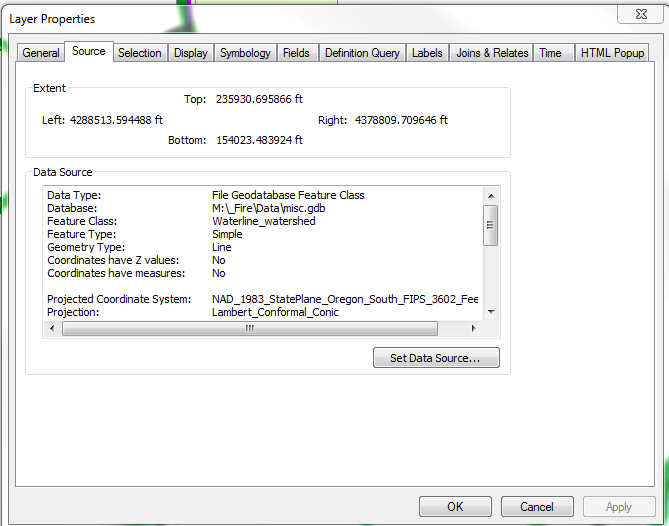
Reasons that this can happen is if you transfer the mxd to a different computer,
Move the layer to another locate, Delete the layer.
If you want to map multiple ArcCatalog is the best way.
- Mark as New
- Bookmark
- Subscribe
- Mute
- Subscribe to RSS Feed
- Permalink
- Report Inappropriate Content
Is this a 1-time occurrence or are there broken links throughout your organization's mxds?
- Mark as New
- Bookmark
- Subscribe
- Mute
- Subscribe to RSS Feed
- Permalink
- Report Inappropriate Content
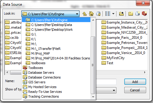
right click on a lost layer
select Data repair data
navigate to the location where the data is located
If you can find it ... and all other data reside in the same location all broken links should be repaired.
if they are repaired, select map document properties, and toggle on the save relative paths checkbox
- Mark as New
- Bookmark
- Subscribe
- Mute
- Subscribe to RSS Feed
- Permalink
- Report Inappropriate Content
As Rickey mentioned, a red exclamation next to a layer means the link to the data has been broken.
You can often relink the data right in ArcMap by clicking on the exclamation point, then browsing to where the data is.
Repairing Broken Data Links
EDIT: Boy, tons of replies came in while I was typing up mine. I guess I have to type faster.... 
Chris Donohue, GISP
- Mark as New
- Bookmark
- Subscribe
- Mute
- Subscribe to RSS Feed
- Permalink
- Report Inappropriate Content
It is the iThingy mind-meld option... I think Rebecca has it too
- Mark as New
- Bookmark
- Subscribe
- Mute
- Subscribe to RSS Feed
- Permalink
- Report Inappropriate Content
That's why this forum is awesome!!!!