- Home
- :
- All Communities
- :
- Products
- :
- ArcGIS CityEngine
- :
- ArcGIS CityEngine Questions
- :
- 3D Printing
- Subscribe to RSS Feed
- Mark Topic as New
- Mark Topic as Read
- Float this Topic for Current User
- Bookmark
- Subscribe
- Mute
- Printer Friendly Page
3D Printing
- Mark as New
- Bookmark
- Subscribe
- Mute
- Subscribe to RSS Feed
- Permalink
- Report Inappropriate Content
My employer has finally decided to print some 3D models of downtown areas to use in community planning. This is a new avenue for me and I wanted to ask a few questions here to people that may have experience with this. I know that my city engine models can be exported to a print-friendly format. However, the model we are ultimately trying to build MUST have topography; And MUST have separate buildings.
a) If I bring in a multipatch file of my buildings into City Engine and perform a simple rule operation...such as coloring...is the geometry tight enough to print?...or should I use and extrude a footprint in CityEngine and print that?
b) If I export an obj of all my model buildings, can I print them one by one (as in not connected) or should i make an obj file for each building?
c) What is a recommended workflow to print a topography base and keep the scale where the individual buildings can sit on the topography as they would in the CityEngine Model?
d) Can a large topography (lets say an 8x8 -- 10x10 Model topography (no buildings)) be printed from CityEngine ; how to make it thick enough to sit on a table (the on-screen terrains look paper thin) ?
I think the idea is to get the topography from somewhere ....and have a smaller 3D printer in-house to print buildings and smaller entities on.
Any advice would be greatly appreciated on how to go about this project.Matthias Buehler
- Mark as New
- Bookmark
- Subscribe
- Mute
- Subscribe to RSS Feed
- Permalink
- Report Inappropriate Content
Did you ever find a good workflow for printing a topography base? I'm having the same issue myself and have tried a few things that have failed, so I'm still looking!
- Mark as New
- Bookmark
- Subscribe
- Mute
- Subscribe to RSS Feed
- Permalink
- Report Inappropriate Content
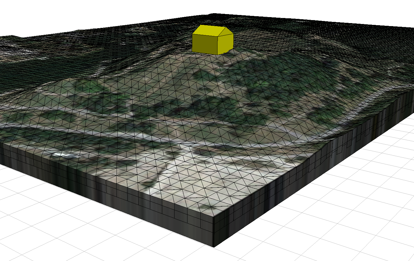
I played around with making a solid terrain a while ago, this was my rather janky result. The basic idea was to triangulate a shape then align it to the terrain, grab the lowest part's y-pos and subtract the current part's y-pos + x to extrude downward. Top it off with a thick plate from below and then slap an aerial image on top of that. If someone wants to know more, I'll try to remember the steps