- Home
- :
- All Communities
- :
- Products
- :
- ArcGIS Enterprise
- :
- ArcGIS Enterprise Questions
- :
- how to make a map of tourist routes
- Subscribe to RSS Feed
- Mark Topic as New
- Mark Topic as Read
- Float this Topic for Current User
- Bookmark
- Subscribe
- Mute
- Printer Friendly Page
how to make a map of tourist routes
- Mark as New
- Bookmark
- Subscribe
- Mute
- Subscribe to RSS Feed
- Permalink
- Report Inappropriate Content
I have a few tours, each tourist route has several tourist attractions(tourist spots), how do I create a travel map base on tourist route, now I do not have an idea yet, any ideas? I am very new to map trip tourist route and would appreciate any assistance on this. thanks you!!!
- Mark as New
- Bookmark
- Subscribe
- Mute
- Subscribe to RSS Feed
- Permalink
- Report Inappropriate Content
Hi La Sinh, that's a bit of a broad question. What have you done/tried so far? Essentially, you'll need to choose a basemap, which you can do from the add data button, and then create line and point features classes, and digitize the attractions and route as features.
- Mark as New
- Bookmark
- Subscribe
- Mute
- Subscribe to RSS Feed
- Permalink
- Report Inappropriate Content
thanks Sephe Fox, i has basemap and spots ponts on map,I have found points and display them on the map, but i do not create lines through the points? how create lines through points? how digitize the attractions and route as features?
- Mark as New
- Bookmark
- Subscribe
- Mute
- Subscribe to RSS Feed
- Permalink
- Report Inappropriate Content
Since you don't specify if the map has to be printed or digital, I would like to draw your attention to this blog post
Creating a multimedia trail web map | ArcGIS Blog (a bit dated, but nice anyway)
To create the routes, you can use a tool that connects the points and creates a line (ArcGIS Help (10.2, 10.2.1, and 10.2.2) , but that will just create straight lines between the points. Maybe this is not what you want and perhaps you have to use routing to connect the points and create the route. See Plan Routes—ArcGIS Online Help | ArcGIS
Do you have an example from somewhere else that shows what you want to achieve and can you include an image of what you have up to now? That will make it easier to suggest what you should do.
You placed this thread in ArcGIS for Server , so may I assume that you have ArcGIS for Server, or is it just Desktop you have?
- Mark as New
- Bookmark
- Subscribe
- Mute
- Subscribe to RSS Feed
- Permalink
- Report Inappropriate Content
I want to create a map of the tourist routes in a province or a city
I use ArcGIS Server to store services cachde map, use ArcGIS Desktop to map editor.
now I've created a web application but only show tourist attractions, not showing the route passing tourist attractions.I added pictures and video to the point in the infowindow of ArcGIS api for javascrip
My problem is how to display the route information and route through the points, thank you
- Mark as New
- Bookmark
- Subscribe
- Mute
- Subscribe to RSS Feed
- Permalink
- Report Inappropriate Content
First use the Create Feature Class tool, from the Data Management toolbox to create a polyline feature class. Then, with the empty feature class added to your map, right click it, and select edit. You can then draw you line using the editing tools. You may want to set your snapping to snap to other features , such as points and roads, and you may want to use the trace tool to follow along the roads.
- Mark as New
- Bookmark
- Subscribe
- Mute
- Subscribe to RSS Feed
- Permalink
- Report Inappropriate Content
Thanks repply!! Say what you mean mean to use ArcGIS Desktop to do this, But I want create web map application.
While using trace tool, is it allowed to display information routes and route passing tourist attractions? how to line snapping to snap to points features and roads features.?
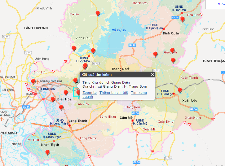
I want to create a map of the tourist routes in a province or a city
I use ArcGIS Server to store services cachde map, use ArcGIS Desktop to map editor.
now I've created a web application but only show tourist attractions, not showing the route passing tourist attractions.I added pictures and video to the point in the infowindow of ArcGIS api for javascrip
My problem is how to display the route information and route through the points, thank you
Current web application I have done like the image below do not connect the tourist attractions of tourist routes