- Home
- :
- All Communities
- :
- Products
- :
- ArcGIS Online
- :
- ArcGIS Online Questions
- :
- Georeference alignment problem Balkan
- Subscribe to RSS Feed
- Mark Topic as New
- Mark Topic as Read
- Float this Topic for Current User
- Bookmark
- Subscribe
- Mute
- Printer Friendly Page
Georeference alignment problem Balkan
- Mark as New
- Bookmark
- Subscribe
- Mute
- Subscribe to RSS Feed
- Permalink
- Report Inappropriate Content
Hello all,
I could use some advise trying to understand where a problem could arise...
I encountered an inconsistency georeferencing maps of the Macedonia. I am using the MGI Balkan 7 coordinate system. Although the coordinates of the scanned maps and Arcmap match perfectly, the geographic location of features on the scanned maps and the ESRI world topographic map do not align, but are shifted by roughly 500m East-West! As an example just compare the country borders on the image below.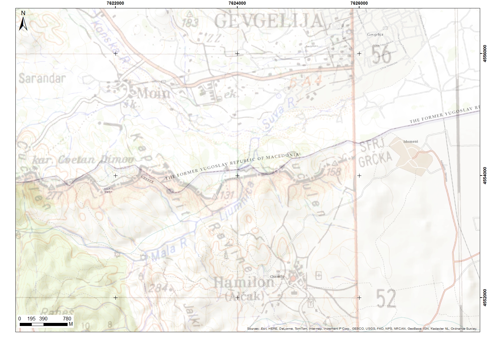
This problem arises in all the maps I have for this area. Normally I use the ESRI world topographic map as base layer to georeference to - it is my Bible. But could it be that in some coordinate systems this base layer is not displayed correctly? Any ideas on where this problem could arise and on what I can take as the 'true' location of any geographic position would be most welcome.
Thanks!
- Mark as New
- Bookmark
- Subscribe
- Mute
- Subscribe to RSS Feed
- Permalink
- Report Inappropriate Content
do they have the same datum? Having the same coordinate system means having the same coordinates and datum
- Mark as New
- Bookmark
- Subscribe
- Mute
- Subscribe to RSS Feed
- Permalink
- Report Inappropriate Content
Hello Dan,
Thanks for your reply and good point. They do seem to have the same datum.
The only mismatch I find comparing the dataframe properties with the parameters for Balkan maps as I found on
MGI / Balkans coordinate systems - spatial-analyst.net
is a difference in semimajor axis value of 6377397.155m as opposed to 6377483.865 m...
I normally do not have to look that closely at the parameters, so I'm not sure if that could make the difference?
- Mark as New
- Bookmark
- Subscribe
- Mute
- Subscribe to RSS Feed
- Permalink
- Report Inappropriate Content
Firstly, from your snapshot, it only shows some ' inconsistency' along the boundary.
If that is true, you should treat your maps as correct ones, rather than relying on ESRI basemaps (like topo).
So, to verify if your maps have misalignments against ESRI maps, you should check other features like city roads....
Secondly, if your maps have spatial displacement issue, it is good idea to find and use other local references (Macedonia, Balkan, Italy...) to geo-correct ...
Generally speaking, in many areas in the world (especially, mountainous areas or developing nations), georefeencing operations shouldn't reply on ESRI basemap...
- Mark as New
- Bookmark
- Subscribe
- Mute
- Subscribe to RSS Feed
- Permalink
- Report Inappropriate Content
Thanks Iarry, good to know.
The misalignment is for all features, including roads, rivers. And a few hunderds of meters seems too much to me to ignore, so I would like to understand where the mismatch comes from.
- Mark as New
- Bookmark
- Subscribe
- Mute
- Subscribe to RSS Feed
- Permalink
- Report Inappropriate Content
As mentioned above, if you really want find out where the issue comes, that is, your maps having wrong operation when georefrencing (which were based on wrong references), or others, you have to use your local reference maps to compare/ verify, rather than ESRI basemap.