- Home
- :
- All Communities
- :
- Products
- :
- Imagery and Remote Sensing
- :
- Imagery Questions
- :
- Split Raster tool results in black images
- Subscribe to RSS Feed
- Mark Topic as New
- Mark Topic as Read
- Float this Topic for Current User
- Bookmark
- Subscribe
- Mute
- Printer Friendly Page
Split Raster tool results in black images
- Mark as New
- Bookmark
- Subscribe
- Mute
- Subscribe to RSS Feed
- Permalink
- Report Inappropriate Content
I have a rather large raster that I am trying to split into small tiles in PNG format. I came across the Split Raster tool and thought it would do exactly what I wanted, so I tried using it. The result was a series of raster in the correct place, but they were all completely black. When I tried to add them in ArcMap they looked fine, but everywhere else they were black. I thought maybe the raster was too large, so I tried it on a small segment and the exact same thing happened. Anyone know what the problem is and/or how to fix this? It would be much easier and faster than trying to figure out a way to do this programatically using clip and a series of square polygons.
- Mark as New
- Bookmark
- Subscribe
- Mute
- Subscribe to RSS Feed
- Permalink
- Report Inappropriate Content
if you wanted to tile them, then split probably isn't the route to go. check into raster catalogs or if you only have a few, set your analysis extent to different values corresponding to your desired output then copy the raster out. Only the cells within the extent get copied over
- Mark as New
- Bookmark
- Subscribe
- Mute
- Subscribe to RSS Feed
- Permalink
- Report Inappropriate Content
Can you clarify this sentence?
When I tried to add them in ArcMap they looked fine, but everywhere else they were black.
What does "everywhere else" mean? Do you mean they appear black in other software?
- Mark as New
- Bookmark
- Subscribe
- Mute
- Subscribe to RSS Feed
- Permalink
- Report Inappropriate Content
Correct, if I view the PNG tiles in windows viewer or paint or any other image editing/viewing software they appear as black images, including the software we use to generate our GIS web site.
- Mark as New
- Bookmark
- Subscribe
- Mute
- Subscribe to RSS Feed
- Permalink
- Report Inappropriate Content
and you specified the same file output type ? same with a different output type?
- Mark as New
- Bookmark
- Subscribe
- Mute
- Subscribe to RSS Feed
- Permalink
- Report Inappropriate Content
The input is a large tif file, output format was set to be PNG. I tried outputting tifs to see if it would make a difference, and the same thing happened, black rasters were outputted.
- Mark as New
- Bookmark
- Subscribe
- Mute
- Subscribe to RSS Feed
- Permalink
- Report Inappropriate Content
I am not so worried about the color, but the range of values in the raster. It sounds like the image is being stretched. you can confirm that in the symbology tab, have a look at the classification type and examine its histogram to ensure that you have valid data to begin with and not just one value
- Mark as New
- Bookmark
- Subscribe
- Mute
- Subscribe to RSS Feed
- Permalink
- Report Inappropriate Content
The raster I'm trying to split is a hillshade model, the values range from 0 to 255.
- Mark as New
- Bookmark
- Subscribe
- Mute
- Subscribe to RSS Feed
- Permalink
- Report Inappropriate Content
Matt,
Can you just screenshot of what you were trying to do so we can see what will it looks like ?
- Mark as New
- Bookmark
- Subscribe
- Mute
- Subscribe to RSS Feed
- Permalink
- Report Inappropriate Content
I have a giant hillshade model: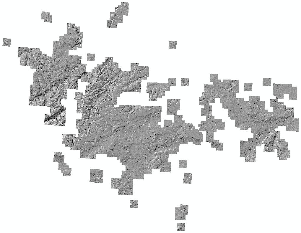
When I run the split raster tool to split this into smaller PNG images to post on my company's GIS web mapping site, I get a whole bunch of these:
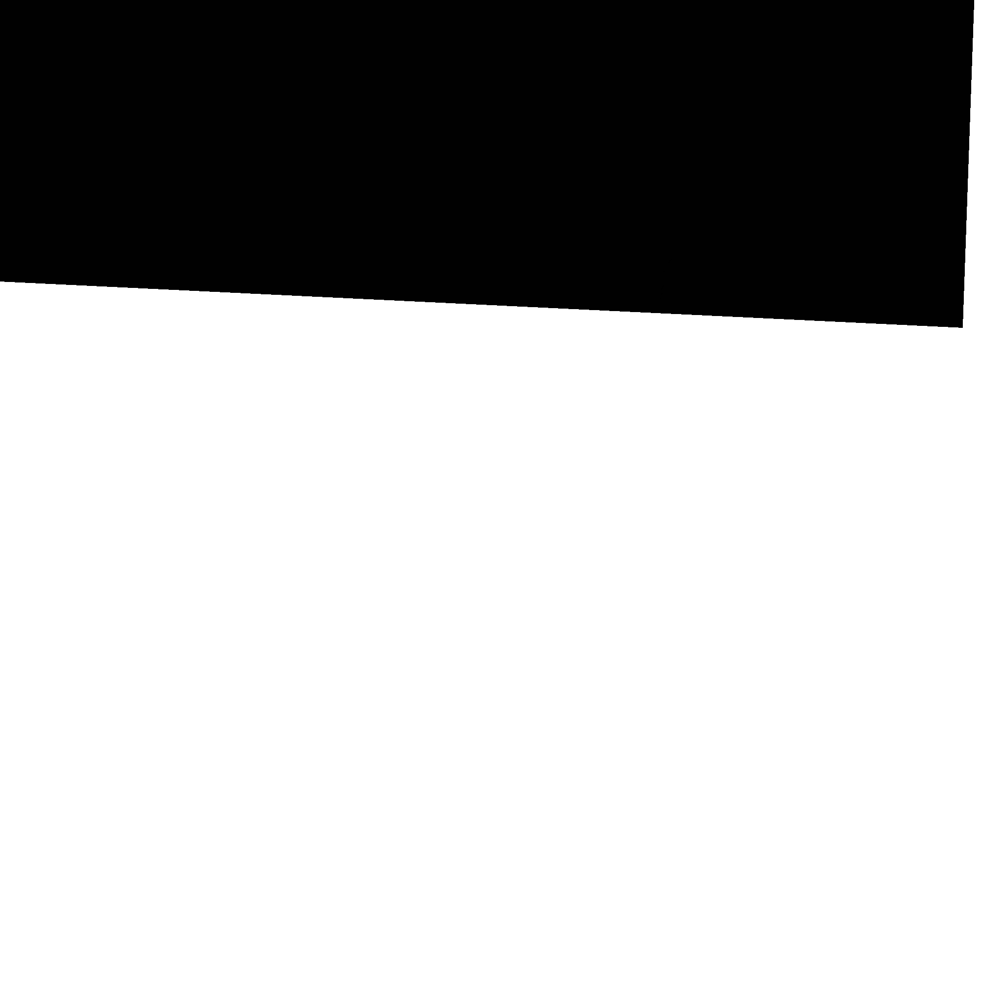
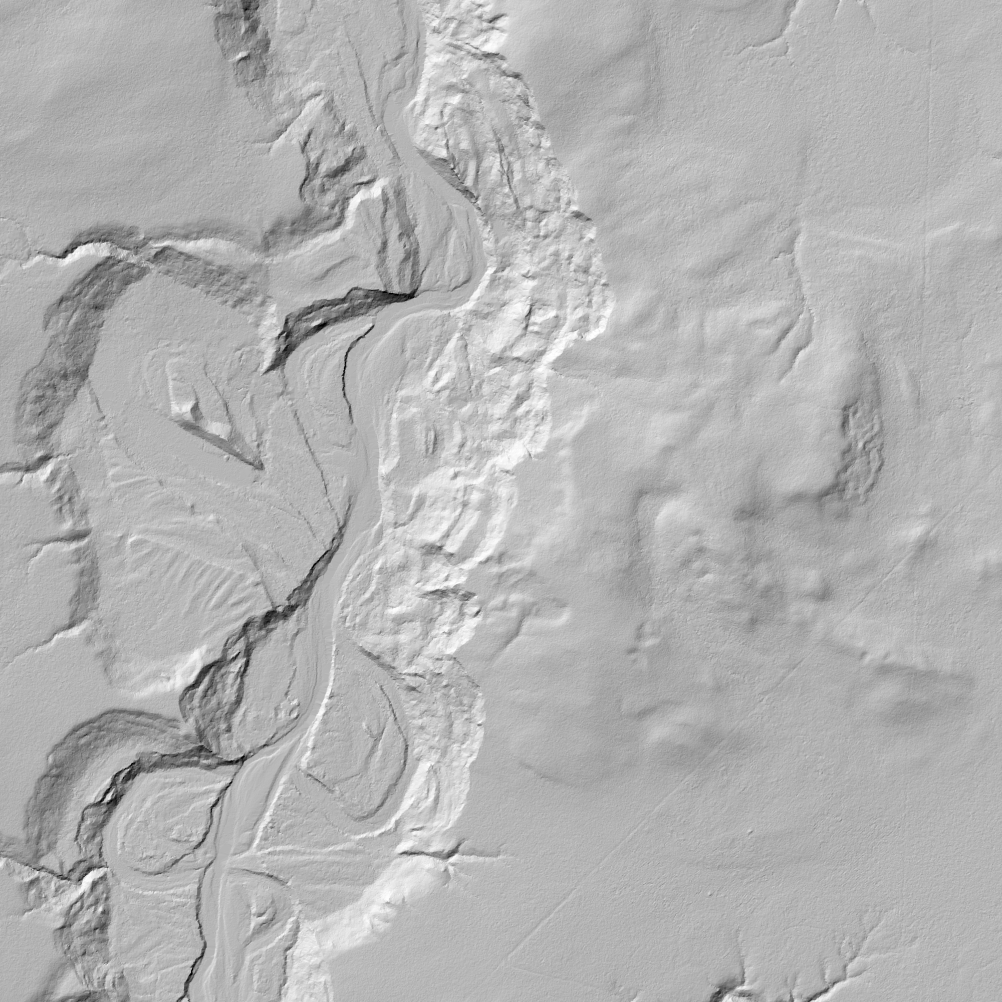
Spatially they are in the correct location and the extents are correct, they just all come out black. As I said in my original post, they look fine in ArcMap but in any other type of software they appear as black.