Turn on suggestions
Auto-suggest helps you quickly narrow down your search results by suggesting possible matches as you type.
Cancel
- Home
- :
- All Communities
- :
- Products
- :
- ArcGIS Spatial Analyst
- :
- ArcGIS Spatial Analyst Questions
- :
- Problem with time-Cost Distance analysis
Options
- Subscribe to RSS Feed
- Mark Topic as New
- Mark Topic as Read
- Float this Topic for Current User
- Bookmark
- Subscribe
- Mute
- Printer Friendly Page
Problem with time-Cost Distance analysis
Subscribe
3687
0
03-01-2015 09:35 PM
03-01-2015
09:35 PM
- Mark as New
- Bookmark
- Subscribe
- Mute
- Subscribe to RSS Feed
- Permalink
- Report Inappropriate Content
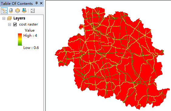
Hi there, I want to use traffic network to calculate the time-cost distance.
I valued the 1*1Km fishnet by the time cost (minutes per kilometer) of each kind of road, and the fishnet was converted into cost raster. Then I had a distance raster. But I don't understand the meaning of the distance raster' pixel value!? How can I use the distance raster to draw a map of time-distance of a city?

0 Replies