- Home
- :
- All Communities
- :
- Developers
- :
- JavaScript Maps SDK
- :
- JavaScript Maps SDK Questions
- :
- How can I print an overview map in an inset box?
- Subscribe to RSS Feed
- Mark Topic as New
- Mark Topic as Read
- Float this Topic for Current User
- Bookmark
- Subscribe
- Mute
- Printer Friendly Page
How can I print an overview map in an inset box?
- Mark as New
- Bookmark
- Subscribe
- Mute
- Subscribe to RSS Feed
- Permalink
- Report Inappropriate Content
I would like to include an inset box that displays an overview map when the user prints it. Here is may app that has print functionality in it:
maps.decaturil.gov/decaturPrintMulti
Click on the hammer.
Click on the printer.
And then the print dialog comes up. I would like to include a checkbox with a default checked to include the overview map. Any ideas?
Solved! Go to Solution.
Accepted Solutions
- Mark as New
- Bookmark
- Subscribe
- Mute
- Subscribe to RSS Feed
- Permalink
- Report Inappropriate Content
You'll need publishing permission on ArcGIS Server too, so chat to the server admin about that. Here is a tutorial page for publishing printing services.
As for the overview map, you can read up on using an extent indicator. Basically you will need an additional data frame in your MXD - one for the main map and one for showing the overview map. Once you've finalised your MXD with an overview map, it must be added to the print templates folder and the print service must be republished.
- Mark as New
- Bookmark
- Subscribe
- Mute
- Subscribe to RSS Feed
- Permalink
- Report Inappropriate Content
I don't think you can manipulate a print template dynamically, therefore I would set up 2 different print templates for each page size: one with an overview map data frame and one without. Then if the user ticks the option for including an overview map, select print template 1, otherwise print template 2 without the overview map.
- Mark as New
- Bookmark
- Subscribe
- Mute
- Subscribe to RSS Feed
- Permalink
- Report Inappropriate Content
I really need the overview map as an inset. I am wanting to migrate something from ArcView and need to keep it simple for the user.
- Mark as New
- Bookmark
- Subscribe
- Mute
- Subscribe to RSS Feed
- Permalink
- Report Inappropriate Content
Just for clarification, must the overview map display in the app in a separate container or in the printout map?
- Mark as New
- Bookmark
- Subscribe
- Mute
- Subscribe to RSS Feed
- Permalink
- Report Inappropriate Content
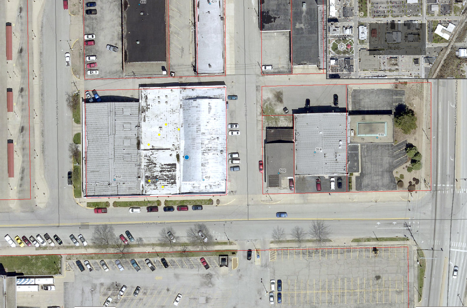
I want it to display in the single printout map to make it simple for the user like in the following image and with a border around it so it's easier to see. The overview is in the upper right hand corner here.
- Mark as New
- Bookmark
- Subscribe
- Mute
- Subscribe to RSS Feed
- Permalink
- Report Inappropriate Content
The print service you are using only uses the default print layouts and none of them has the option for an overview map. You will need to set up a custom print template MXD (for each page size) that contains an additional data frame for the overview map, copy the new templates to your print templates folder (C:\Program Files (x86)\ArcGIS\Desktop10.2\Templates\ExportWebMapTemplates or create/select another folder which your ArcGIS Server has access to) and then republish the print service again with the Export Web Map tool. You should then be able to use one of the new print templates with an overview map as part of your print service. Check out my very basic jsFiddle example.
You will have to decide on a background image service for your overview map's data frame in the new print template MXD - this cannot be changed when calling the print task unfortunately. Also, the overview map's extent indicator cannot be set transparent in ArcGIS.
- Mark as New
- Bookmark
- Subscribe
- Mute
- Subscribe to RSS Feed
- Permalink
- Report Inappropriate Content
I don't get into ArcMap as much and I never have published a print service. Could you outline the steps that I need to do to make this work? Your example does what I want my app to do; I'm just not sure how to put it together.
- Mark as New
- Bookmark
- Subscribe
- Mute
- Subscribe to RSS Feed
- Permalink
- Report Inappropriate Content
You'll need publishing permission on ArcGIS Server too, so chat to the server admin about that. Here is a tutorial page for publishing printing services.
As for the overview map, you can read up on using an extent indicator. Basically you will need an additional data frame in your MXD - one for the main map and one for showing the overview map. Once you've finalised your MXD with an overview map, it must be added to the print templates folder and the print service must be republished.
- Mark as New
- Bookmark
- Subscribe
- Mute
- Subscribe to RSS Feed
- Permalink
- Report Inappropriate Content
Awesome! I will give it a go. If I run into problems, I will start a new thread. Thanks!
- Mark as New
- Bookmark
- Subscribe
- Mute
- Subscribe to RSS Feed
- Permalink
- Report Inappropriate Content
Thanks for your JSFiddle example. It is pretty neat to try. However, when I try to print with overview selected, I got a blank PDF. Could you please fix it if possible? I need to create a custom print layout with an inset, however, the map is only showing on the active frame. Is there something I should do so the map will appear on both frames?