- Home
- :
- All Communities
- :
- User Groups
- :
- Coordinate Reference Systems
- :
- Questions
- :
- How to alter a Conic projection
- Subscribe to RSS Feed
- Mark Topic as New
- Mark Topic as Read
- Float this Topic for Current User
- Bookmark
- Subscribe
- Mute
- Printer Friendly Page
How to alter a Conic projection
- Mark as New
- Bookmark
- Subscribe
- Mute
- Subscribe to RSS Feed
- Permalink
- Report Inappropriate Content
I am making a print map of Russia. I think I need to use an Albers Conic projection. I can move the central meridian to center the map on the middle of Russia according to that meridian. How do I adjust the map in regards to the central parallel? Essentially, I would like to slide the center of the map up so that Russia appears to "wrap" around the north pole more.
- Mark as New
- Bookmark
- Subscribe
- Mute
- Subscribe to RSS Feed
- Permalink
- Report Inappropriate Content
All I did was select the Asia albers in PCS/Continental/Asia, then copy and modify it. Changed the central meridian to 110degE, and changed the standard parallels to 70 & 75. There is a 15deg graticule on top so that you can see conic projection better. It seems that as you push the SP further north, the "cone" gets tighter.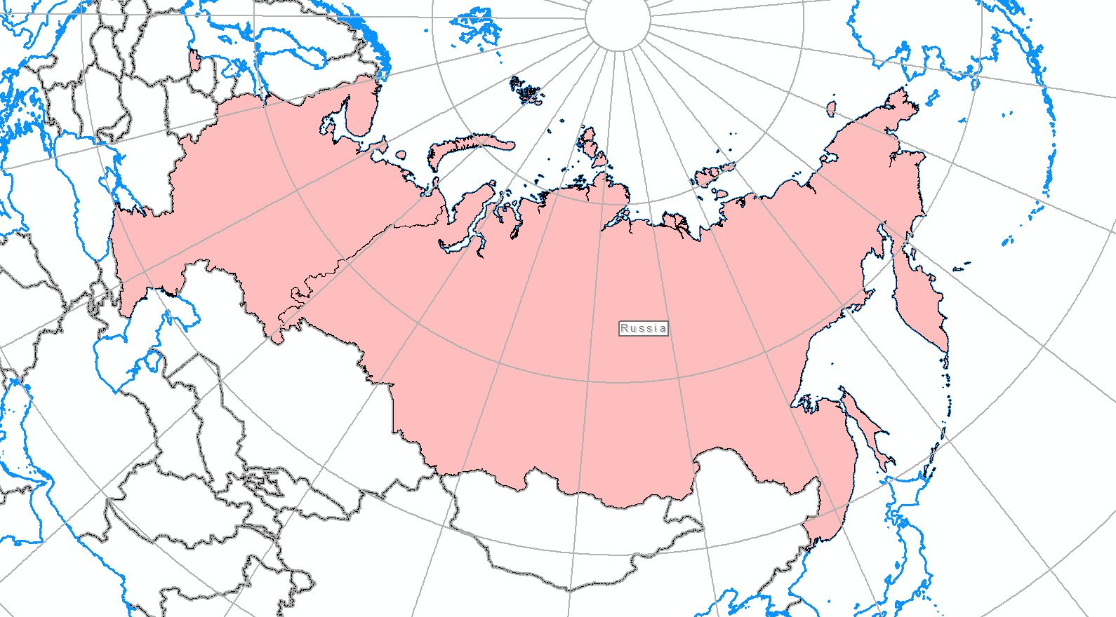
- Mark as New
- Bookmark
- Subscribe
- Mute
- Subscribe to RSS Feed
- Permalink
- Report Inappropriate Content
Thanks Neil - I was able to produce that result too. I think that will do the trick.