- Home
- :
- All Communities
- :
- Products
- :
- ArcGIS Spatial Analyst
- :
- ArcGIS Spatial Analyst Questions
- :
- SRTM 30m DEM: Fill Voids
- Subscribe to RSS Feed
- Mark Topic as New
- Mark Topic as Read
- Float this Topic for Current User
- Bookmark
- Subscribe
- Mute
- Printer Friendly Page
- Mark as New
- Bookmark
- Subscribe
- Mute
- Subscribe to RSS Feed
- Permalink
- Report Inappropriate Content
I've recently downloaded the SRTM 30m DEM tiles from the USGS Earth Explorer website. The current version of the SRTM 30m DEM has numerous voids that need to be filled. I'd like to hear from the GIS community on the most appropriate methods that can be used to fill the voids within adding additional systematic errors to the DEM.
I was considering resampling the SRTM 90m DEM using the natural neighbours to 30m and using the following to fill the voids within the raw SRTM 30m DEM. Would the following yeild better results than simply filling the voids from the surrounding cells. I'm concerned that some of the voids are pretty large and simply filling the voids from the surrounding cells would not represent the actual topographic features correctly.
If anyone has gone through a similar exercise, please would you mind explaining the functions\tools that you used within ArcGIS to accomplish the following.
Regards
Peter Wilson
Solved! Go to Solution.
Accepted Solutions
- Mark as New
- Bookmark
- Subscribe
- Mute
- Subscribe to RSS Feed
- Permalink
- Report Inappropriate Content
Peter,
Share with you below:
Traditionally, there are three types of methods to fill voids in DEM like SRTM, which are available in ArcGIS.
A method to fill voids uses a variety of interpolators; a method to determine the most appropriate void filling algorithms using a classification of the voids based on their size and a typology of their surrounding terrain; and the classification of the most appropriate algorithm for each of the voids in the SRTM data.
Obviously, the choice of void filling algorithm is dependent on both the size and terrain type of the void. Generally, the best methods can be generalized as: Kriging or Inverse Distance Weighting interpolation for small and medium size voids in relatively flat low-lying areas; Spline interpolation for small and medium sized voids in high altitude and dissected terrain; Triangular Irregular Network or Inverse Distance Weighting interpolation for large voids in very flat areas, and an advanced Spline Method (ANUDEM) for large voids in other terrains.
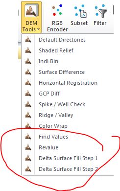
However, it looks to me that two latest methods (Fill and Feather method, Delta Surface Fill) are mostly recommended to do DEM/ DTM filling task in operation (attachment)...
- Mark as New
- Bookmark
- Subscribe
- Mute
- Subscribe to RSS Feed
- Permalink
- Report Inappropriate Content
Peter,
Share with you below:
Traditionally, there are three types of methods to fill voids in DEM like SRTM, which are available in ArcGIS.
A method to fill voids uses a variety of interpolators; a method to determine the most appropriate void filling algorithms using a classification of the voids based on their size and a typology of their surrounding terrain; and the classification of the most appropriate algorithm for each of the voids in the SRTM data.
Obviously, the choice of void filling algorithm is dependent on both the size and terrain type of the void. Generally, the best methods can be generalized as: Kriging or Inverse Distance Weighting interpolation for small and medium size voids in relatively flat low-lying areas; Spline interpolation for small and medium sized voids in high altitude and dissected terrain; Triangular Irregular Network or Inverse Distance Weighting interpolation for large voids in very flat areas, and an advanced Spline Method (ANUDEM) for large voids in other terrains.
However, it looks to me that two latest methods (Fill and Feather method, Delta Surface Fill) are mostly recommended to do DEM/ DTM filling task in operation (attachment)...
- Mark as New
- Bookmark
- Subscribe
- Mute
- Subscribe to RSS Feed
- Permalink
- Report Inappropriate Content
Dear Larry
Thanks for the following its truly appreciated. I'm going to follow the suggested approach by NGIA as I'm working with the SRTM 30m DEM (1 Arc Second) for Africa and going to use the SRTM 90m DEM (3 Arc Second) to fill the voids based on their suggested approach.
Regards
- Mark as New
- Bookmark
- Subscribe
- Mute
- Subscribe to RSS Feed
- Permalink
- Report Inappropriate Content
Sounds good.
If so, DSF workflow within ERDAS can be used to help you ...
- Mark as New
- Bookmark
- Subscribe
- Mute
- Subscribe to RSS Feed
- Permalink
- Report Inappropriate Content
It has been nearly 2 years since the original question was asked. Can anyone recommend what is the best method to fill SRTM 30m holes now? I am thinking of filling the holes using SRTM 90m. What is the best approach to do this in ArcGIS? What tools would be best to use? I was thinking of mosaicing to a new raster using SRTM 30 and 90, and using the method 'minimum' instead of the default, would this be the best approach?
Thanks