- Home
- :
- All Communities
- :
- Products
- :
- 3D
- :
- 3D Questions
- :
- How to Import multibeam XYZ data
- Subscribe to RSS Feed
- Mark Topic as New
- Mark Topic as Read
- Float this Topic for Current User
- Bookmark
- Subscribe
- Mute
- Printer Friendly Page
How to Import multibeam XYZ data
- Mark as New
- Bookmark
- Subscribe
- Mute
- Subscribe to RSS Feed
- Permalink
- Report Inappropriate Content
Hi,
I work for a survey company and we are exploring ways of manipulating the multibeam data acquired.
We have huge amount of these data in XYZ form (easting, northing and depth), most of them are too big to view in Excel or Note Pad.
My question is this, how can I import this data into ArcMap, and also how can I create a raster files from these data and perform slope angle calculation?
Many thanks
- Mark as New
- Bookmark
- Subscribe
- Mute
- Subscribe to RSS Feed
- Permalink
- Report Inappropriate Content
Quite large point files can be built into tin models deirectly. From there to a raster visualization is easy.
If you have very large datasets then terrains might be the answer.
http://resources.arcgis.com/en/help/main/10.2/#/What_is_a_terrain_dataset/005v00000002000000/
http://resources.arcgis.com/en/help/main/10.2/#/What_is_a_TIN_surface/006000000001000000/
- Mark as New
- Bookmark
- Subscribe
- Mute
- Subscribe to RSS Feed
- Permalink
- Report Inappropriate Content
But you need to have the tabular data converted to vector data firs,t and to do that use Make XY Event Layer in ArcToolbox.
1. Convert your tabular data to vector data.
2. Create your TIN or terrain as you see fit.
3. Use the geoprocessing tools in ArcToolbox to generate a slope surface.
- Mark as New
- Bookmark
- Subscribe
- Mute
- Subscribe to RSS Feed
- Permalink
- Report Inappropriate Content
Hi Gerry,
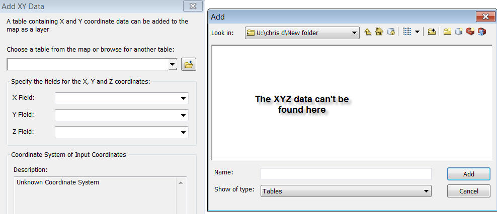
I tried add the data as X,Y in ArcMap but wasn't sucessful. Any tips? I'm barely 1 week old into arcmap.
- Mark as New
- Bookmark
- Subscribe
- Mute
- Subscribe to RSS Feed
- Permalink
- Report Inappropriate Content
Chris, in what way was your attempt to import the data "unsuccessful"....
What did you try?
What is the structure of the text, csv, tab separated.
There is an Excel to Table tool in the Toolbox (Conversion tools / Excel).
If the files are not gigantic, then you could use the text importing dialogs in Access and create a feature from that.
Create Events will also allow you to point to a text file directly.
I think you need to tell us exactly what you have tried so far, and what the data actually looks like if you want someone to help.
- Mark as New
- Bookmark
- Subscribe
- Mute
- Subscribe to RSS Feed
- Permalink
- Report Inappropriate Content
Hi Neil,
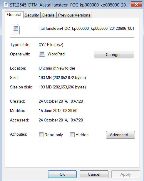
The XYZ data is so gigantic that I can't open it. It was sent to us by a client, when I tried opening it with excel it wouldn't let me.
I went on arcmap, tried adding layer as x,y and arcmap cannot seem to find the XYZ data.
- Mark as New
- Bookmark
- Subscribe
- Mute
- Subscribe to RSS Feed
- Permalink
- Report Inappropriate Content
Have you tried this:
Importing .xyz files containing nodes coordinates
I'm a newbie too, just trying to help...
- Mark as New
- Bookmark
- Subscribe
- Mute
- Subscribe to RSS Feed
- Permalink
- Report Inappropriate Content
chris,
xyz file is a commom format applied in survey (terrain), marine (seabed), and geology (subsurface lith and faults, ...).
With ArcGIS 10.x (3D), the gp tool called 'ASCII 3D To Feature Class' can help you to bring into Feature Class (point). The Spatial Reference should be provided properly. Pls refer to ArcGIS Help (10.2, 10.2.1, and 10.2.2)
Once point FC obtained, many gp tools can help you FC to raster terrain. For example, ArcGIS Help (10.2, 10.2.1, and 10.2.2) and ArcGIS Help (10.2, 10.2.1, and 10.2.2)
Aspect can be from ArcGIS Help (10.2, 10.2.1, and 10.2.2)