- Home
- :
- All Communities
- :
- Products
- :
- ArcGIS Online
- :
- ArcGIS Online Questions
- :
- World Geocode Service Issue
- Subscribe to RSS Feed
- Mark Topic as New
- Mark Topic as Read
- Float this Topic for Current User
- Bookmark
- Subscribe
- Mute
- Printer Friendly Page
World Geocode Service Issue
- Mark as New
- Bookmark
- Subscribe
- Mute
- Subscribe to RSS Feed
- Permalink
- Report Inappropriate Content
I am trying to use the World Geocode Service to batch geocode addresses across the U.S. However, whenever I do so, I get the following error message:
"There was an error trying to process this table. ArcGIS Online subscription is required for geocoding the table of addresses."
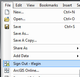
The problem is that I am actually logged into ArcGIS Online when this happens (see image). Perhaps I have the wrong subscription type?! I can't tell though, despite my efforts to figure this out.
This is especially annoying for multiple reasons, among them. 1. It worked in previous versions of the software; 2. There are free batch geocoders online; and 3. There are other desktop solutions (e.g. QGIS with the Nominatim and Google web services) that are fully functional.
As an educator and an individual who promotes GIS solutions, I am finding it increasingly difficult to promote Esri products, especially when something as basic and near universal as geocoding is not properly functioning. I implore Esri to fix this.
- Mark as New
- Bookmark
- Subscribe
- Mute
- Subscribe to RSS Feed
- Permalink
- Report Inappropriate Content
Todd,
You would need an organizational subscription or a developer subscription to do this, since it will use credits. Maybe you could look into getting a educational account?
Tim
- Mark as New
- Bookmark
- Subscribe
- Mute
- Subscribe to RSS Feed
- Permalink
- Report Inappropriate Content
You can log into ArcMap with a global esri account but it won't allow you to use the World Geocoding Service. The ArcGIS Online account is separate. Depending on what state you are in, ArcGIS Online Educational Subscriptions may be free.
- Mark as New
- Bookmark
- Subscribe
- Mute
- Subscribe to RSS Feed
- Permalink
- Report Inappropriate Content
I would assume our educational subscription should be "free" since we have a campus-wide license. This begs the question of how I would check this and how I would go about using this account?
I am still flummoxed as to what Esri hopes to achieve with this business model when such services are freely and readily available elsewhere. I am left shaking my head in disbelief.
- Mark as New
- Bookmark
- Subscribe
- Mute
- Subscribe to RSS Feed
- Permalink
- Report Inappropriate Content
When I mentioned educational, I was referring to K-12. You could contact ESRI with your customer number and check on your subscription to see what's all included.
- Mark as New
- Bookmark
- Subscribe
- Mute
- Subscribe to RSS Feed
- Permalink
- Report Inappropriate Content
You may also find this list of geocoders useful.
- Mark as New
- Bookmark
- Subscribe
- Mute
- Subscribe to RSS Feed
- Permalink
- Report Inappropriate Content
There is a 30 day free trial that grants you 200 credits for free.
The credit fee for geocoding is 40 credits per 1,000 geocodes
- Mark as New
- Bookmark
- Subscribe
- Mute
- Subscribe to RSS Feed
- Permalink
- Report Inappropriate Content
Todd, I know this might be a bit obvious, but the ArcGIS desktop Geocoding tools do work fine to geocode addresses as well. You may find it that geocoding the addresses with out the use of a service that is based upon a cost recovery model (data and services cost money to support), is the best approach. If you have solid road data or places names data and or property info, you can geocode just fine with out a ArcGIS Server service. The added benefit of doing this is that you can govern the quality control. Many answer machine base geocoders such as Bing and Google are built to give you an answer "no matter what". This is often worst than getting no information back. They all are sourcing their data back to just one or two commercial clearing houses, which charge for access, e.g., NavTec.
Absent this approach, you need to be in an organizational AGOL subscription with the rights to send credits (which are money).
- Mark as New
- Bookmark
- Subscribe
- Mute
- Subscribe to RSS Feed
- Permalink
- Report Inappropriate Content
In a nutshell, this is a problem. Previously, Esri made its default address locator available for free. It was very useful if you were needing a quick answer to a problem. For instance, if you have to geocode in a very large area, it is easier to use a canned geocoding service rather than building your own based on available data. It wasn’t perfect, but it worked.
Esri makes a lot of money off its customers already. This is just another way for it to gauge us. It is getting to the point of being ridiculous.
Todd Fagin
Oklahoma Natural Heritage Inventory/
Department of Geography and Environmental Sustainability
- Mark as New
- Bookmark
- Subscribe
- Mute
- Subscribe to RSS Feed
- Permalink
- Report Inappropriate Content
Todd, this is not the case at all. Many many for profit business give away services and products with the intention of getting the customers accustom to the product or its utility. This was no different. It is called a “loss leader”. There is no gouging on behalf of a company that sells services and supplies (software). Credits are incredible cheap and they are the cost of doing business for those that do not wish to set up their own enterprise GIS services with ArcGIS Server. Think of it this way, they are making it possible for you to have ArcGIS Server experiences for a work breakdown schedule of individual parts as services (software as a service), rather than asking you to buy the entire system. Credits cost only 1% of total costs relative to the costs of setting up an ArcGIS for Server Enterprise system. You are essentially getting something much better than you had before for a very low cost.
Respectfully,
Ross Paul Martin – County GIS Manager