- Home
- :
- All Communities
- :
- Products
- :
- Mapping
- :
- Mapping Questions
- :
- Layers with same projections, scales are way off a...
- Subscribe to RSS Feed
- Mark Topic as New
- Mark Topic as Read
- Float this Topic for Current User
- Bookmark
- Subscribe
- Mute
- Printer Friendly Page
Layers with same projections, scales are way off and layers don't overlap.
- Mark as New
- Bookmark
- Subscribe
- Mute
- Subscribe to RSS Feed
- Permalink
- Report Inappropriate Content
I am working with ArcMap 9.2 but when I learned the program in school I worked with ArcMap 10 so I'm having to learn some different functions. I have added a shapefile collected by a Trimble GeoExplorer 6000 in the field, differentially corrected and shapefile created in ArcCatalog. Once added to ArcMap with the aerial (both shapefile and aerial have the same projection: NAD_1983_StatePlane_Georgia_East_FIPS_1001) the two are not overlapping and when I zoom to layer for the shapefile the scale is 1:0.551492 while the aerial zoom to layer gives me a scale of 1:299,915.
I have tried georeferencing and reprojecting both layers to the UTM 17N projections (project is in Wilkinson County, GA) with no luck changing the scale.
What steps am I missing? I have had this problem before, trying to pinpoint the source, had this problem with several groups of data collected in the field and then applied to ArcMap in the office.
Thanks in advance,
Hannah
- Mark as New
- Bookmark
- Subscribe
- Mute
- Subscribe to RSS Feed
- Permalink
- Report Inappropriate Content
Something tells me the corrected data may have an issue. Do you have access to the the uncorrected shp files/raw data? If you do, what happens when you bring them into ArcGIS? Do they line up properly? If you are post-processing data and the parameters are not set correctly, you could end up with some funny results.
Also is the imagery an issue? how does it all line up with other known data? These checks can help you and us narrow down the problem a little better.
Cheers
- Mark as New
- Bookmark
- Subscribe
- Mute
- Subscribe to RSS Feed
- Permalink
- Report Inappropriate Content
My guess is that the shapefile is still in NAD 1983 (or a later re-adjustment), which is why you're getting a weird map scale values. The coordinate values are tiny so the data's all bunched up when looked at via the State Plane zone definition.
Melita
- Mark as New
- Bookmark
- Subscribe
- Mute
- Subscribe to RSS Feed
- Permalink
- Report Inappropriate Content
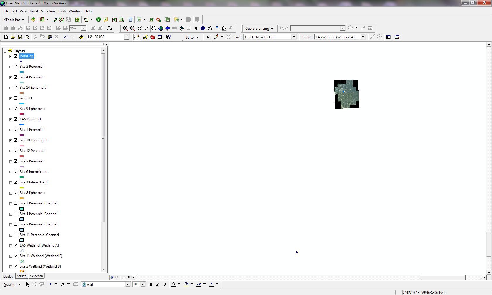
The raw data won't load into ArcMap, says the file isn't supported. I am worried that when the points were collected in the field, the gps unit wasn't collecting points on the correct datum (NAD 1983 UTM 17N or the state plane i mentioned). Is that a possible mess up? Not sure if the correction of the data is supposed to fix that error or if that will make our data unusable from the start.
This is what I am seeing when I zoom to full extent in ArcMap. I haven't been able to get the points to line up with any known data so not sure if the imagery is an issue.
- Mark as New
- Bookmark
- Subscribe
- Mute
- Subscribe to RSS Feed
- Permalink
- Report Inappropriate Content
The raw data is an SSF file I am assuming? There should be ways to convert SSF to shp file through GPS Correct or Trimble Office Pathfinder if you have access to those.
Also have have you ensured the right units are being used? UTM by default meters and I see that your data frame is set to feet, that can cause some issues too.
Cheers
- Mark as New
- Bookmark
- Subscribe
- Mute
- Subscribe to RSS Feed
- Permalink
- Report Inappropriate Content
Hannah,
Can you add just the shapefile to a new ArcMap and check its extents. I think it's really in either NAD83 aka latitude-longitude aka decimal degrees or possibly in UTM or a meters-based State Plane zone (but defined with a feet-based SPCS), but you have it labeled as a meters- or feet-based projected coordinate system.
If the values are latitude-longitude, use the Define Projection Tool or the data's property page in ArcCatalog to set the coordinate system to NAD 1983.
Melita
- Mark as New
- Bookmark
- Subscribe
- Mute
- Subscribe to RSS Feed
- Permalink
- Report Inappropriate Content
My guess would be that the GPS data was collected in a different projection than the one you are currently using and was improperly projected (should use Define Projection tool).
- Mark as New
- Bookmark
- Subscribe
- Mute
- Subscribe to RSS Feed
- Permalink
- Report Inappropriate Content
Most GPS units capture and store data internally using WGS84 geographic coordinates. Changing the coordinate system and datum on the unit will only changed the way the coordinates are displayed on the GPS - not the way they are stored.
I would try assigning a WGS84 geographic projection to your GPS data shapefile and then try projecting it to NAD_1983_StatePlane_Georgia_East_FIPS_1001.