Turn on suggestions
Auto-suggest helps you quickly narrow down your search results by suggesting possible matches as you type.
Cancel
- Home
- :
- All Communities
- :
- Products
- :
- Geoprocessing
- :
- Geoprocessing Questions
- :
- How to control which shapefile is displayed on top...
Options
- Subscribe to RSS Feed
- Mark Topic as New
- Mark Topic as Read
- Float this Topic for Current User
- Bookmark
- Subscribe
- Mute
- Printer Friendly Page
How to control which shapefile is displayed on top after a merge?
Subscribe
686
1
02-14-2012 08:33 AM
02-14-2012
08:33 AM
- Mark as New
- Bookmark
- Subscribe
- Mute
- Subscribe to RSS Feed
- Permalink
- Report Inappropriate Content
I am working with numerous polygon layers that represent fire perimeters. When I merge the polygons into one shapefile containing each perimeter as the the fire progressed, I will sometimes (about 50%) end up with a final display with the last record (final perimeter) 'covering up' all the other records so that only the final perimeter can be seen. The other half of the time (and it is almost literally every other time; one good, one bad, one good, one bad...) the first (smallest) perimeter is 'on top' with the second perimeter displayed next until finally the final perimeter is displayed, but one can view where each days perimeter was located (one can see all the polygon borders - this is the desired format, not the cover-up).
Opening up the layer properties box and changing the symbology order doesn't change the 'cover-up' of the final perimeter hiding all the earlier fire perimeters.
How does one control what the merged shapefile will look like? How can I get the smallest perimeter to display first and never have the final perimeter draw over the earlier fire perimeters?
I have tried bringing in each of the individual shapefiles into the merge tool in the desired order, but it doesn't seem to affect the outcome (surprise, surprise; for I have long thought that the most consistent thing about ArcGIS is its inconsistency). I have tried loading them into the merge tool en masse, one at a time, two-at-a-time, etc.
All the necessary attribute information is merged correctly and in the correct order, it is simply the display that has no predictable result.
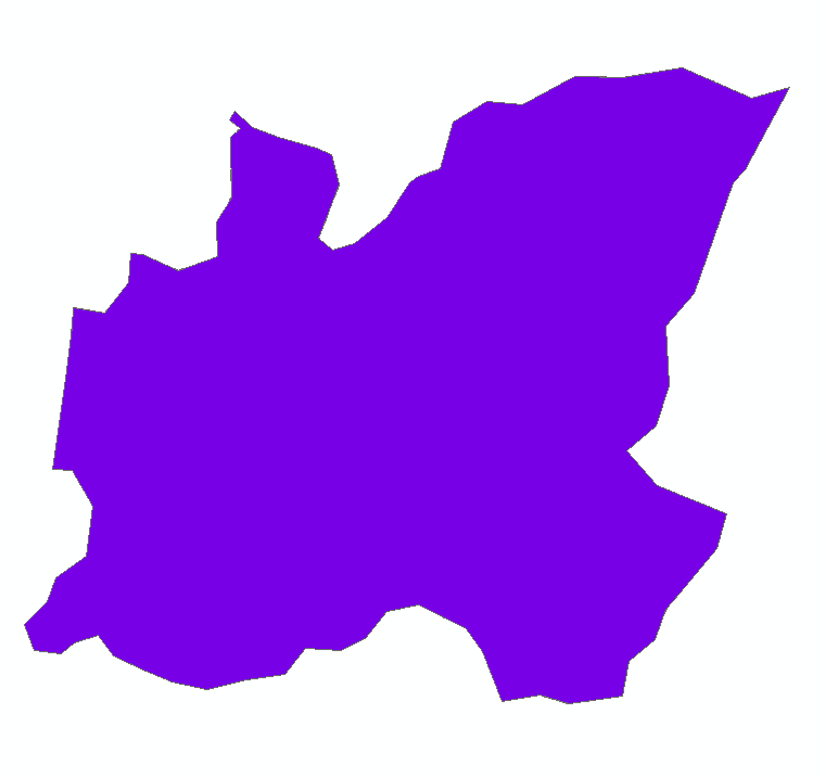
I have included two screenshots: the one labeled 'final_perimeter_on_top.png' as an example of what I don't want.
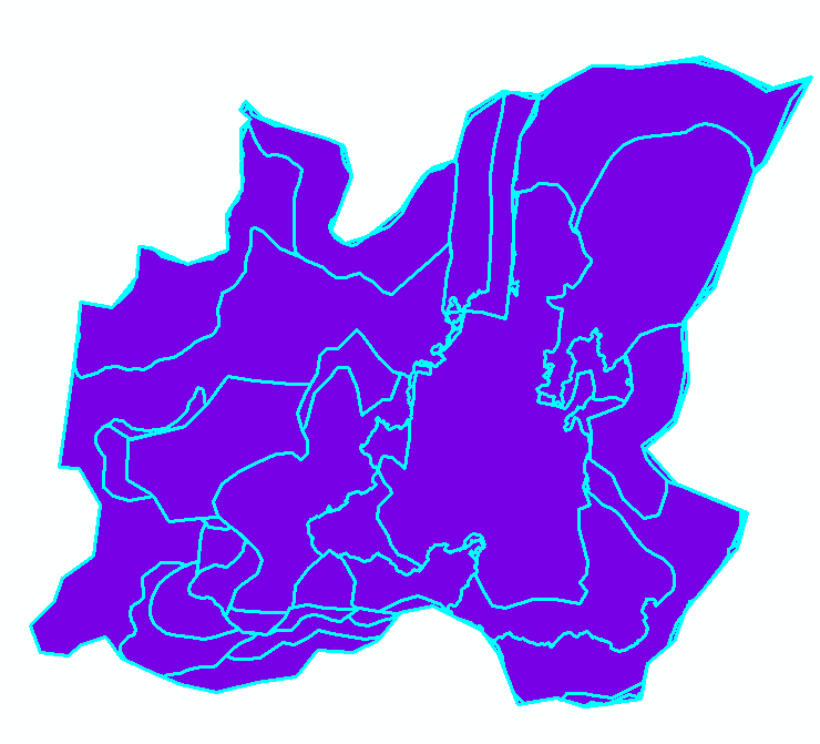
The other screenshot, 'selected_records.png' shows all the earlier perimeter boundaries I would like to see without having to select each record; it should be the default appearance of all merged records not a random ~50% of merged records.
Opening up the layer properties box and changing the symbology order doesn't change the 'cover-up' of the final perimeter hiding all the earlier fire perimeters.
How does one control what the merged shapefile will look like? How can I get the smallest perimeter to display first and never have the final perimeter draw over the earlier fire perimeters?
I have tried bringing in each of the individual shapefiles into the merge tool in the desired order, but it doesn't seem to affect the outcome (surprise, surprise; for I have long thought that the most consistent thing about ArcGIS is its inconsistency). I have tried loading them into the merge tool en masse, one at a time, two-at-a-time, etc.
All the necessary attribute information is merged correctly and in the correct order, it is simply the display that has no predictable result.
I have included two screenshots: the one labeled 'final_perimeter_on_top.png' as an example of what I don't want.
The other screenshot, 'selected_records.png' shows all the earlier perimeter boundaries I would like to see without having to select each record; it should be the default appearance of all merged records not a random ~50% of merged records.
1 Reply
02-14-2012
02:12 PM
- Mark as New
- Bookmark
- Subscribe
- Mute
- Subscribe to RSS Feed
- Permalink
- Report Inappropriate Content
I believe the draw order by default is controlled by the order of records in the attribute table - based on decending order of the OBJECTID field. So for example, a feature with OBJECTID = 20 will potentially obscure OBJECTID = 19 if they overlap. Using the Sort tool (new in v10.0) you can create a new feature class that is sorted however you want (SHAPE_Length, ACRES, YEAR, etc). If you are using v9.x, you might find this script handly: http://forums.esri.com/Thread.asp?c=93&f=1729&t=298702#933185, which also sorts tables or FCs.
Also, if you are just concerned with display, I know there is a property under the Symbology Tab > Advanced > Symbol Levels that can control the order in which features are drawn.
If you are interested in a more quantitative way to deal with overlapping features, this script (or some of the code behind it) might help you: http://arcscripts.esri.com/details.asp?dbid=16700. Google tells me another guy doing fire history stuff went so far as to use it in his masters thesis: repository.lib.ncsu.edu/dr/bitstream/1840.4/.../KetchieChris+final.pdf - what a brave guy!