Turn on suggestions
Auto-suggest helps you quickly narrow down your search results by suggesting possible matches as you type.
Cancel
- Home
- :
- All Communities
- :
- Products
- :
- Data Management
- :
- Data Management Questions
- :
- Raster Displays with "Holes" after Building Pyrami...
Options
- Subscribe to RSS Feed
- Mark Topic as New
- Mark Topic as Read
- Float this Topic for Current User
- Bookmark
- Subscribe
- Mute
- Printer Friendly Page
Raster Displays with "Holes" after Building Pyramids
Subscribe
2410
10
05-05-2011 11:11 AM
05-05-2011
11:11 AM
- Mark as New
- Bookmark
- Subscribe
- Mute
- Subscribe to RSS Feed
- Permalink
- Report Inappropriate Content
Good day,
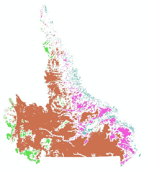
We have a large 16-bit unsigned integer raster in GRID format in 9.3. Before building pyramids it displays fine when zoomed out to the entire layer (see before.jpg, attached).
After building pyramids to improve display performance, it displays with "holes" (see after.jpg, attached). When we zoom in, the holes go away. What is causing this and how can we overcome it?
Thanks in advance,
Randal Greene
10 Replies
05-05-2011
12:00 PM
- Mark as New
- Bookmark
- Subscribe
- Mute
- Subscribe to RSS Feed
- Permalink
- Report Inappropriate Content
What renderer are you using?
by
Anonymous User
Not applicable
05-05-2011
12:01 PM
- Mark as New
- Bookmark
- Subscribe
- Mute
- Subscribe to RSS Feed
- Permalink
- Report Inappropriate Content
Original User: rgreenenf
Unique values renderer.
What renderer are you using?
Unique values renderer.
05-05-2011
12:05 PM
- Mark as New
- Bookmark
- Subscribe
- Mute
- Subscribe to RSS Feed
- Permalink
- Report Inappropriate Content
I believe this may be NIM040765. If you change <all other values> in the renderer to some color, I bet your white "holes" will display using this color.
by
Anonymous User
Not applicable
05-06-2011
02:51 AM
- Mark as New
- Bookmark
- Subscribe
- Mute
- Subscribe to RSS Feed
- Permalink
- Report Inappropriate Content
Original User: rgreenenf
Yes, that's it. Thanks.
I believe this may be NIM040765. If you change <all other values> in the renderer to some color, I bet your white "holes" will display using this color.
Yes, that's it. Thanks.
11-15-2011
03:43 AM
- Mark as New
- Bookmark
- Subscribe
- Mute
- Subscribe to RSS Feed
- Permalink
- Report Inappropriate Content
Very frustrating that this bug has still not been addressed as of ArcGIS 10 SP3! Note that the problem occurs when you have pyramids and you map one of the fields from the Raster Attribute Table (not when you map the value itself)...
by
Anonymous User
Not applicable
11-15-2011
04:20 AM
- Mark as New
- Bookmark
- Subscribe
- Mute
- Subscribe to RSS Feed
- Permalink
- Report Inappropriate Content
Original User: rgreenenf
Correction - the problem also still occurs when you map the raster value, just with less holes.
Correction - the problem also still occurs when you map the raster value, just with less holes.
by
Anonymous User
Not applicable
11-15-2011
04:33 AM
- Mark as New
- Bookmark
- Subscribe
- Mute
- Subscribe to RSS Feed
- Permalink
- Report Inappropriate Content
Original User: voldune
Please try deleting the pyramids, and re-build them using ArcGIS 10. Let me know if that clears up the issue.
Please try deleting the pyramids, and re-build them using ArcGIS 10. Let me know if that clears up the issue.
11-15-2011
06:47 AM
- Mark as New
- Bookmark
- Subscribe
- Mute
- Subscribe to RSS Feed
- Permalink
- Report Inappropriate Content
Very frustrating that this bug has still not been addressed as of ArcGIS 10 SP3! Note that the problem occurs when you have pyramids and you map one of the fields from the Raster Attribute Table (not when you map the value itself)...
It does seem that you are encountering NIM040765 as Patrick suggested, but we can't be sure until you tell us what version you built the pyramids in. If you built the pyramids in 10.0, then you are encountering a new bug. NIM040765 is specific to pyramids built in 9.3.x. That bug is not open at this time. The status is Rejected - non repro -when you build the new pyramids (OVR files) in 10.0.
Regards,
Eric
by
Anonymous User
Not applicable
01-19-2012
02:40 PM
- Mark as New
- Bookmark
- Subscribe
- Mute
- Subscribe to RSS Feed
- Permalink
- Report Inappropriate Content
Original User: rogerloweth
I am using ArcGIS 10 (both SP2 and SP3 updates).
I encountered the same problem with a single band raster - the edges disappear when zoomed out to full extent with built pyramids.
Rebuilding the pyramids with level set to 0 solved the problem.
Note that I am mapping the raster value, NOT one of the fields.
Is this a new bug??
Regards, Roger