Turn on suggestions
Auto-suggest helps you quickly narrow down your search results by suggesting possible matches as you type.
Cancel
- Home
- :
- All Communities
- :
- Products
- :
- ArcGIS Explorer Desktop (Retired)
- :
- ArcGIS Explorer Desktop Questions
- :
- Map Service invalid in 1500 but ok in 1200
Options
- Subscribe to RSS Feed
- Mark Topic as New
- Mark Topic as Read
- Float this Topic for Current User
- Bookmark
- Subscribe
- Mute
- Printer Friendly Page
Map Service invalid in 1500 but ok in 1200
Subscribe
2494
7
09-09-2010 08:46 AM
09-09-2010
08:46 AM
- Mark as New
- Bookmark
- Subscribe
- Mute
- Subscribe to RSS Feed
- Permalink
- Report Inappropriate Content
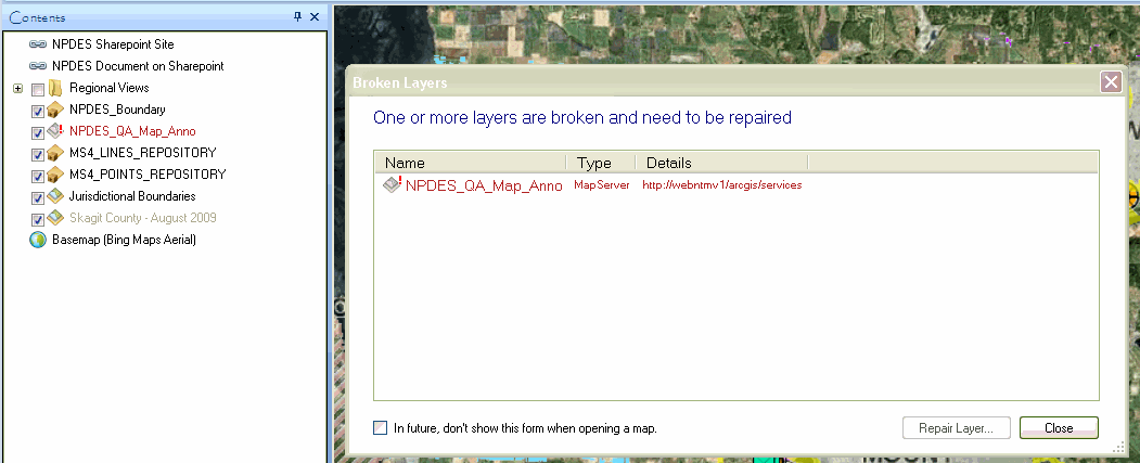
I have a map service in a AGX map document that displays fine when the map doc is opened in AGX 1200 but gets an invalid data source when opened in AGX 1500. The map service is in a folder on the ArcGIS Server and I am able to add other map services from the same folder to AGX 1500 with no connection errors however when I add the problem child I get an error stating that AGX is unable to add service. I have attached screen shots from both AGX 1200 and AGX 1500. Anybody else have this problem? I notice that the map service is colored green in the list of services when I try using repair layer in AGX 1500... You can see this in one of the attached images... what does the green text mean?
Thanks for any help.
Janice.
Thanks for any help.
Janice.
7 Replies
by
Anonymous User
Not applicable
09-09-2010
02:39 PM
- Mark as New
- Bookmark
- Subscribe
- Mute
- Subscribe to RSS Feed
- Permalink
- Report Inappropriate Content
Original User: janiceb
I went into the ArcGIS Explorer Options > Advanced > Cache Management in 1500 and deleted all of my caches. Now none of my map services are working in 1500. They still work on my workstation that has AGX 1200. Well, at least they did until I deleted my caches on that workstation. Now I am unable to add any map services in AGX 1200. This cache stuff is really confusing. Why do the services stop working when I delete caches? I was able to add services with no errors in 1200 before I deleted my caches.
I went into the ArcGIS Explorer Options > Advanced > Cache Management in 1500 and deleted all of my caches. Now none of my map services are working in 1500. They still work on my workstation that has AGX 1200. Well, at least they did until I deleted my caches on that workstation. Now I am unable to add any map services in AGX 1200. This cache stuff is really confusing. Why do the services stop working when I delete caches? I was able to add services with no errors in 1200 before I deleted my caches.
09-10-2010
03:10 AM
- Mark as New
- Bookmark
- Subscribe
- Mute
- Subscribe to RSS Feed
- Permalink
- Report Inappropriate Content
Janice,
This sounds most unusual - what I would expect to happen once you have deleted the caches is that the application simply begins re-streaming the map services. Just to make sure the delete function properly cleared out the cache folder you could open Windows Explorer then type %temp% in the address bar then look for the E3 folder and delete everything in there.
Otherwise, try a new map (Explorer button > New) - do the services work in that map?
Regards
Mike
by
Anonymous User
Not applicable
09-13-2010
02:23 PM
- Mark as New
- Bookmark
- Subscribe
- Mute
- Subscribe to RSS Feed
- Permalink
- Report Inappropriate Content
Original User: janiceb
Mike,
I am unable to add services to a new map. I can connect to the server and see the services but get an unable to add service error when I try to add the service. I have uninstalled and reinstalled AGX 1200 on one computer with no changes and I have uninstalled and reinstalled AGX 1500 on another computer. I asked my co-worker to delete all caches on her workstation and she can no longer use GIS Services in explorer. My other co-worker did not delete his caches and is still able to connect to the GIS Services. I have one co-worker using 1500 and viewing map services and one co-worker using 1200 and viewing map services (neither of them deleted the caches on their workstations). This is very frustrating. I am trying to get ArcGIS Explorer approved by my department head for use by many other employees where I work and find it very difficult to convince even myself that this is the correct product to use when I can't understand what makes it work and what makes it fail.
Thanks for your help,
Janice.
09-14-2010
01:32 AM
- Mark as New
- Bookmark
- Subscribe
- Mute
- Subscribe to RSS Feed
- Permalink
- Report Inappropriate Content
Janice,
Are the GIS services you're using internal - i.e. do you have ArcGIS Server in your organisation? If so, you're entitled to Technical Support with your ArcGIS Explorer deployment.
Some other questions/ideas:
- Do the basemaps still work?
- Do the Find/Directions tools work?
- Can you add map services from http://sampleserver1.arcgisonline.com/arcgis/services ?
- Can you add map services from http://sampleserver3.arcgisonline.com/ArcGIS/services ?
Regards
Mike
by
Anonymous User
Not applicable
09-21-2010
08:04 AM
- Mark as New
- Bookmark
- Subscribe
- Mute
- Subscribe to RSS Feed
- Permalink
- Report Inappropriate Content
Original User: ryan.clark
I'm experiencing the same problems, but quite inconsistently.
For example, using build 1500, I've consistently been able to connect to this service:
http://services.azgs.az.gov/ArcGIS/rest/services/demonstrations/caGeologicMap/MapServer
But sometimes receive the error messages posted above when trying to connect to this one:
http://services.azgs.az.gov/ArcGIS/rest/services/demonstrations/CaFaultActivity/MapServer
We've noticed quite a few ArcGIS Services popping in and out of availability, and as of yet have not been able to isolate the problem. It seems to be one of these things that will work on one computer one day, and then not the next. Just this morning I was unable to add the CaFaultActivity service, then without closing Explorer added a few other services without issue, and then tried adding the CaFaultActivity one again, and it worked.
We use ArcGIS Explorer most frequently in presentation settings. Using the same broadband modem connection one day may not turn up any problems, and then the next day some of the ArcGIS Services won't work. This becomes particularly difficult to troubleshoot because the problems are not reproducible. We need some guidance on how to effectively keep logs or ideas what to look for in order to even begin isolating the problem.
We only have noticed these problems with ArcGIS Services -- WMS services seem to work fine. We've also experienced some strange difficulties with shapefiles. It would appear that Explorer is very pathname sensitive. Not too long, no special characters, that kind of thing.
Mike, do I understand correctly from your post above that licensing ArcGIS Server entitles us to ArcGIS Explorer support?
09-22-2010
04:45 AM
- Mark as New
- Bookmark
- Subscribe
- Mute
- Subscribe to RSS Feed
- Permalink
- Report Inappropriate Content
Ryan,
As you said, these type of intermittent problems are exceedingly difficult to track down. Yes - if you have ArcGIS Server under maintenance you should be entitled to tech support for ArcGIS Explorer (as client of your ArcGIS Server implementation).
RE: Example services you provided - I'll keep checking them everyday to see if i notice any issues.
RE: Shapefiles - I'm not aware of any issues related to path length or complexity.
Regards
Mike
by
Anonymous User
Not applicable
09-22-2010
07:53 AM
- Mark as New
- Bookmark
- Subscribe
- Mute
- Subscribe to RSS Feed
- Permalink
- Report Inappropriate Content
Original User: bszukalski
There may be something that is happening with map cache from specific services - we're investigating this further. But in the meanwhile here's what might present a temporary workaround if you have services which seem to intermittently fail. Open the service that fails in ArcMap, and save out the layer as a layer file (.lyr). Use this layer file to connect to the service with ArcGIS Explorer.
There may be something that is happening with map cache from specific services - we're investigating this further. But in the meanwhile here's what might present a temporary workaround if you have services which seem to intermittently fail. Open the service that fails in ArcMap, and save out the layer as a layer file (.lyr). Use this layer file to connect to the service with ArcGIS Explorer.