- Home
- :
- All Communities
- :
- Products
- :
- ArcGIS Spatial Analyst
- :
- ArcGIS Spatial Analyst Questions
- :
- Create raster surface map with points.
- Subscribe to RSS Feed
- Mark Topic as New
- Mark Topic as Read
- Float this Topic for Current User
- Bookmark
- Subscribe
- Mute
- Printer Friendly Page
Create raster surface map with points.
- Mark as New
- Bookmark
- Subscribe
- Mute
- Subscribe to RSS Feed
- Permalink
- Report Inappropriate Content
Hello.
I have a hospital point shapefile in a state and would like to create a raster map based on these hospitals. What I would like to have is a map that each cell has a value of accessibility, the accessibility value need to be based on distance to the nearest hospital, for example, value 1 means distance less than 3 miles, and 2 for 3-10 miles and 3 for 10 miles and longer, so that when adding patients data to the map, I will get a accessibility value for each patient. It's just like the service area map, but I don't have network dataset.
Could anyone give me some suggestions or advice on that? Thanks a lot!
Yichuan
- Mark as New
- Bookmark
- Subscribe
- Mute
- Subscribe to RSS Feed
- Permalink
- Report Inappropriate Content
I assume that you have the Spatial Analyst extension?! If so, did you rule out Euclidean Distance and/or Euclidean Allocation tools in Arctoolbox? (neither follow road networks however) Can you not just use vector data and associated buffers? (same limitation previously mentioned)
- Mark as New
- Bookmark
- Subscribe
- Mute
- Subscribe to RSS Feed
- Permalink
- Report Inappropriate Content
Are you planning on entering the accessibility values to attributes of your point shapefile or do you want to run some analysis for that like near tool?
- Mark as New
- Bookmark
- Subscribe
- Mute
- Subscribe to RSS Feed
- Permalink
- Report Inappropriate Content
How about:
1.) Create 1m x 1m raster of your roads (may have to buffer your roads first to make a more connected raster).
2.) Assign value of 1 to all cells in road raster.
3.) Make sure all of your hospital points fall on the road raster.
3.) Run Cost Distance tool, using hospitals as feature source and road raster as cost raster. Distance should be least number of accumulated meters between source and pixel.
edit 1: 1m x 1m is probably overkill for an entire state, but you can use any pixel size you like as long as you keep track of the units.
edit 2: the distance returned from Cost Distance is an overestimate of the true distance. It is the distance it would take if your choices of movement were limited to one of the 8 cardinal directions, per pixel.
- Mark as New
- Bookmark
- Subscribe
- Mute
- Subscribe to RSS Feed
- Permalink
- Report Inappropriate Content
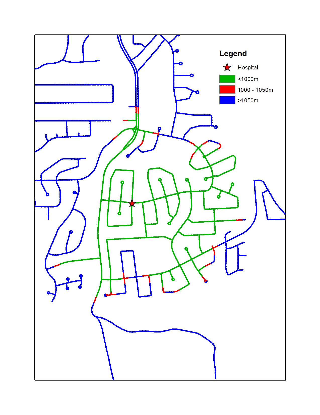
Example using Cost Distance: