- Home
- :
- All Communities
- :
- Products
- :
- Mapping
- :
- Mapping Questions
- :
- State Loop Symbol for Highways in a Map
- Subscribe to RSS Feed
- Mark Topic as New
- Mark Topic as Read
- Float this Topic for Current User
- Bookmark
- Subscribe
- Mute
- Printer Friendly Page
- Mark as New
- Bookmark
- Subscribe
- Mute
- Subscribe to RSS Feed
- Permalink
- Report Inappropriate Content
Does anyone know where I can get a state loop symbol to use on my maps. Our font library here at work that we use is corrupt and cant be fixed. Thanks for the help.
Solved! Go to Solution.
Accepted Solutions
- Mark as New
- Bookmark
- Subscribe
- Mute
- Subscribe to RSS Feed
- Permalink
- Report Inappropriate Content
Thanks! Looks like our font library has always had the wrong symbol. I really appreciate all your help. Thank you!
- Mark as New
- Bookmark
- Subscribe
- Mute
- Subscribe to RSS Feed
- Permalink
- Report Inappropriate Content
Michele,
Can you give more details? What state? Are you talking about something like these?


- Mark as New
- Bookmark
- Subscribe
- Mute
- Subscribe to RSS Feed
- Permalink
- Report Inappropriate Content
No. It would be a state loop shield for a highway. I'm in Texas. The shield looks like a rectangle with the ends that come to a point. I don't really have a picture to attach. Is there maybe a whole library of highway shields, from ESRI or the internet. I haven't been able to find one.
- Mark as New
- Bookmark
- Subscribe
- Mute
- Subscribe to RSS Feed
- Permalink
- Report Inappropriate Content
Michelle,
The MUTCD (Manual on Uniform Traffic Control Devices) is the authoritative source for signs.
Not being from Texas I am not familiar with the shield you are looking for does the below site help?
Texas State Highway Loop 360 - Wikipedia, the free encyclopedia
ArcMap has Character Marker Symbol > ESRI US MUTCD 1, ESRI US MUTCD 2, ESRI US MUTCD 3. I would search through those.
- Mark as New
- Bookmark
- Subscribe
- Mute
- Subscribe to RSS Feed
- Permalink
- Report Inappropriate Content
Thanks! Looks like our font library has always had the wrong symbol. I really appreciate all your help. Thank you!
- Mark as New
- Bookmark
- Subscribe
- Mute
- Subscribe to RSS Feed
- Permalink
- Report Inappropriate Content
Michelle,
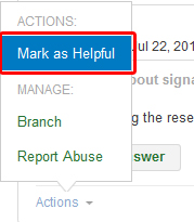
Glad I could help. If you don't mind you can mark my reply as helpful by clicking on the Actions Menu link on my reply and choosing "Mark as Helpful"
