Turn on suggestions
Auto-suggest helps you quickly narrow down your search results by suggesting possible matches as you type.
Cancel
- Home
- :
- All Communities
- :
- Products
- :
- Data Management
- :
- Data Management Questions
- :
- Create Random Points for Each Land Cover Class in ...
Options
- Subscribe to RSS Feed
- Mark Topic as New
- Mark Topic as Read
- Float this Topic for Current User
- Bookmark
- Subscribe
- Mute
- Printer Friendly Page
Create Random Points for Each Land Cover Class in a Raster?
Subscribe
504
0
05-02-2014 08:54 AM
05-02-2014
08:54 AM
- Mark as New
- Bookmark
- Subscribe
- Mute
- Subscribe to RSS Feed
- Permalink
- Report Inappropriate Content
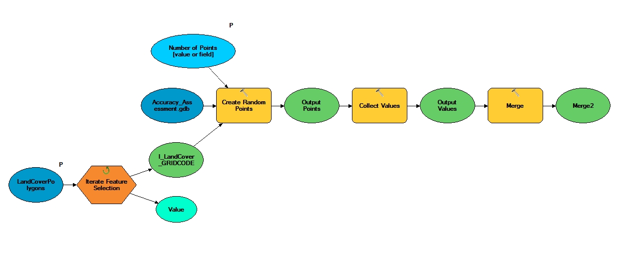
I've attached a model that works for dissolved land cover polygons to illustrate what I'd like to do in a land cover raster. The user can specify n number of random points to be created per feature in the Land Cover Polygons feature class. As I've had problems converting our countywide raster to polygons and dissolving them, I'm looking to do this with a python script but I don't know how to get access to the land cover grid codes to distribute random points for each class (tree, grass, bare earth, etc.).
I've tried the arcpy.Describe tableType property to give me the list of cell values (1-7 in my case) but it didn't work. I need to get the list of cell values and then distribute my points in each of their extents. Any suggestions on this are appreciated.
I've tried the arcpy.Describe tableType property to give me the list of cell values (1-7 in my case) but it didn't work. I need to get the list of cell values and then distribute my points in each of their extents. Any suggestions on this are appreciated.
0 Replies