- Home
- :
- All Communities
- :
- Industries
- :
- Water Resources
- :
- Water Resources Questions
- :
- Why do I get differing symbology for Flow Directio...
- Subscribe to RSS Feed
- Mark Topic as New
- Mark Topic as Read
- Float this Topic for Current User
- Bookmark
- Subscribe
- Mute
- Printer Friendly Page
Why do I get differing symbology for Flow Direction, even when processing in the same manner?
- Mark as New
- Bookmark
- Subscribe
- Mute
- Subscribe to RSS Feed
- Permalink
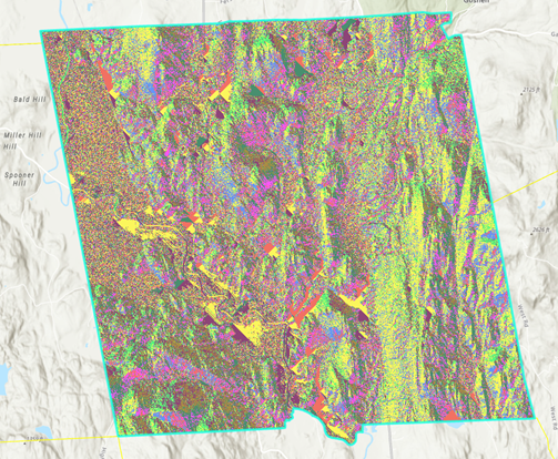
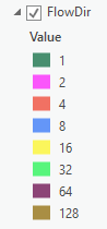
Can anyone help to explain how sometimes I receive the appropriate symbology for flow direction (using a filled DEM, D8 flow type), with an output showing the typical directional coding (1, 2, 8, 16, 32, 64, 128)
But other times, i will get an output more like a hillshade:
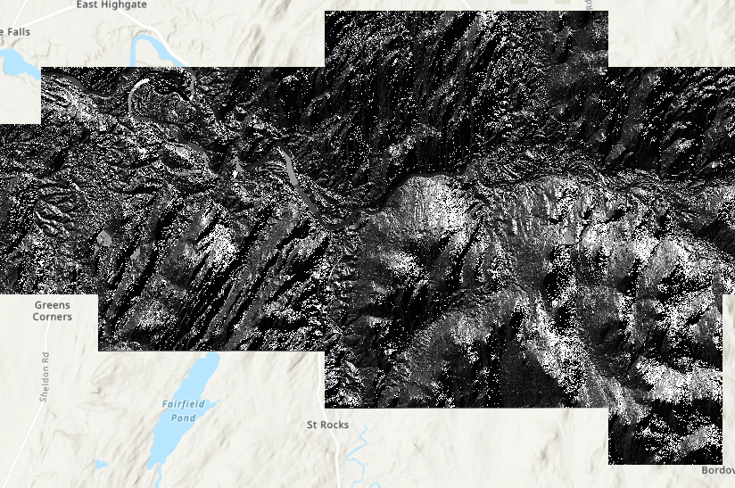
(examples are from different towns)
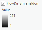
This second, incorrect display and corresponding legend doesn't reflect the elevation, so I'm curious why I am getting this output and if there is a way to ensure that I only get the directional coding instead. Is it just as simple as going in and changing the symbology?
Any help would be appreciated. I am using ArcGIS Pro 2.4 and have the spatial analyst extension enabled.
- Mark as New
- Bookmark
- Subscribe
- Mute
- Subscribe to RSS Feed
- Permalink
I am not very skilled with rasters, but rather interested in them. I did some research regarding your question, and I think you might be running into sink pixels. If you are unfamiliar with sink pixels, they are spatially connected pixels that do not fit the d8 flow direction codes. Since they do not meet the criteria to be coded, the pixel is assigned a value using one of the other available methods, MFD or DINF.
This documentation does a fantastic job of explaining this: Flow Direction function—ArcGIS Pro | ArcGIS Desktop
If a pixel is lower than its eight neighbors, that pixel is given the value of its lowest neighbor, and flow is directed towards this pixel. If multiple neighbors have the lowest value, the pixel is still assigned this value but flow is defined with one of the two methods described below. This method is used to remove sinks, which are considered noise.
A sink is a pixel or set of spatially connected pixels whose flow direction cannot be assigned one of the eight valid values in a flow direction raster. This can occur when all neighboring pixels are higher than the processing pixel or when two pixels flow into each other, creating a two-pixel loop.
- If a pixel has the same change in z-value in multiple directions and that pixel is part of a sink, the flow direction is referred to as undefined. In such cases, the value for that pixel in the output flow direction raster will be the sum of those directions. For example, if the change in z-value is the same to the right (flow direction = 1) and down (flow direction = 4), the flow direction for that pixel is 1 + 4 = 5.
- If a pixel has the same change in z-value in multiple directions and that pixel is not part of a sink, the flow direction is assigned with a lookup table defining the most likely direction. See Greenlee (1987) below.
To match the symbology of one layer to another, consider checking out the GP tool, Apply Symbology from Layer. This will give you the same color ramp, but you might have to play around with the data statistics/classification a little.
Hopefully this helps!
Jillian