- Home
- :
- All Communities
- :
- Industries
- :
- Water Resources
- :
- Water Resources Questions
- :
- Re: Station Distances Reversed in HEC GeoRAS?
- Subscribe to RSS Feed
- Mark Topic as New
- Mark Topic as Read
- Float this Topic for Current User
- Bookmark
- Subscribe
- Mute
- Printer Friendly Page
Station Distances Reversed in HEC GeoRAS?
- Mark as New
- Bookmark
- Subscribe
- Mute
- Subscribe to RSS Feed
- Permalink
- Report Inappropriate Content
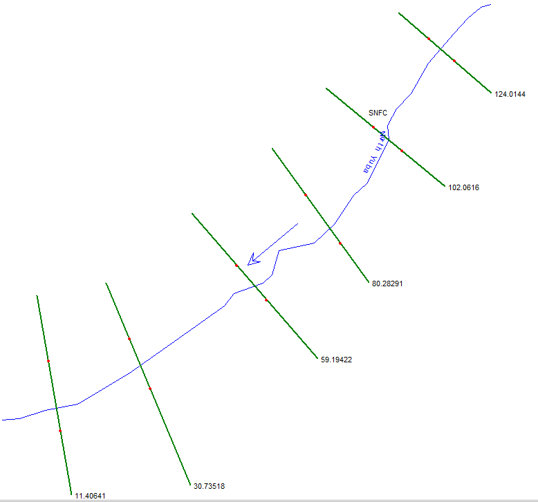
The instructions for HEC-GeoRAS has you digitize river center lines from upstream to downstream, and when that gets imported into HEC-RAS gets the direction right. However XS Cut Line station distances end up accumulating in the wrong direction: the XS Cut Line attributes for the most upstream XS has the highest station value, as shown below. I do know that engineers tend to count distances moving upstream, in contrast to hydrologists and boaters, so maybe there's some confusion. Anyone know? And how to get all of this working right?
- Mark as New
- Bookmark
- Subscribe
- Mute
- Subscribe to RSS Feed
- Permalink
- Report Inappropriate Content
It's working as designed for the hydraulics modelers. If you want to reverse the stationing, flip the stream centerline, and then do the XS stationing. I think you can also reverse the stationing in the RAS program. You can also use the linear referencing tools in Arc Toolbox.