- Home
- :
- All Communities
- :
- Industries
- :
- Water Resources
- :
- Water Resources Questions
- :
- How to generate watershed for a particular water b...
- Subscribe to RSS Feed
- Mark Topic as New
- Mark Topic as Read
- Float this Topic for Current User
- Bookmark
- Subscribe
- Mute
- Printer Friendly Page
How to generate watershed for a particular water body?
- Mark as New
- Bookmark
- Subscribe
- Mute
- Subscribe to RSS Feed
- Permalink
- Report Inappropriate Content
Hello everyone - I'm working on an analysis of public drinking water sources at a conservation organization. I am new to using Arc Hydro, but would like to implement it on this project. I have followed some guides on how to find watersheds, which has worked for me in general, but I'm hoping for some more precise results.
What I'm trying to do is find the upland watershed area for each reservoir - so find all surrounding land that drains into each individual body of water. This can be done if the 'Drainage Lines' are generated through those bodies of water, but what am I to do if they do not? Should I be doing a different analysis?
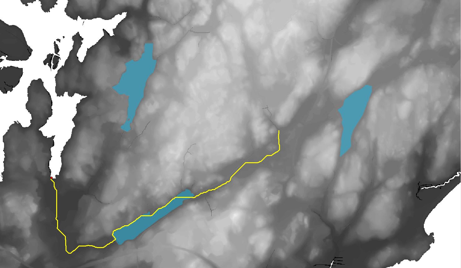
Image above shows my question. The drainage line runs through one reservoir which allows me to generate its watershed by selecting a point on that line. But what if I wanted to generate the watershed area of just the farthest east reservoir? Why does the drainage line stop where it does? Can I just extend the drainage line?
Thanks!
- Mark as New
- Bookmark
- Subscribe
- Mute
- Subscribe to RSS Feed
- Permalink
- Report Inappropriate Content
Okay, I've modified my process to use the Batch Watershed Delineation for Polygons tool, and that seems to have me on the right track.