- Home
- :
- All Communities
- :
- Industries
- :
- Water Resources
- :
- Water Resources Questions
- :
- Define HAND-based Flood Depth and Extent tool (Arc...
- Subscribe to RSS Feed
- Mark Topic as New
- Mark Topic as Read
- Float this Topic for Current User
- Bookmark
- Subscribe
- Mute
- Printer Friendly Page
Define HAND-based Flood Depth and Extent tool (Arc Hydro)
- Mark as New
- Bookmark
- Subscribe
- Mute
- Subscribe to RSS Feed
- Permalink
- Report Inappropriate Content
Hello,
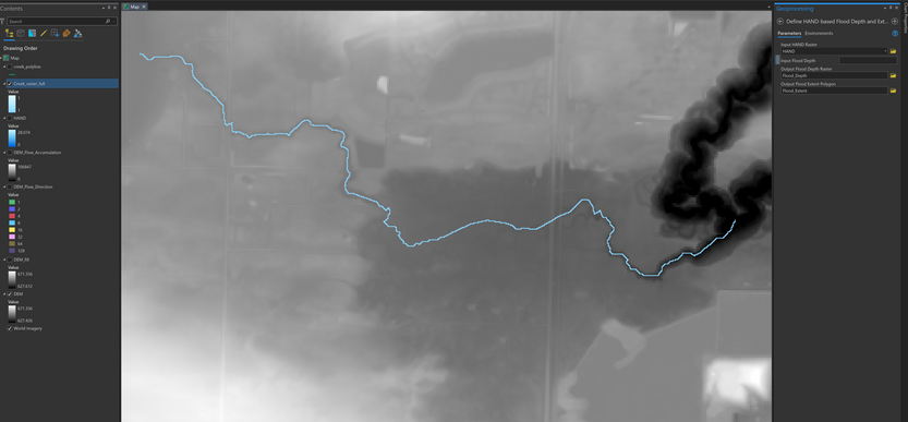
I am trying to delineate a floodplain of a small creek in ArcGIS Pro 2.9 with Arc Hydro.
I have been following the workflow presented in the recent webinar: Arc Hydro: Flooding and Forecasting.
1. Filled sinks in LiDAR-based DEM
2. Flow Direction and Flow Accumulation
3. Flow Distance to create a HAND raster
4. ArcHydro tool: Define HAND-based Flood Depth and Extent
How do you determine what the 'Input Flood Depth' parameter should be?
The webinar mentions it is the vertical threshold, but am unsure what that means. Is it the max depth of the creek?
I only have LiDAR data, the DEM, and the creek line/raster available.
Any advice on this tool is appreciated, thanks!
Solved! Go to Solution.
Accepted Solutions
- Mark as New
- Bookmark
- Subscribe
- Mute
- Subscribe to RSS Feed
- Permalink
- Report Inappropriate Content
When using HAND method for "flooding", the "Input Flood Depth" is the depth above stream centerline that you want to "flood" with.
What that specific value is, is up to you. For example, if you use the "max depth of the creek", that is the equivalent of the "bankfull" and most of the resulting flood polygon should be contained within the channel. Anything higher should start spilling into the overbanks and you should get "flooding".
So where do you get that number? Depends on what you are doing. It can come from the observations (e.g. high water mark or a stage from a gage) or through flow modeling and rating curve to convert flow to depth. If you are doing the rating curve approach, make sure that the rating curve is based on the same resolution data you used to derive HAND with (or is adjusted accordingly).
And remember that inherent assumption in HAND flood modeling approach is that your water surface is uniform (constant) and parallel to the bottom of the channel. For each channel segment. So if you expect that the depth will change (significantly) as you go downstream, you should partition the overall stream into multiple segments that have uniform (but variable from segment to segment) depth and then use "Define HAND-based Flood Depth and Extent from Table" tool to get the floodplain. More work but might give you better results.
If you stream segment is short, then first follow the approach you have presented (single reach), see if you like the results, and if not, then use the "table" approach. Note that you will have to reprocess the input data and partition the streams and get their catchments before you can use the "table" approach.
Hope this helps.
- Mark as New
- Bookmark
- Subscribe
- Mute
- Subscribe to RSS Feed
- Permalink
- Report Inappropriate Content
Thank you kindly Dean, this explanation helps a lot. Your webinars and presentations have been very useful for my project and learning!
