- Home
- :
- All Communities
- :
- Events
- :
- User Conference
- :
- User Conference Blog
- :
- Esri UC 2020: Plenary Recap - Jack Welcomes the GI...
Esri UC 2020: Plenary Recap - Jack Welcomes the GIS World from Redlands
- Subscribe to RSS Feed
- Mark as New
- Mark as Read
- Bookmark
- Subscribe
- Printer Friendly Page
- Report Inappropriate Content
Day 1: Plenary
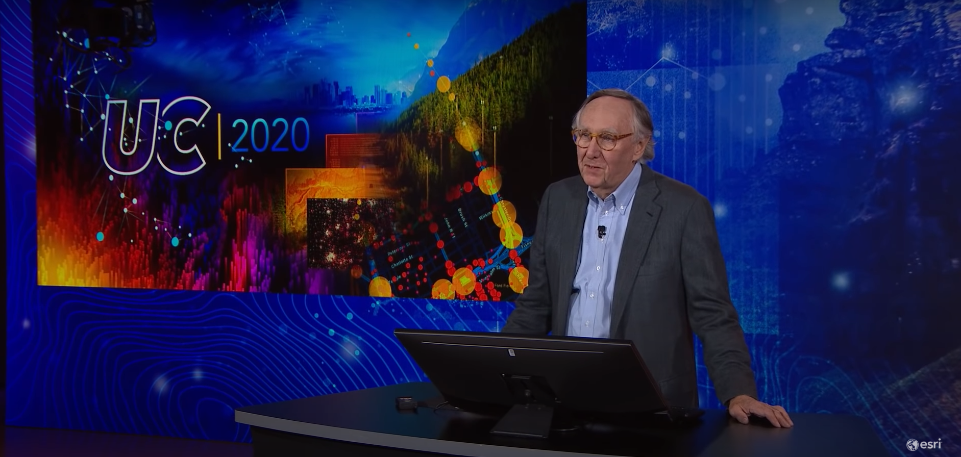
Jack warmly welcomed an audience of 80,000 to the first virtual Esri User Conference hosted at corporate headquarters in Redlands. This is a second first-time for Esri to host a user conference in Redlands, as this was where the first Esri User Conference was hosted 40 years ago, with 11 people in attendance.
The virtual UC provides more users the opportunity to attend the conference who haven’t attended before from all over the world. While the audience is diverse with industries, disciplines, and interests with GIS, we are united by our mission to address the issues of the world that impact us all.
Your Work
 Jack highlighted a few maps out of thousands that were submitted for the Esri User Conference. This review features several types of geospatial analysis and applications including Environmental Monitoring, Modeling, and Assessment, Natural Resources Management, Managing and Analyzing Land Information, Urban Design and Planning, 3D Building and City Modeling, Transportation Planning and Management, Engineering and Public Works, Utilities and Telecommunications, Public Safety and Emergency Management, Water and Wastewater Management, Disaster Preparation and Response, Remote Sensing Sensing, and Cartography.
A video highlighting the GIS Community’s work with COVID-19 responses featured a glimpse of the thousands of ArcGIS Dashboards, ArcGIS Online maps, and ArcGIS Hub created to monitor the pandemic in local communities.
Celebrating Excellence in GIS
Out of all of the Esri users in the world, “less than 100th of 1 percent” of users were selected in the United States and Global categories for the Special Achievement in GIS Awards (SAG Awards). Winners from a variety of industries were acknowledged on screen and with a special message from Jack on the SAG Awards page.
“There’s no greater acknowledgment that we can give GIS professionals than to be acknowledged in front of their peers. Only they know what it took to build the systems, to get the support, to do the right science, to build the right workflows, to create the right maps,” said Jack.
View the full list of winners on the Esri’s website to sort winners by category.
 The honoree for the Making A Difference Award went to Johns Hopkins University Center for Systems Science and Engineering. Johns Hopkins made trillions of maps and generated billions of views behind an idea that started from graduate student, Ensheng Dong, to track the spread of coronavirus and ultimately “woke up the world to seeing it in context” after the Johns Hopkins team scaled their work for everyone.
The Enterprise GIS Award went to the Louisiana Department of Transportation and Development for implementing enterprise GIS within their department and empowering each field employee in the organization with GIS capabilities.
Enel Green Power was an additional Enterprise GIS Award recipient, as pioneering leaders with renewable energy.
The President’s Award went to The Regional Municipality of York in Ontario, Canada. They built the first shared geospatial infrastructure system by collaborating with agencies and networks.
Watch Esri UC 2020 – Welcoming Our Users Virtually, Jack Dangermond
GIS-Interconnecting Our World
The world saw how a global pandemic, social unrest, and changes in our natural environment are impacting us in 2020. Environmental degradation and social instability are challenges that interconnect us, but with understanding, communication, and collaboration, we can address these together through GIS.
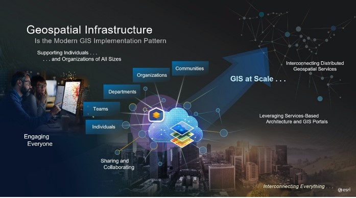 To scale this effort, GIS professionals and organizations are working towards creating geospatial infrastructures to communicate and collaborate on unified approaches to address what’s happening now and what will come in the future. Hear from Jack on the importance of GIS during these challenging times.
Watch GIS-Interconnecting Our World
ArcGIS – Helping Our Users Be Successful
In this segment, Jack reviews what’s new and what’s on the road ahead for ArcGIS to help users be successful with their efforts to integrate and transform the use and application of GIS in our world.
The Developer team opens this segment with a 4-minute overview of what’s new with ArcGIS software in 3D, Smart Cities Solutions, ArcGIS Online, Spatial Data Management, ArcGIS Mission, and more. Here are the products reviewed and what’s new with their video timestamps:
Capabilities
- Content
- Smart Mapping
- Mapping and Cartography
- ArcGIS StoryMaps
- Embedding Maps
- ArcGIS Dashboards
- Location Analytics
- Spatial Analysis and Data Science
- Jupyter Notebooks
- AI, Machine Learning, Deep Learning
- Imagery and Remote Sensing
- Drone Mapping
- ArcGIS Excalibur – Integrated Imagery Exploitation
- 3D GIS
- Real-Time Visualization and Analytics
- Data Management and Editing
- Field Operations
ArcGIS Products
- ArcGIS Pro
- ArcGIS Pro Extensions
- ArcGIS Enterprise
- ArcGIS Online
- ArcGIS Hub
- ArcGIS Solutions
- ArcGIS App Builders
- ArcGIS for Developers
- ArcGIS Location Services (for Developers)
Esri Geo-Enabled Systems
 As GIS technology and your career in the industry progresses, Esri has resources available and training to keep your skills sharp. GeoNet is one of those resources where users can learn from each other, collaborate, share ideas about their work. If you’re not a member, start here to learn more about the community.
Follow places of interest for professional development and skill-building here including Esri Training, Esri Press Books, and Learn ArcGIS.
Serving Our Users
Like many people around the world, Esri staff is working from home to see you succeed in your work with GIS. After playing a montage of what working from home looks like for Esri staff, Jack highlighted a few resources from Esri, Esri Partners, and Esri relationships to serve your work.
- The Disaster Response Team has been working diligently with Coronavirus disease 2019 (COVID-19) solutions and supporting users with building GIS responses in communities.
- Through Esri’s special relationship with National Geographic Society, a free 3-month digital subscription to the magazine is offered to Esri users as a part of the digital swag bag.
- For K-12 students, the National Geographic Society also announced a new resource for education through TeachwithGIS.com.
- Learn ArcGIS will be extending access to lessons for one year for higher education students starting September 1, 2020.
“You’ll be increasingly essential as the world continues to evolve,” said Jack in closing. With global challenges impacting organizations, communities, and our environment, GIS professionals, and the technology they use will be essential to helping the world understand the way to creating a sustainable future.
You must be a registered user to add a comment. If you've already registered, sign in. Otherwise, register and sign in.