- Home
- :
- All Communities
- :
- Industries
- :
- Telecommunications
- :
- Telecommunications Blog
- :
- Setting up Esri's Coverage Processing & Mapping So...
Setting up Esri's Coverage Processing & Mapping Solutions
- Subscribe to RSS Feed
- Mark as New
- Mark as Read
- Bookmark
- Subscribe
- Printer Friendly Page
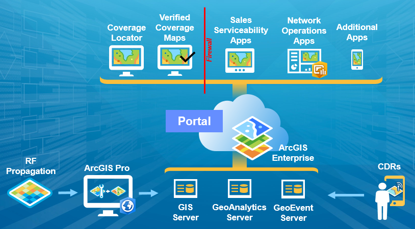
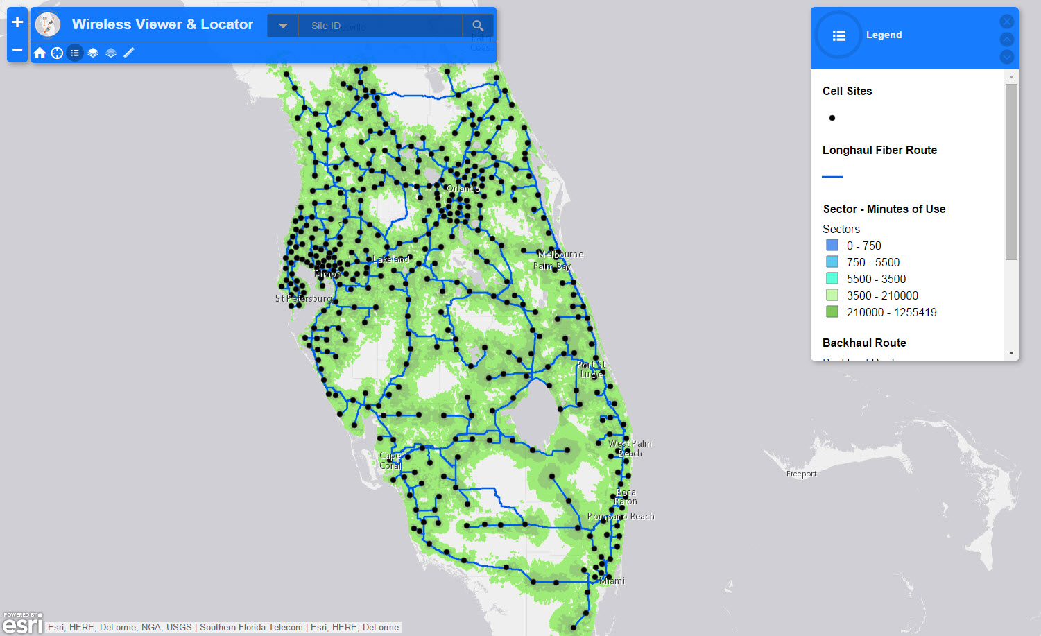
Esri offers a suite of coverage processing and mapping solutions that enable carriers and wireless service providers to create highly performant web based coverage maps. These coverage maps can be generated very quickly and shared to external customers and internal stakeholders using configurable apps sitting on top of the ArcGIS platform. In this blog we'll take a look at the steps and provide a few tips and tricks for creating beautiful coverage maps using ArcGIS.
Step 1: Getting Started
To get started, download the the Coverage Processing Solution Template. Once downloaded, follow the steps on the solutions web site for deploying the coverage processing tool.
Ninja Pro Tip: Coverage Processing Solution Requirements
Step 2: Processing the RF Propagation Raster and Converting to Vector Features
There are many benefits to converting RF Propagation data from a raster format to a vector format for your coverage maps. Better looking maps, faster performing maps, and vector tile caches are just a few of the benefits. Follow the steps outlined on the solutions web site to import your RF Propagation raster into ArcGIS so that you can convert it to vector features. Esri can handle a variety of raster formats from engineering tools on the market, or Esri also partners with organizations who have built Engineering and Design solutions directly on top of ArcGIS. If you only have the individual propagation area rasters, and not the complete mosaic of the entire coverage area, you can build a mosaic dataset, creating a complete coverage map.
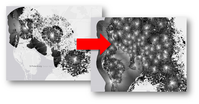
Once you have run the coverage processing solution template with your RF Propagation raster, you'll have a complete vector coverage map.
Ninja Pro Tip: Supported raster dataset file formats—Help | ArcGIS Desktop
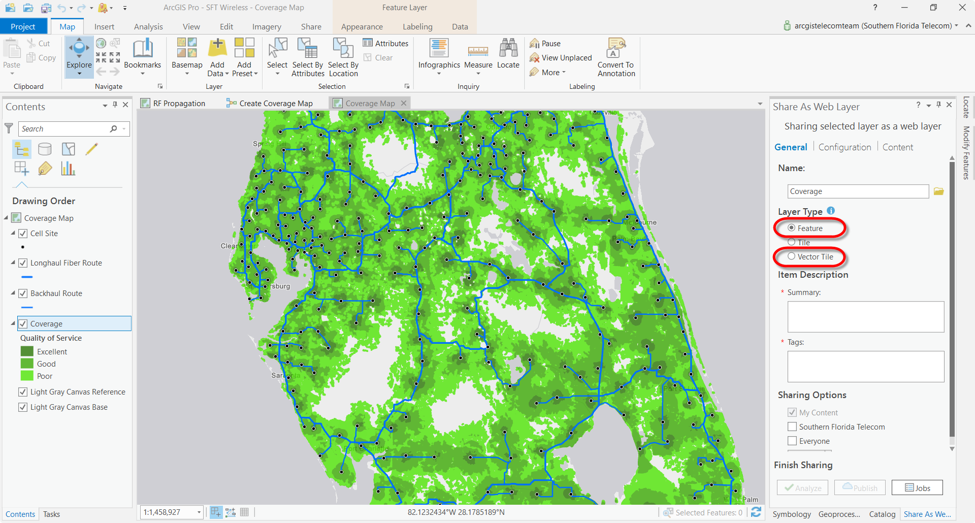
Step 3: Publish a Vector Tile Service and a Feature Service of Your Coverage Map
Now that you have a vector coverage map, publish the coverage map to your ArcGIS Enterprise or Online portal. When you publish the web layer, be sure to publish both a feature service and a vector tile service. The feature service will be used to run web based spatial analysis for serviceability look-ups and business apps, while the vector tile service will be used as the display layer for rendering the coverage data very quickly in a web application.
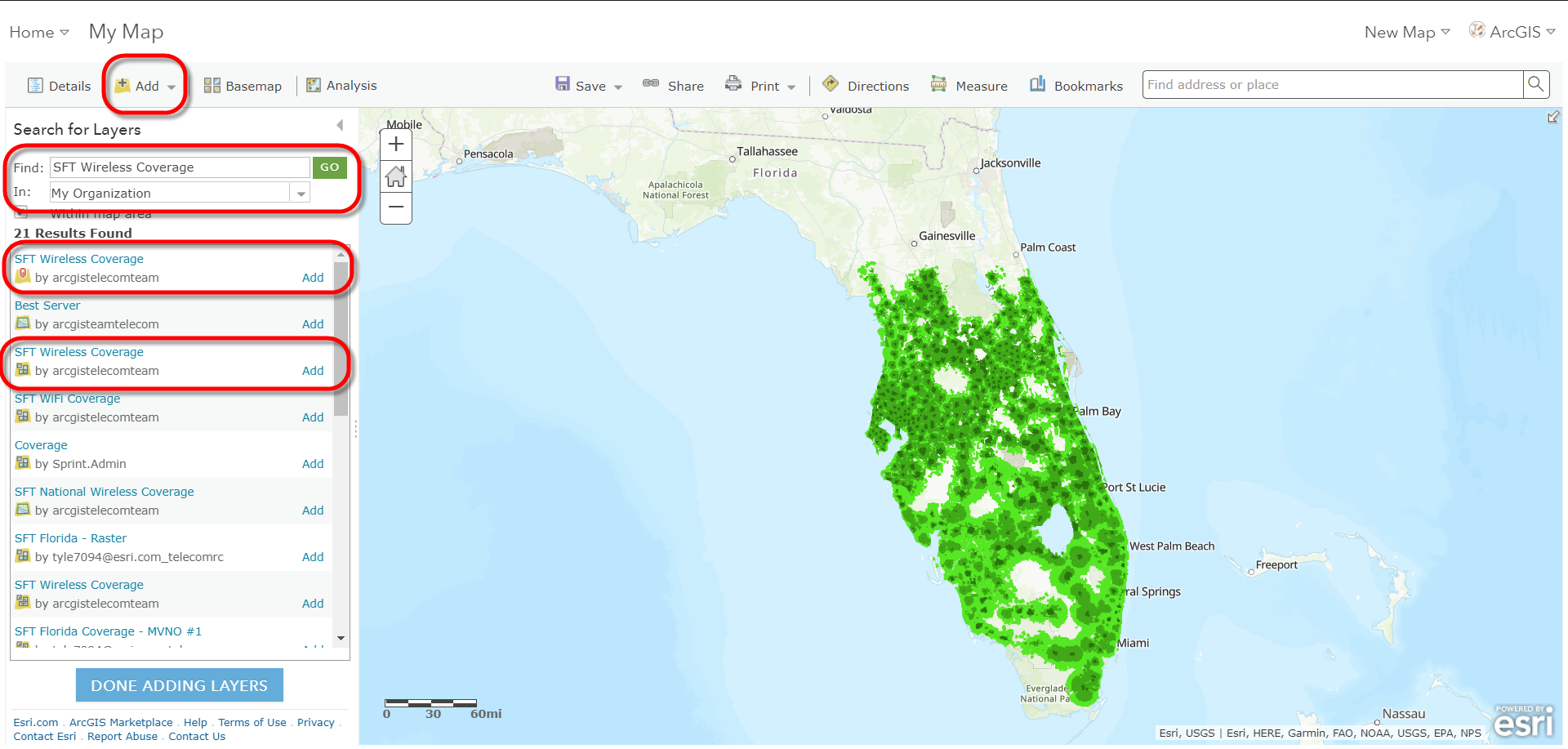
Step 4: Add Layers to Web Map and Modify Vector Tile Style
Once you have published the coverage map services, add your coverage map layer from your ArcGIS Enterprise or Online portal into a web map. If you are planning on creating a web app for visualizing the coverage map, add the vector tile service layer. If you are building a web app that requires analysis on the coverage map, then also add the feature service layer.
Vector Tile caches allow you to modify the look and feel of the layer by editing the web service's JSON. You can add filters to the data, change the symbology, and create a new layer in your portal. This allows you to quickly change the tile caches style without requiring you to re-publish a new service. For more information, check out this Story Map, and to see how this is done, follow the video below.
Ninja Pro Tip: VectorTile Style Simple Editor
Step 5: Configuring Coverage Map Apps
Esri offers a variety of web app templates for configuring different apps for different audiences using web maps creating in you portal. So, once you have all the layers styled the way you want them in the web map, configure the layer's pop-ups and transparency to your preferences. Then Save the final web map, Share the web map with groups in your organization, and select Create Web App. Then you can configure the web map in one of the configurable web app templates, or within Web AppBuilder.
Ninja Pro Tip: Wireless Bulk Serviceability | ArcGIS for Telecommunications
Be sure to follow the Telecom Coverage Processing & Mapping (Esri) thread for more information and to ask any questions about this blog, or to post enhancement requests for the Esri solutions. And re-watch the Coverage Processing webinar HERE. Coming soon.
Patrick Huls
Technical Evangelist - Utilities and Communications
LinkedIn: Patrick Huls| Twitter: @SpatialNinja| GeoNet:Phuls-esristaff
You must be a registered user to add a comment. If you've already registered, sign in. Otherwise, register and sign in.