- Home
- :
- All Communities
- :
- Industries
- :
- State & Local Government
- :
- State & Local Government Questions
- :
- Re: Lines Change from Traverse Grid when Joining P...
- Subscribe to RSS Feed
- Mark Topic as New
- Mark Topic as Read
- Float this Topic for Current User
- Bookmark
- Subscribe
- Mute
- Printer Friendly Page
Lines Change from Traverse Grid when Joining Parcel Fabric
- Mark as New
- Bookmark
- Subscribe
- Mute
- Subscribe to RSS Feed
- Permalink
- Report Inappropriate Content
I just moved to a Parcel Fabric, and am having problems with quite a few of my parcels going wonky when I join them. Below is an example I've been scratching my head over for a while.
I enter all my coordinates in the traverse grid and we get a nice parcel that looks like it will join the fabric without issue.
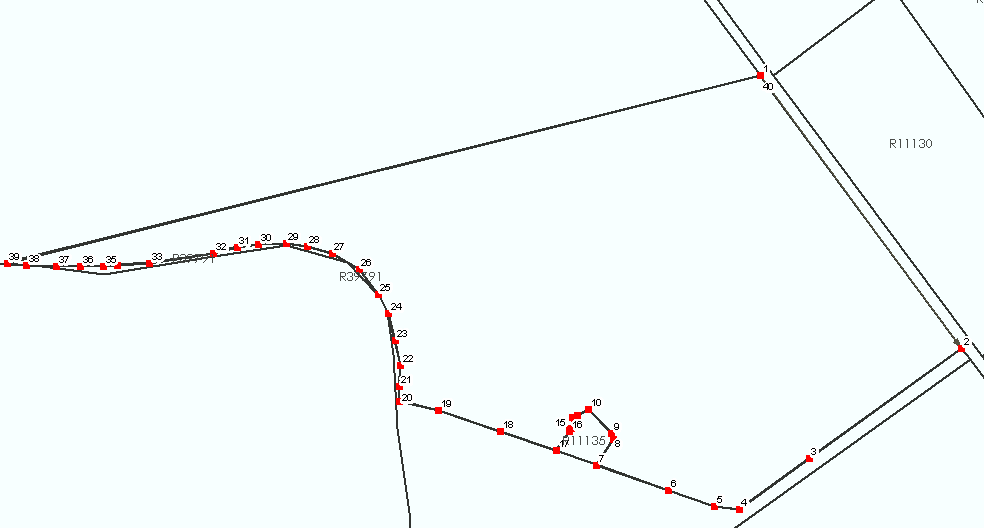
However, when I join the parcel the lines adjust to the following whether I create join links or not:
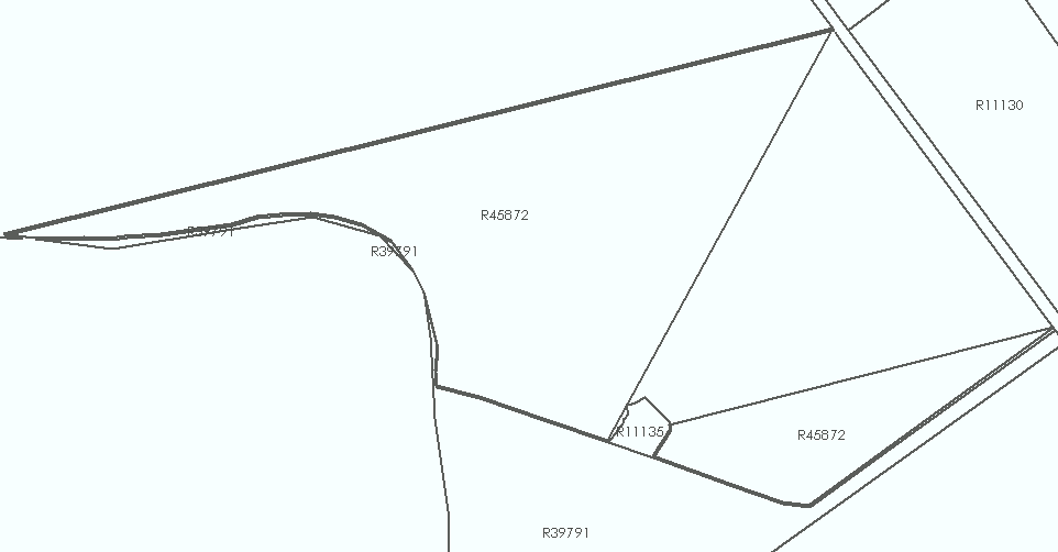
When I open the parcel details I see the lines are still there and are still the same. If I select them, I can see the original outline of the parcel as I should, but it displays differently on the map. So, what is going on here? Also, I'm new to the parcel fabric model and I'm trying to understand where the disconnect is between the line's I've entered and the actual polygon dimensions?
Thanks!!
Edit: I'm continuing to have the same problem. On the latest parcel giving me trouble, one of the vertexes just disappears from the polygon when the parcel is joined, even though I very carefully setup all my join links. When I unjoin the parcel from the fabric, that vertex is back and my polygon is correct.
- Mark as New
- Bookmark
- Subscribe
- Mute
- Subscribe to RSS Feed
- Permalink
- Report Inappropriate Content
Michael,
Parcel fabric saves the original COGO shape for you, but displays the joined shape. That is why you can see the pre-joined lines when you open the parcel.
We do not ever utilize join links to make adjustments to our boundary lines. ESRI's join function does not ever seem to work for us as advertised. It always gave us issues like you describe. Instead we COGO our plats using Parcel Fabric's COGO tool and then georeference the plat from the COGO'ed lines. Then we match either the plat itself or surrounding parcels (or both) to make lines match up exactly by selecting all "involved" parcels. This usually includes parcels not part of the plat but bordering it because our data is never perfect and always needs slight adjustments. We then perform all line work using the Construct from Parent tool.
Hope this helps.
Conor
- Mark as New
- Bookmark
- Subscribe
- Mute
- Subscribe to RSS Feed
- Permalink
- Report Inappropriate Content
Hello Michael,
When you enter a parcel there is a button that you can turn on/off (toggle) that is called Measurement View. If it is pressed it will show you the parcel based on its measurements (as it looked before joining / floating). You can press this button on and off and see the difference between the geometry after joining and before joining, which usually depends on the joining method you used.
The record measurements never change, even if / when the geometry changes.
Vertices / segments should not disappear during the join process.
Please contact technical support with your case to have someone look at it and determine if there is a bug in the software / data issue / training issue.
Thanks,
Amir