- Home
- :
- All Communities
- :
- Industries
- :
- State & Local Government
- :
- State & Local Government Questions
- :
- Re: Fire Service Maps from ESRI Solutions for Loca...
- Subscribe to RSS Feed
- Mark Topic as New
- Mark Topic as Read
- Float this Topic for Current User
- Bookmark
- Subscribe
- Mute
- Printer Friendly Page
Fire Service Maps from ESRI Solutions for Local Gov't
- Mark as New
- Bookmark
- Subscribe
- Mute
- Subscribe to RSS Feed
- Permalink
- Report Inappropriate Content
HI all,
I am attempting to create Fire Run books in the new Fire Service Maps solutions for Local Gov't using ArcGIS Pro 2.2.1. I am all good with loading data and installing ReportLab (with the required pillow and python - adn yes, I cloned my environment first before installing ReportLab, due to running ArcGIS Pro 2.2). Where I am getting stuck is in the "Create Run Book pages". I get to the last step, attempt to run and the tool crashes every time at random pages. I am creating a map book with 163 pages, one time it crashed at page 94, another at 55 and even another at 161. Ugh! I cannot seem to find anything wrong with data, display or process. And there is nothing to be found in the geoprocessing history. I have successfully created the cover page and index map. If anyone has successfully used this solution and/or have had the same issues, I would love some advice. Thanks all!
- Mark as New
- Bookmark
- Subscribe
- Mute
- Subscribe to RSS Feed
- Permalink
- Report Inappropriate Content
I guess "sufficient" is the relative word there. It is sufficient for a good number of streets, but any long street that crossed through multiple grids is an issue:
So if we get dispatched to "1234 Butler Pike" it's an exercise in page-flipping frustration trying to find the right page!
Our old hand-drawn map books had the index pages something like this:
Butler Pike 100-299 A10
Butler Pike 300-399 B9
Butler Pike 400-599 B19
etc.
The street centerline data actually has different street segments with lower and upper address bounds, so there has to be some way to interrogate the data to see what address ranges fall within which grid and create the index appropriately. I say "some way", but it could be extremely complex. I'm not sure. So at this point I'll put it out there for discussions, but at this point I'm anticipating taking the generated index pages and exporting them to a word doc and manually editing in my desired format. Not ideal, but it is what it is.
(Oh, there's also a little bug there also, where if a street name is too long it just gets overlays the grid...details, details!)
- Mark as New
- Bookmark
- Subscribe
- Mute
- Subscribe to RSS Feed
- Permalink
- Report Inappropriate Content
Hi Bucky,
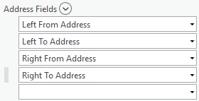
You can add address ranges to your street index by populating the Address Fields parameter. The fields below are in the Road Names layer.
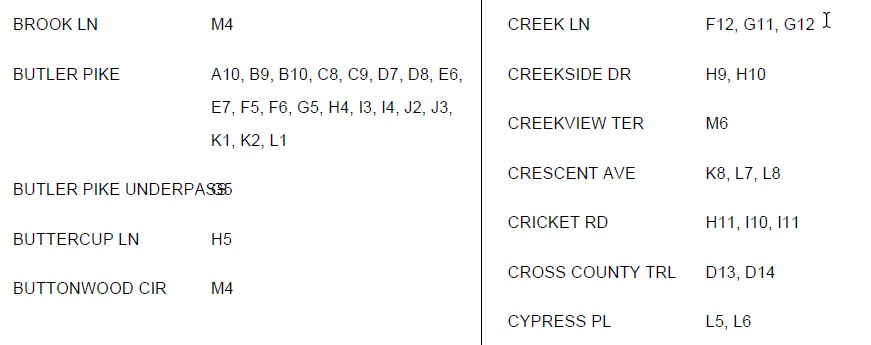
This is an example of what the end result looks like.

It's not exactly how you have your example above layout, but it will allow you to display addresses.
As for the long street name issue you ran in to, I'm not sure what might be causing it. I'll look in to it.
- Mark as New
- Bookmark
- Subscribe
- Mute
- Subscribe to RSS Feed
- Permalink
- Report Inappropriate Content
Thanks Heather! I did populate those columns, thinking that it was specifically for the index page...but as you saw above, it didn't work....is your sample from the ArcMap or Pro package?
- Mark as New
- Bookmark
- Subscribe
- Mute
- Subscribe to RSS Feed
- Permalink
- Report Inappropriate Content
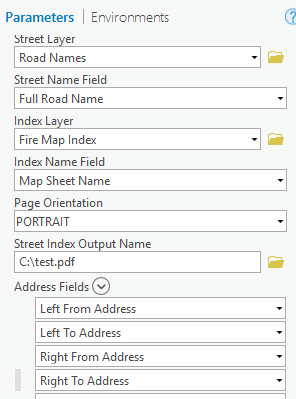
Yes, I used the sample data from the ArcGIS Pro project. Here are the parameters I used.
Unfortunately, I can't attach the PDF. Here is a screenshot of the first page.

- Mark as New
- Bookmark
- Subscribe
- Mute
- Subscribe to RSS Feed
- Permalink
- Report Inappropriate Content
Aha, so I just manually add those four fields to the "Address Fields" dropdowns...? Let me give that a shot!!
- Mark as New
- Bookmark
- Subscribe
- Mute
- Subscribe to RSS Feed
- Permalink
- Report Inappropriate Content
Yes.
- Mark as New
- Bookmark
- Subscribe
- Mute
- Subscribe to RSS Feed
- Permalink
- Report Inappropriate Content
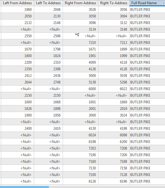
My run bombed...comparing my data to the sample data, looks like the sample script doesn't like null values. Off to python land and figuring out how to change any <null> in these 4 columns to '0' (zero)....
- Mark as New
- Bookmark
- Subscribe
- Mute
- Subscribe to RSS Feed
- Permalink
- Report Inappropriate Content
Yay! Some weird overlapping of ranges here, but I imagine that's something in the source data. But still much more desirable than what I was seeing previously. Thanks for correcting my ID-10-T error!!

- Mark as New
- Bookmark
- Subscribe
- Mute
- Subscribe to RSS Feed
- Permalink
- Report Inappropriate Content
You're welcome. I'm glad you were successful in getting a more desirable result.
- « Previous
- Next »
- « Previous
- Next »