- Home
- :
- All Communities
- :
- Products
- :
- Spatial Data Science
- :
- Spatial Data Science Questions
- :
- How can labels, or a field NAME from a feature cla...
- Subscribe to RSS Feed
- Mark Topic as New
- Mark Topic as Read
- Float this Topic for Current User
- Bookmark
- Subscribe
- Mute
- Printer Friendly Page
How can labels, or a field NAME from a feature class (lines), can be extracted, and added/put in another feature class (lines too)?
- Mark as New
- Bookmark
- Subscribe
- Mute
- Subscribe to RSS Feed
- Permalink
- Report Inappropriate Content
Dear experts:
I have 2 layers:
(1) one with the labels I wish to take, field: NAME of the streams.
(2) the other one is the new processed layer with the streamlines as product created from DEM. They do not have the NAME of the streams.
The question is, what should I do to extract the NAME field in (1), and have these labels on layer (2)? There is not primary and foreign similar field can be used to make a join.
Difficult? I do appreciate your support!
Thanks for your support!
- Mark as New
- Bookmark
- Subscribe
- Mute
- Subscribe to RSS Feed
- Permalink
- Report Inappropriate Content
Without seeing your data I can only guess at some of the issues.
As they probably don't match up spatially, I would look to use the Near Analysis tool Near (Analysis)—ArcGIS Pro | Documentation to create a new feature with the original features appended with the ObjectID of the closest Near feature. Use this is the foreign key to Join Essentials of joining tables—Help | ArcGIS Desktop to the label feature.
This is not foolproof but probably the best you can hope for.
- Mark as New
- Bookmark
- Subscribe
- Mute
- Subscribe to RSS Feed
- Permalink
- Report Inappropriate Content
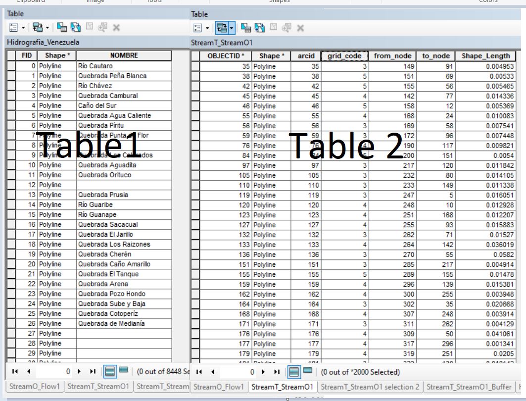
Thanks  David, I will check it out! I think both images are clear indIcating the existing 2 tables. I will let you know!
- Mark as New
- Bookmark
- Subscribe
- Mute
- Subscribe to RSS Feed
- Permalink
- Report Inappropriate Content
You probably have a much bigger issue, joining the names from one river network to another would be scale dependent. You also don't show us the topological nature of the first dataset, your secondly clearly having an arc-node topology as indicated by the attributes.
For example Rio Cautaro, in table 1 is never mentioned elsewhere in your table which would suggest it's "1 long line" to me and that would almost certainly weave on/off your DEM derived network and cause all sorts of issues with spatial selections, especially at tributary junctions.
You need to provide much more information/screenshots of your data.
- Mark as New
- Bookmark
- Subscribe
- Mute
- Subscribe to RSS Feed
- Permalink
- Report Inappropriate Content
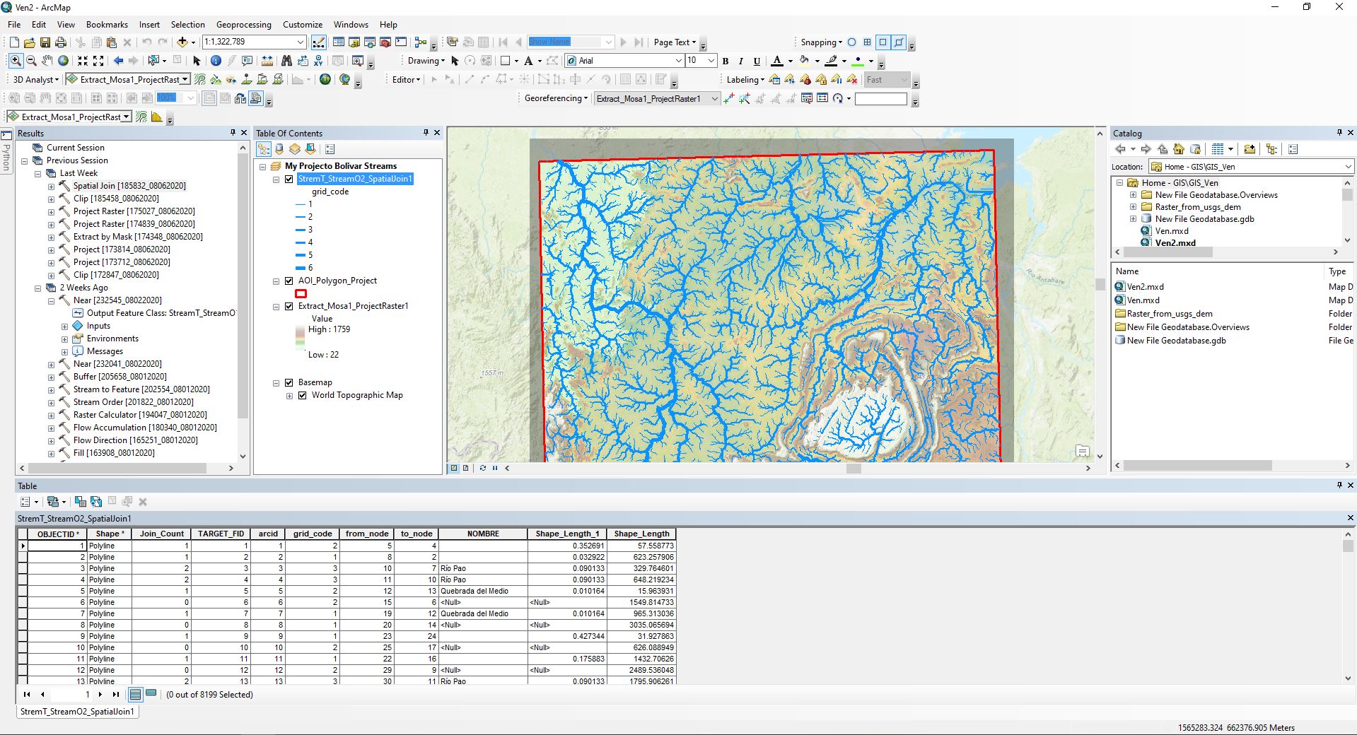
fortunately both overlap spatially, so not issue on the first hand, on the other hand, a simple spatial run join_one_to_one was enough to get the required field name the streams.
So, the image below shows just the final layer result with the new attribute table and names!
Reason of doing that, it was not happy with the found spatial data of the previous streams that have the names because some of them if not to many where not properly sketched, and in many cases uncompleted.
Again, thank you!