- Home
- :
- All Communities
- :
- Industries
- :
- Science
- :
- Science Questions
- :
- Re: Join us for a GeoNet AMA (Ask Me Anything) wit...
- Subscribe to RSS Feed
- Mark Topic as New
- Mark Topic as Read
- Float this Topic for Current User
- Bookmark
- Subscribe
- Mute
- Printer Friendly Page
Join us for a GeoNet AMA (Ask Me Anything) with Dawn Wright, Esri Chief Scientist
- Mark as New
- Bookmark
- Subscribe
- Mute
- Subscribe to RSS Feed
- Permalink
- Report Inappropriate Content
Event details:
• What: Join us, with special guest Dawn Wright, Esri Chief Scientist, for an AMA (Ask Me Anything) live on the GeoNet Community in the Sciences group. Ask Dawn anything about science, GIS, her work at Esri (including the relationship of Esri to the scientific community), what's coming up at AGU, and any fun, interesting and thought-provoking questions.
• When: The AMA event will take place in this discussion thread on Friday December 8, 2017 from 10:00am-11am PT.
How to participate:
• During the AMA, if you are logged into GeoNet, you can post your questions in the comments below and Dawn will reply to your questions in the comments.
• You're welcome to post questions ahead of the AMA but we won't begin answering them until the AMA begins on December 8th at 10:00am PT.
Reminder: AMA Tips and GeoNet Community Guidelines
• You will need a GeoNet account in order to participate. If you don't have one, you can create one here.
• When asking questions and comments during the AMA, remember to follow the GeoNet Community Guiding Principles.
• During the AMA this discussion page will not auto-refresh, so please remember to refresh this page to see new questions, comments and replies.
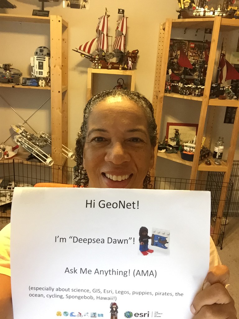
You'll know the AMA is live when you see the picture below with Dawn. And then remember to refresh the page to see our updates and new questions and comments.
Thanks for joining us and we'll see you then!
10:00 am - And we're live! Go ahead and ask your questions!
10:30 am - We're halfway through. Great questions! Keep 'em coming!
10:55 am - Five minutes to go! Got any fun questions for Dawn?
11:00 am - Overtime! We'll continue to take your questions during this bonus 10 minutes!
11:10am - And that's a wrap! The live AMA has ended but Dawn will continue to answer questions as schedules allow. Thanks for joining us and asking great questions!
Manager, Community Experience & Programs
- Mark as New
- Bookmark
- Subscribe
- Mute
- Subscribe to RSS Feed
- Permalink
- Report Inappropriate Content
What is a cool project that you are currently working on?
- Mark as New
- Bookmark
- Subscribe
- Mute
- Subscribe to RSS Feed
- Permalink
- Report Inappropriate Content
Hi Gregory - Thanks for this great question to get us off and running! There are so many great project that I'm working on at Esri right now but I'd say the coolest is the Ecological Marine Units, http://www.esri.com/ecological-marine-units which is essentially a "digital ocean" that Esri has built along with colleagues at USGS, and several other partners. This was built as commissioned by the Group on Earth Observations, sort of a United Nations of Earth observing organizations. There is a lot of info on the web site shared but happy to provide more info later.
Dawn Wright (she/her/hers), Ph.D. & GISP | Esri Chief Scientist
- Mark as New
- Bookmark
- Subscribe
- Mute
- Subscribe to RSS Feed
- Permalink
- Report Inappropriate Content
What inspired you to pursue GIS?
- Mark as New
- Bookmark
- Subscribe
- Mute
- Subscribe to RSS Feed
- Permalink
- Report Inappropriate Content
Hi Denise! I was inspired to pursue GIS while a graduate student at UC Santa Barbara in the early 1990s when GIS was really starting to evolve from not just a mapping technology, but a whole field of science, now known as geographic information science or geospatial data science. So it was a FANTASTIC time to be introduced to GIS and to take courses from some of the great innovators of the field there at UCSB.
Dawn Wright (she/her/hers), Ph.D. & GISP | Esri Chief Scientist
- Mark as New
- Bookmark
- Subscribe
- Mute
- Subscribe to RSS Feed
- Permalink
- Report Inappropriate Content
Hi Dawn!
- Mark as New
- Bookmark
- Subscribe
- Mute
- Subscribe to RSS Feed
- Permalink
- Report Inappropriate Content
What database architecture would you recommend for point vectors of water quality information? I am not believing the EMU has sufficient scale for such a near shore project.
- Mark as New
- Bookmark
- Subscribe
- Mute
- Subscribe to RSS Feed
- Permalink
- Report Inappropriate Content
Great question Donald! There is an excellent post by Kevin Butler of our Spatial Statistics Team, that may answer this question much better for you: https://community.esri.com/thread/200285-is-there-a-way-to-displayanalyze-vertical-profile-data-eg-w... And in addition, the next phase of the EMU project now includes the release of a "task" in ArcGIS Pro that allows you to "localize" your own EMUs with much higher resolution data, hopefully data that you have yourself, rather than just relying on the global World Ocean Atlas that the EMUs were originally built on.
Dawn Wright (she/her/hers), Ph.D. & GISP | Esri Chief Scientist
- Mark as New
- Bookmark
- Subscribe
- Mute
- Subscribe to RSS Feed
- Permalink
- Report Inappropriate Content
thanks.
Have you heard of the Fox River Watershed database as documented in
DEVELOPMENT OF A RELATIONAL DATABASE FOR
STUDYING ECOLOGICAL RESPONSE OF STREAMS
TO ANTHROPOGENIC WATERSHED STRESSES AND
STREAM MODIFICATIONS by Alena Bartošová, Ph.D. at the Illinois State Water Survey?
I am thinking of using this model. (I see you are not so keen on MGET anymore.)
- Mark as New
- Bookmark
- Subscribe
- Mute
- Subscribe to RSS Feed
- Permalink
- Report Inappropriate Content
Hi Donald - no have not heard of this database but will try to look it up after the AMA and would be happy to discuss with you further. And regarding MGET, my colleagues and I remain super keen on that platform of tools. They continue to improve upon the existing ones, to add new ones, and their use of the ArcGIS platform pushes us to improve on this end as well.
Dawn Wright (she/her/hers), Ph.D. & GISP | Esri Chief Scientist