- Home
- :
- All Communities
- :
- Industries
- :
- Science
- :
- Science Questions
- :
- How to manipulate the raster after polygon to rast...
- Subscribe to RSS Feed
- Mark Topic as New
- Mark Topic as Read
- Float this Topic for Current User
- Bookmark
- Subscribe
- Mute
- Printer Friendly Page
How to manipulate the raster after polygon to raster?
- Mark as New
- Bookmark
- Subscribe
- Mute
- Subscribe to RSS Feed
- Permalink
- Report Inappropriate Content
Hi all,
I am trying to create a soil dataset of the whole of Indonesia, and then clipping it to the extents of certain areas of Interest and resampling them to different resolutions.
So far, I have managed to create a soil dataset of the whole of Indonesia in a raster format. This is, however, where it gets tricky, and where I get confused.
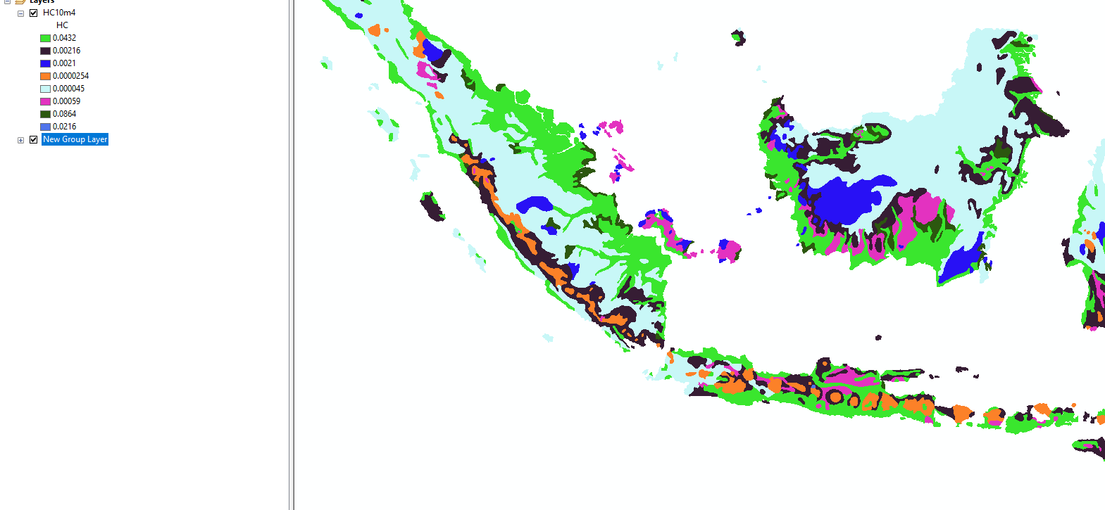
The first image details the soil dataset for the whole of Indonesia - that is what I want so no problem.
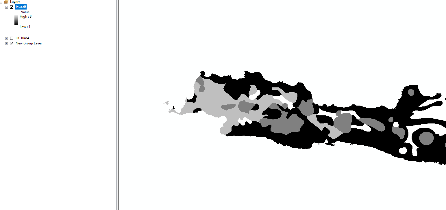
The second image shows the dataset after I have clipped it to each Island. For some reason, the values change from the original ones to integers from 1 to 7. I am sure it has something to do with the way clip acts on the data and would appreciate any methods, that I am simply overlooking, that could resolve this.
Thanks all so much in advance!!
- Mark as New
- Bookmark
- Subscribe
- Mute
- Subscribe to RSS Feed
- Permalink
- Report Inappropriate Content
Matthew,
Try using Extract by Mask instead of Clip Raster. Another approach to try to is use the Extent Environment in your Resample to avoid the need to clip.