- Home
- :
- All Communities
- :
- Industries
- :
- Natural Resources
- :
- Renewable Energy
- :
- Renewable Energy Questions
- :
- Re: Determining the observation point with largest...
- Subscribe to RSS Feed
- Mark Topic as New
- Mark Topic as Read
- Float this Topic for Current User
- Bookmark
- Subscribe
- Mute
- Printer Friendly Page
Determining the observation point with largest viewshed
- Mark as New
- Bookmark
- Subscribe
- Mute
- Subscribe to RSS Feed
- Permalink
- Report Inappropriate Content
I am looking for the optimal location to place a radio repeater on a 25,000 acre preserve. Therefore, I need to determine a point with the largest viewshed of the property that is within a 1/4-mile buffer of a hiking trail or road.I have layers for the preserve boundaries, DEM, trails/roads, and a 1/4-mile buffer all laid out, but I am unsure how to proceed. I know there are viewshed and observer point tools, but I am not certain how to use them to my desired end.
- Mark as New
- Bookmark
- Subscribe
- Mute
- Subscribe to RSS Feed
- Permalink
- Report Inappropriate Content
First, I used Flow Direction and then Flow Accumulation to identify ridgelines. I converted all pixels where flow accumulation = 0 to a point shapefile, then split the shapefile into individual points using Split Layer By Attributes. I built a model to iterate each point shapefile through the Viewshed tool, then to convert to the resulting rasters into polygon shapefiles. I merged all of the polygon shapefiles and selected for only the viewshed polygons. I clipped the polygon shapefile to my preserve boundary layer and added an Area_Acres field to the attribute table and calculated the geometry for each polygon. I selected for the 6 polygons with an area larger than 8,000 acres, and send the resulting polygons and corresponding observer points to the Preserve Manager. Success!
- Mark as New
- Bookmark
- Subscribe
- Mute
- Subscribe to RSS Feed
- Permalink
- Report Inappropriate Content
Here is a picture of the sample output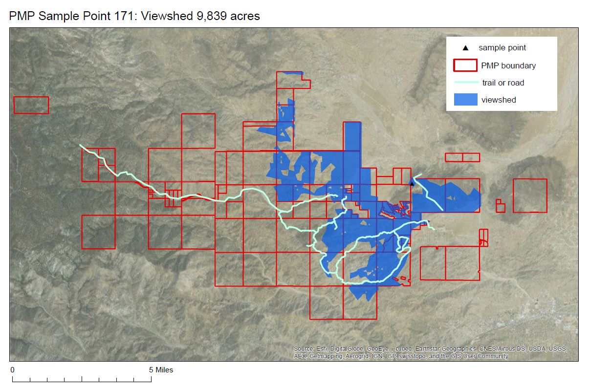
- Mark as New
- Bookmark
- Subscribe
- Mute
- Subscribe to RSS Feed
- Permalink
- Report Inappropriate Content
Another idea:
Besides Viewshed, look into Visibility (Spatial Analyst). I have not used this tool, but it seems to have much of the functionality of Viewshed but with some added functions. Using an analysis type set to Frequency may be the way to go.
ArcGIS Help (10.2, 10.2.1, and 10.2.2)
Chris Donohue, GISP
- « Previous
-
- 1
- 2
- Next »
- « Previous
-
- 1
- 2
- Next »