Turn on suggestions
Auto-suggest helps you quickly narrow down your search results by suggesting possible matches as you type.
Cancel
- Home
- :
- All Communities
- :
- Developers
- :
- Python
- :
- Python Questions
- :
- Create a raster grid in vertical plane from xyz da...
Options
- Subscribe to RSS Feed
- Mark Topic as New
- Mark Topic as Read
- Float this Topic for Current User
- Bookmark
- Subscribe
- Mute
- Printer Friendly Page
Create a raster grid in vertical plane from xyz data
Subscribe
1326
2
07-17-2013 07:24 AM
07-17-2013
07:24 AM
- Mark as New
- Bookmark
- Subscribe
- Mute
- Subscribe to RSS Feed
- Permalink
Hi
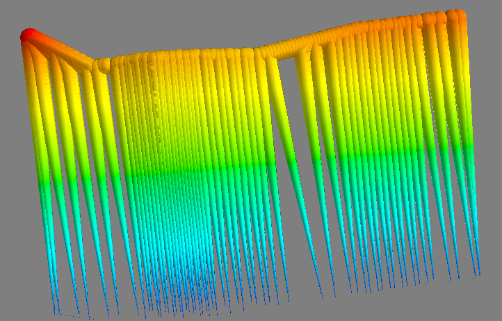
I need to create a grid of the point dataset (image attached) and export as a .grd file so that it can imported into ArcScene. I am using python xy and mayavi library to visualise this data.
If anyone could help me with this problem, I would greatly appreciate it.
Thanks in advance
[ATTACH=CONFIG]26009[/ATTACH]
2 Replies
07-17-2013
08:43 AM
- Mark as New
- Bookmark
- Subscribe
- Mute
- Subscribe to RSS Feed
- Permalink
Hi Shane,
You can use the IDW tool to interpolate a raster surface from points. The resulting raster can then be used in ArcScene.
You can use the IDW tool to interpolate a raster surface from points. The resulting raster can then be used in ArcScene.
07-17-2013
10:16 AM
- Mark as New
- Bookmark
- Subscribe
- Mute
- Subscribe to RSS Feed
- Permalink
Hey,
For some reason, idw will not work. I think this is because I'm working in a vertical plane as opposed to a horizontal plane. Is there a way to possibly flip the data by 90 degres so that it is on a horizontal plane, create the grid and reflip back perhaps?
Thanks
For some reason, idw will not work. I think this is because I'm working in a vertical plane as opposed to a horizontal plane. Is there a way to possibly flip the data by 90 degres so that it is on a horizontal plane, create the grid and reflip back perhaps?
Thanks