- Home
- :
- All Communities
- :
- Industries
- :
- Transportation
- :
- Public Transit
- :
- Public Transit Questions
- :
- Issues running the Generate GTFS Shapes with Netwo...
- Subscribe to RSS Feed
- Mark Topic as New
- Mark Topic as Read
- Float this Topic for Current User
- Bookmark
- Subscribe
- Mute
- Printer Friendly Page
Issues running the Generate GTFS Shapes with Network Analyst Tool
- Mark as New
- Bookmark
- Subscribe
- Mute
- Subscribe to RSS Feed
- Permalink
I have never been able to successfully run the "Generate GTFS shapes with Network Analyst" tool. Currently testing the tool out on a small transit agency, and using their GTFS located here:
https://transitfeeds.com/p/annapolis-transit/567
I created a network based on the county's centerlines to run this with.
When run in ArcDesktop, I either get straight lines between stops generated with the error "Unable to create the on-street routes because the solve failed" or it generates the full route (instead of shapes between stops) without error.
When run in ArcPro, I got a partial completion with the error:
On-street route shapes for the following shape_ids could not be generated. Straight-line route shapes will be generated for these shape_ids instead:
['1', '13', '16', '2']
If you are unhappy with this result, try re-running your analysis with a different u-turn policy and/or network restrictions, and check your network dataset for connectivity problems.
With this error, there are more than just the listed straight line segments generated.
Any help on getting this to run properly is appreciated!
I looked into U-turn policies and network connections and haven't been able to pin point issues with those.
Solved! Go to Solution.
Accepted Solutions
- Mark as New
- Bookmark
- Subscribe
- Mute
- Subscribe to RSS Feed
- Permalink
Oh, I see. Unfortunately, no, there's not a way to do that right now. I have it on my long-term to-do list, though. If you use GitHub, feel free to up-vote the issue.
The challenge in implementing something like this is that GTFS's route shapes are not directly correlated with the location of the stops. I could do something like what I do in Generate GTFS Shapes for the case where the GTFS data does not already have any shapes, but this would not satisfy the majority of users who already have a GTFS shapes.txt file.
- Mark as New
- Bookmark
- Subscribe
- Mute
- Subscribe to RSS Feed
- Permalink
It sounds like a problem with your network dataset. Have you tested the network dataset in the map just for normal routing? Try doing that before you plug it into the Generate GTFS Shapes tool.
This tutorial can help you if you're unfamiliar with Network Analyst: Exercise 3: Finding the best route using a network dataset—Help | ArcGIS Desktop
There are many factors that can cause network datasets to misbehave, but the most common are:
- Bad network connectivity because the streets are physically disconnected (small gaps and dangles)
- Bad connectivity because the connectivity policy isn't set up correctly for the characteristics of the data (the streets have vertices at intersections, but the connectivity policy is set to End Point; the connectivity policy is set to Any Vertex, but the streets don't even have vertices at intersections)
- The impedance attribute isn't calculating travel time or distance correctly.
- Mark as New
- Bookmark
- Subscribe
- Mute
- Subscribe to RSS Feed
- Permalink
Thank you for your response Melinda,
I didn't have any issues calculating routes with the network, and the connectivity policy is set to any vertex to which there are vertices at intersections.
Alternatively, we attempted to run the tool using ArcOnline and ended up with each route, instead of stop-to-stop segments (similar to the generate GTFS shapes tool).
- Mark as New
- Bookmark
- Subscribe
- Mute
- Subscribe to RSS Feed
- Permalink
So did the ArcGIS Online version solve your problem, or do you still need help?
- Mark as New
- Bookmark
- Subscribe
- Mute
- Subscribe to RSS Feed
- Permalink
Unfortunately it did not, agol is generating the full route as oppose to node to node pairs.
- Mark as New
- Bookmark
- Subscribe
- Mute
- Subscribe to RSS Feed
- Permalink
This tool generates full routes representing the path driven by buses throughout the entire route, from the first stop to the last stop. It does not generate individual lines connecting each stop.
What is your desired output, or what is your goal? Maybe I can help you find another way to create this.
- Mark as New
- Bookmark
- Subscribe
- Mute
- Subscribe to RSS Feed
- Permalink
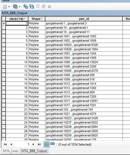
My goal is to produce an output similar to what is produced from the Better Bus Buffers toolbox "Count Trips on Lines" tool (like the screenshot below). Where stop pairs are attributed to line segments, only the line segments follow the roads network as opposed to straight lines. Is this possible?
Thank you for your help!
- Mark as New
- Bookmark
- Subscribe
- Mute
- Subscribe to RSS Feed
- Permalink
Oh, I see. Unfortunately, no, there's not a way to do that right now. I have it on my long-term to-do list, though. If you use GitHub, feel free to up-vote the issue.
The challenge in implementing something like this is that GTFS's route shapes are not directly correlated with the location of the stops. I could do something like what I do in Generate GTFS Shapes for the case where the GTFS data does not already have any shapes, but this would not satisfy the majority of users who already have a GTFS shapes.txt file.
- Mark as New
- Bookmark
- Subscribe
- Mute
- Subscribe to RSS Feed
- Permalink
I know this post is from quite a long time ago, but I wanted to report back on the functionality that was requested.
With the release of ArcGIS Pro 3.4, the Calculate Transit Service Frequency tool (the successor to BetterBusBuffers) has been enhanced to include an option to output transit statistics using actual route shapes instead of straight lines. To use this option, you have to run the GTFS To Public Transit Data Model tool in ArcGIS Pro 3.4 or higher to with the option to use your GTFS shapes.txt file to generate the new LVEShapes feature class in the public transit data model.
Instead of this:

You get this:
