Public Safety Blog

cancel
Showing results for 
Show  only  | Search instead for 
Did you mean: 

Other Boards in This Place

Latest Activity

(64 Posts)
KatieSmith
Esri Regular Contributor

Learn how to turn data into actionable intelligence. Esri's two-day course explores tools and techniques to visualize public safety data trends and predict future behavior. View course details and upcoming class dates.

Read more...

more
0 0 950
by Anonymous User
Not applicable

By Mike King, Director of Emergency Communications – Esri

Twitter @printcop

In July of this year, public safety professionals from around the world descended on San Diego, California to attend Esri’s 4-day National Security and Public Safety Summit. Over 700 commanders and staff came together to share the challenges and successes they’ve had while protecting over the past year.
 
As the conference began, I stood in awe, hand over heart, as the flag of the United States was presented. I listened intently as our national anthem was powerfully sung.  I felt a sense of gratitude at the reverence displayed by our many international colleagues and government leaders in attendance.
 
During a “moment of silence” for those who had lost their lives in the line of duty last year, my mind raced back to personal friends who died in the line of duty. Their deaths and the accompanying heartache felt by comrades and loved ones suddenly raced back and I found myself stirred with deep emotion. I could see the faces of many of the attendees, and they too seemed to be humbly honoring those great heroes from around the world.
 
Once the summit was underway, I saw police officers, firefighters and emergency managers sitting side-by-side, interacting with each other, both during and in-between sessions. Their common mission of public protection powerfully eliminated preconceived misconceptions and personal biases. Together, they were learning from each other, embracing commonalities and solving problems.
 
I marveled at the great work being done globally, like the work of the Lebanese Red Cross who adopted a new GIS strategy to improve ambulance response times.  These efforts are now saving lives and our colleagues in Lebanon are leveraging that investment to improve their mobile web applications for improved data collection and information sharing.

Lebanese RedCross at Esri
 
The summit provided examples of real-world, national security and public safety challenges, like those shared by CEO Brian Fontes of NENA, the National Emergency Number Association. Fontes shared NENA’s newly created national PSAP Registry portal, designed to spatially show all public safety answering points (command & control centers). The Registry will support many of the next generation call-taking efforts.

CEO Brian Fontes of NENA at Esri


Other presentations included how U.S. Customs and Border Protection is saving lives through the Missing Migrant Program. This program was designed to save lives along the 4,200 square miles of the Rio Grande Valley and evidence shows that it’s working. 

US Border Patrol

Richard Reed of the FirstNet Authority shared how GIS is used in the rollout of the
first voice and data broadband network dedicated to first-responders and Colonel Volker Kozok showed how the German Armed Forces are using GIS to combat hybrid warfare.
German Armed Forces

 
At one point, I found myself smiling as I reflected on what I was witnessing. It was a true “coming together” of several life-saving disciplines and it included all of the fun-loving banter that exists between first-responders.

 
My personal example goes like this (and sounds like a broken record) as several old firefighter friends approached me with the same humor I’ve heard for 40 years, saying, “Hey King, if you could have scored two more points on your public safety exam, you could have been a fireman too!”  Not to be outdone, and in true form to my law enforcement brotherhood, I simply responded with some of the many reasons why law enforcement is a more noble career, and why we always won the town celebration tug-o’-wars – not just by brawn… but also our brilliance!

Mike King and John Beck at Esri
 
The National Security and Public Safety Summit offered everyone in attendance with a unique balance between visionary leader keynotes, forward-thinking presentations and networking opportunities where attendees could learn about the rapid advances that are occurring globally, including how GIS is influencing and empowering first-responders. Let's continue the conversation in this GeoNet discussion, h
ow will you work to build resilience and collaborate in the new normal?


We want to thank our generous sponsors of the summit which include our gold sponsors: GeoComm, Juvare, Microsoft, and RapidDeploy; and our silver sponsors: BCS, FirstNet, HERE Technologies, and IBM.  If you missed this year’s summit, we will release the proceedings in the coming weeks. Please plan to join us next year at the National Security and Public Safety Summit on July 11-14, 2020 in San Diego. Those registered can also attend the first two days of the Esri International User Conference where more than 19,000 professionals from around the world come together. 


more
0 0 1,745
by Anonymous User
Not applicable
0 0 1,050
by Anonymous User
Not applicable

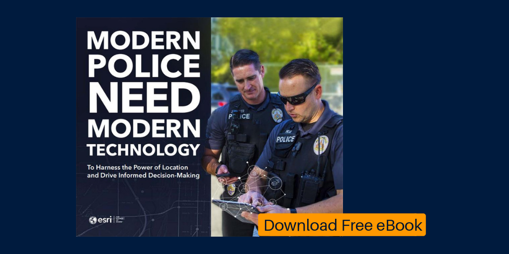
Download the New Law Enforcement eBook Today.

In this eBook you will learn how to 

  • Implement Modern Crime Control Strategies
  • Prepare and Manage Special Events in Real Time
  • Support Community Policing Initiatives
  • Respond and Assist Homeless Populations
  • Combat the Opioid Epidemic

Advances in police technology and the evolution of modern systems are transforming policing. Sensors have become ubiquitous and include automatic vehicle location (AVL) and license plate recognition (LPR) technology, closed-circuit television (CCTV), body-worn cameras, gunfire detection systems, and drone platforms. Police data systems have also evolved. Computer-aided dispatch (CAD), records management system (RMS), and business intelligence (BI) technologies are becoming increasingly sophisticated and producing larger, more robust datasets. Leading law enforcement agencies are linking all these information systems with GIS technology, giving police the ability to make data-driven decisions like never before

Law Enforcement eBook

Download: go.esri.com/l/82202/2019-03-24/mg8jw4

more
1 0 1,178
BrendaMartinez
Esri Regular Contributor

Early September historically sees the most disaster damage in the US, because it’s the height of the hurricane season in the Atlantic Basin. In time for this busy season, FEMA has released Preliminary Damage Assessment (PDA) templates for Survey123 for ArcGIS. The templates streamline data collection on handheld devices and mark an ongoing digital transformation from traditional paper forms.


A PDA report is mandated by Congress in order to determine if disaster damages warrant a presidential major disaster declaration and the funds that come with it. The templates address one of the primary goals of FEMA’s new strategic plan—to reduce complexity—making it easier and quicker for communities and individuals to receive the assistance they need.


“We designed the survey to be easy for anyone to fill out,” said Erin Densford, Recovery Operations Officer, FEMA headquarters. “We know that state, local, tribal and territorial governments sometimes have to rely on people that have never done a damage assessment before, and the language on the survey is meant to be very straightforward.”


The PDA process starts at the local level where damage details are initially collected, shared, and validated by State, Tribal, and Territorial authorities. These entities generally have 30 days from the start of an incident to determine whether or not federal assistance in the form of FEMA Individual Assistance, Public Assistance or other federal programs may be necessary.


Many local authorities thankfully face disasters for the first time or go decades between events. For those new to the process or refreshing their understanding, the process is well-documented in a detailed manual. However, the level of detail is hard to process in the immediate aftermath of a disaster event.


“With the templates, you can look at the data schema and have a good sense of what we want within five or ten minutes,” Densford said. “It’s far faster than looking through the 60-page manual, which users can reference for clarification.”


The template approach has been in the works for some time. It has been tested in pilot programs with state and local authorities. Refinements have reached the point where it’s ready to be shared broadly with the emergency management community.


This process isn’t a great leap forward in time savings for individual assessments, but it greatly improves accuracy and overall reporting. In testing, it takes a bit more time than paper because the step-by-step form-based approach requires that each field be filled out for each assessment.  With this template approach, “We’re getting all the pieces of information that we hope to collect, whereas we had gaps in the paper-based process in the past,” Densford said.


This improved accuracy also relates to improved location details.


“We have used GPS for some time,” Densford said. “With the manual effort, it was easier to get a location wrong by incorrectly transposing long numbers of latitude and longitude which meant we weren’t able to create maps based on the data.”


With Survey123, location is automatically registered to the damage details and photos of the damage, making map-based reporting as easy as hitting a button.


Work is ongoing on streamlining the data flow from the data being collected in the templates to the Public Assistance grant program system (PA Grants Manager). This next step promises to speed the flow of funds needed to rebuild, repair or replace damaged infrastructure in impacted communities.


“We have priorities to reduce the complexity and deliver individual assistance quickly, and this tool speaks to both of those objectives,” Densford said. “We’re making the process more transparent and hopefully condensing the time it takes for a community to achieve recovery.”


Learn how to configure and optimize the FEMA Preliminary Damage Assessment templates using Survey123 in this GeoNet post.

more
1 0 4,723
BrendaMartinez
Esri Regular Contributor

By Mike Cox, Fire and EMS Industry Manager, Esri

The 38th Esri User Conference (Esri UC) was an incredible success. When nearly 18,000 Esri geographic information system (GIS) technology users gather for a week of learning, networking, and sharing ideas, the result can only benefit all involved. The content ranged from integrating data from “low earth orbit” satellites to dealing with a total solar eclipse “where the sun don't shine”.

This was my first User Conference since becoming an employee of Esri, and while I had attended the Esri UC previously as a user, my role this year provided a new perspective on the event. It was humbling to see the commitment of Esri personnel to our user community. Our only focus is to support our users, to see them succeed, and to serve. It is through this servant role that we see the incredible accomplishments of our users. For those of us in the public safety industry, these accomplishments mean saving lives, preserving property, and protecting the environment. The 2018 Esri UC had multiple examples of GIS leveraged to do just that—maintaining safe communities and protecting our neighbors.

For the public safety team, the event started with the National Security and Public Safety Summit (NSPSS) @ Esri UC. The theme this year was Prepare for the New Normal—explore new ways to overcome increasingly complex and unpredictable threats and hazards. This two-day preconference event had its largest attendance to date. Over 450 defense, law enforcement, fire, emergency medical, and emergency management personnel gathered for presentations about the successful use of GIS.

These NSPSS presentations covered topics including responding to wildfires, managing significant events such as the Super Bowl and the NCAA Final Four tournament, and sharing data with multiple agencies to coordinate preparations for and response to disasters. Local, state, federal, and international agencies demonstrated how GIS is used to prevent, assess, and respond to incidents. As an example, the European Union (EU) Satellite Centre presented on the use of satellite data to provide geospatial intelligence to a wide range of users within the European External Action Service and the EU member states. This presentation showcased the use of Esri technology, ranging from analysis performed on the desktop to the services being delivered through portals, from the management of the migration crisis to the support for the dismantlement of chemical weapons depots in Syria.

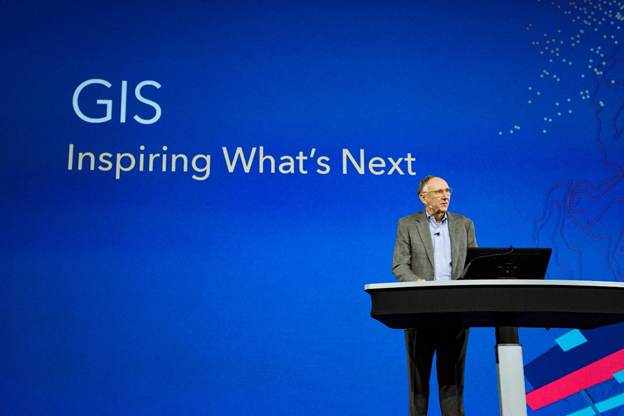
The theme of this year's Esri User Conference was Inspiring What's Next. As always, the main event began with Jack Dangermond presenting his vision at the Plenary Session. While his vision included where the technology is going, Dangermond started the week by having all in attendance consider what's next for our planet. What does that mean to individuals, families, and our communities? We live in a complex, interconnected world, and we can use geography to connect us. This constantly changing world creates many challenges—climate change, drought, deforestation, pollution, increasing urbanization, and many others. These challenges require us to fundamentally understand our world, as understanding precedes action. The Science of Where provides the framework and process for applying geographic knowledge that we can use to change our world. You can watch the 2018 Esri UC Plenary Session https://www.esri.com/videos/?event=594d5ac051b03b9718bde52b&title=Esri%20User%20Conference if you missed it earlier.

The Plenary Session maintained the Inspiring What's Next theme with a discussion of the emerging capabilities for the Esri platform. These capabilities include augmented reality, the Internet of Things, artificial intelligence, and machine learning. The increasing use of embedded devices in vehicles, clothing, and our environment—all with a geographic component—will impact our lives every day. With 3D capabilities providing a better understanding of our environment, first responders can—in seconds—identify the location of a person needing help, such as which floor in the building the person is in. GIS removes the technological complexities to allow us to solve real problems easily.

The latest release of ArcGIS Pro can help you visualize, edit, and analyze your geographic data in both 2D and 3D, providing full context to the area you are mapping. You are able to easily share your work—from mobile web scenes to paper maps—creating tailored experiences for different types of users. ArcGIS Pro 2.2 has many new features that are exciting, particularly when it comes to editing in 2D and 3D; performing quick visibility analysis; and sharing your 3D content on any device, anywhere, anytime.

Esri's ArcGIS Living Atlas of the World continues to evolve and provide multiple data sources for our users. One example of Living Atlas data is Sentinel-2 imagery for the entire planet. Each place on earth is reimaged every five days, and the data is updated daily. This service provides imagery and infrared views. The rich content of the Living Atlas is brought together in the Earth Systems Monitor. The monitor allows you to view climate data, real-time weather conditions, and urban development as well as a global human footprint map. You can review some of the Sentinel-2 capabilities at sentinel2explorer.esri.com/.

Thousands of attendees from over 140 countries gathered in the San Diego Convention Center to learn how the innovative use of GIS addresses the issues impacting our planet. Examples of this work included the following:

  • Environmental modeling and assessment
  • Planning and urban design
  • Engineering and public works
  • Utilities and telecommunications
  • Public health and demographics
  • Public safety and security
  • Portal for ArcGIS, open data, and citizen engagement
  • Cartography
  • Story maps

The week continued with multiple technical workshops on subjects ranging from basic GIS capabilities to in-depth data analysis and application use. These technical workshops can be reviewed at esri.com/videos/watch?playlistid=PLaPDDLTCmy4Z27yCYMJkyxj3WHtFBW08l&title=2018-esri-uc-technical-wor....

One of the event highlights for Esri staff is the direct interaction and support we provided to our customers. For the public safety team, these exchanges primarily occurred in the Public Safety Neighborhood at the GIS Solutions Expo. This area allowed us to provide one-on-one demos, answer questions about solutions, and demonstrate solutions from our partners. There were also comprehensive presentations by our skilled staff in the Operations Platform for Safety/Security (OPS) Center Theater.

The Esri UC always focuses on our user community and its success. Throughout the conference, attendees could join other users during their presentations about the use of GIS. One of the most interesting sessions I was able to attend was about one community's effort to deal with "Where the Sun Don't Shine"! Trich Van Wagner, GIS manager for Bonneville County, Idaho provided an extremely entertaining presentation about how the county used GIS to manage the influx of visitors in the Idaho Falls area for the August 21, 2017, solar eclipse. Hundreds of thousands of people across the nation were vying for the best viewing spot, impacting localities across the nation.

Van Wagner and Bonneville County staff leveraged GIS to create incident maps and web apps for local government use. They mapped campsites and emergency response resources, and they used mobile applications such as Survey123 for ArcGIS and the ArcGIS  environment to provide real-time incident data. This data was analyzed and communicated via story maps and dashboards. This presentation clearly demonstrated how The Science of Where helped provide a safe and efficient response to this significant special event.

Dangermond clearly stated that the goal of this year's Esri User Conference is unchanged from 38 years ago: to be together, learn from each other, share knowledge, and—from time to time—have a little fun. By all indications, we met this goal in 2018.

Please join us at the 2019 Esri User Conference, to be held July 8–12, 2019, at the San Diego Convention Center in San Diego, California. esri.com/en-us/about/events/uc/overview

more
0 0 1,217
BrendaMartinez
Esri Regular Contributor

By Ryan Lanclos, Director of Public Safety Industries, Esri

As San Antonio, Texas prepared to host the 2018 NCAA Men’s Final Four Championship in early April, a series of bombs exploded in nearby Austin.

“That put everybody on edge, then one of the bombs went off at the FedEx transfer facility in Schertz, which is just 17 miles up the road, and it brought the risk home,” said James Glass, deputy director of the Southwest Texas Fusion Center, one of many such centers across the US that collaborate with all first responders to detect, prevent, investigate and respond to criminal and terrorist activities.

Fears continue to escalate as the world experiences more tragedies at big events. In response, local and national law enforcement agencies are enhancing venue security and raising public awareness with promotional campaigns such as “If you see something, say something.”

“For the NCAA games, people were paying closer attention,” said Douglas Berry, San Antonio Fire Department Battalion Chief. “There were a lot more reports of suspicious packages, and the ability to vet those quickly was very important.”

Forces on Foot

The NCAA Final Four weekend in San Antonio included a three-day music festival at Hemisfair Plaza, a fan fest at the Henry B. Gonzalez Convention Center, and games at the Alamodome. With all event venues within walking distance of each other, hundreds of thousands of people milled around the city’s compact downtown. San Antonio deployed a large force of on-foot officers to ensure safety. The challenge for the Southwest Texas Fusion Center was twofold: give every officer the maps and data they needed for each event and maintain visibility of each officer’s location.

“We had been getting details on temporary setups from the NCAA months in advance,” said Sean Cummings, Public Safety Enterprise GIS Solutions Supervisor at City of San Antonio. “We put all of the details on the map, including the buildings, the booths, the road closures, the entrances, the access control points, the stage, and where lines would form.”

The Fusion Center deployed these maps to more than 200 networked smartphones. At command centers, staff could track and share the identity of each phone, and officers could search the map and share photos tied to locations.
Vetting Suspicious Packages

Word went out well before the events that attendees could only bring a clear bag no larger than 12-by-6-by-12 inches. Despite this widely broadcasted message, and free bags distributed at multiple locations, many people brought bags that they ditched when they realized that they couldn’t bring them inside a venue.

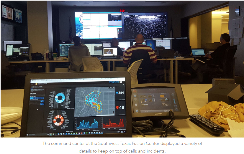
This lead to many suspicious bag reports and follow-up responses from officers and joint hazard assessment teams (JHAT) that specialize in bomb and hazardous material threats. With each call, came a rough location. Command post staff used a live common operating picture to correlate each report with the real-time location and input from responding officers. They also were able to access and point the closest CCTV camera to capture and share a view of the scene.

“Even if someone just left a bag, you can’t rule it to chance,” Glass said. “The teams collected 264 separate suspicious packages that they went through, cataloged, and put in the police property room.

In one case, a patrolman forwarded a picture of a suspicious package that turned out to be one of many remote hazardous materials monitoring stations. With the visual evidence, the JHAT team was immediately able to dismiss it and save a time-consuming trip.

“Photos let us vet each suspicious package a lot sooner,” Berry said. “That makes a huge difference on response times and resources when you go from making one run every couple of days to making more than 10 runs a day.”

More Big Moments

At many crucial moments during the NCAA weekend, maps proved vital for those charged with public safety. A few hours prior to the final game on Monday night, the Fusion Center team went out for a quick meal. Just then, they received two suspicious package alerts. Instead of rushing for the door, staff pulled out their phones to look at the live map. They watched a play by play as the package was investigated and revealed to be a harmless diaper bag that had fallen out of a minivan. This real-time situational awareness brought relief, and a much-needed dinner break, to Fusion Center staff.

During the March Madness Music Festival, Fusion Center staff noticed a sudden convergence of officers near the main stage. Training a camera on the gathering, staff noted that officers were not responding to an incident but were showing support for performer Jason Aldean, a country music star who was last on stage in Las Vegas in October 2017 when a gunman opened fire on the crowd. The officers gathered for an impromptu “we’ve got your back” moment, making their presence known to the performer and the crowd.

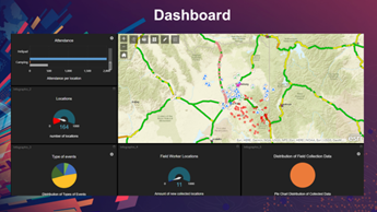
In command centers throughout downtown San Antonio, dashboards displayed details beyond the live common operating picture. Staff could see an incident log for different zones across all venues and a running tally of events with levels of activity. Dashboard users could zoom into each logged event for more details. Another dashboard provided the historical record, parsing the number of calls for service and types of calls over time.

Dedicated Bandwidth for First Responders


AT&T recently won the contract to set up a high-bandwidth first responder network called FirstNet, which provides a dedicated interoperable public safety broadband network. In the first phase, it prioritizes network bandwidth for every SIM card assigned to the FirstNet network, putting priority on messages and images shared by first responders. In phase two, it will provide a completely new infrastructure to separate law enforcement communication from consumer communication.


“It’s one thing to have the software and the hardware to do it, but you’re only as good as the cell phone towers,” Berry said. “When 200,000 people cram into a small area downtown, the network starts to bog down. It’s huge to be able to bump selfie traffic in order for law enforcement to communicate and send text messages and photos.”


The phones and the FirstNet network augment the professional radios that each officer carries. While the radios provide secure communications, they don’t provide location services or the ability to text or take photos. Because phones use GPS as well as WiFi and Bluetooth signals, each one returns an accurate location for the officer carrying it whether they were indoors or out.


Fusing Intelligence

Law enforcement agencies increasingly share intelligence, and today’s digital workflows make this easier. San Antonio set up its Fusion Center more than ten years ago, taking an all-crimes and all-hazards approach to information sharing across the city’s public safety community.

The need for a new special event management solution centered in the Fusion Center became apparent after an incident at the city’s annual ten-day Fiesta historical celebration. When someone passed out from heat exhaustion during the parade, emergency medical staff rushed in to help. Seeing this, nearby police officers thought it was the beginning of a fight and moved in. The two groups forcing their way into a small and crowded area caused some minor injuries in the crowd.

“It really screamed to us that we needed a common operating platform where we can communicate amongst each other,” Glass said. “We had two different dispatching systems and dispatchers that didn’t communicate in a crisis.”

The Fusion Center now centralizes calls for service and aggregates intelligence from a variety of different systems. Using mobile phones for the NCAA event made fusion easier than ever before by getting everyone on the same page fast. FBI agents, plainclothes police officers, and various food inspection and ordinance enforcement personnel each had their own phones. Everyone with a phone could easily access relevant information and communicate with their peers. Live tracking of each phone’s location gave the command centers a clear picture of available resources.

“That’s really the power of a web-based map,” said Aric Jimenez, special projects manager at the Southwest Texas Fusion Center. “You have nothing to set up except granting people access and sending them a URL.”

Accountability has become a driving force in law enforcement with the advent of body cams and bystanders taking and sharing images and videos from their phones. The solution San Antonio deployed for the NCAA Final Four helped in the moment and afterward by providing a record of the event.

“Going forward, it’s very important to not only track activity, but to look at the data a number of different ways, capture it, and then analyze it and do forecasting,” Berry said. “Everybody has a different perspective, fusion allows us to break down the data so that each person can see what they need when they need it.”

Using Smart Devices to Increase Situational Awareness

The Fusion Center deployed Workforce for ArcGIS to provide the common view for both the officers on foot and the command centers. The software provides the means to define the roles and work areas of different field workers. In this case, the Fusion Center defined the location and geographic extent of each officer’s post as well as the expertise and incident type best suited to each officer. It also provides the overall status of each person that both the Fusion Center and individual officers could view on a real-time map. This data fuels the Operations Dashboard for ArcGIS for the flexible display of real-time information at a glance. The software enhanced the centralized dispatching and incident response system, allowing the Fusion Center to efficiently and effectively respond to any call. Workforce and Operations Dashboard are used widely in public works, utilities, construction, field sales, and public safety domains. The software and mobile device applications fill in data gaps while maintaining connections to enhance the coordination of activities.

more
2 1 788
BrendaMartinez
Esri Regular Contributor

We look forward to seeing you at the 2018 FedGIS Conference. To help you and your organization gain the maximum benefit from this event, we have highlighted a few resources among the hundreds of different activities, workshops and Expo opportunities available on March 20-21.  Learn more at 2018 Esri Federal GIS Conference

more
0 0 841
BrendaMartinez
Esri Regular Contributor

Counter Drug—Managing the Opioid Epidemic—Part Two of an Eight-Part Safe Communities Blog Series

By Carl Walter, National Security and Fusion Center Industry Manager • Esri Public Safety Team


Recent global events have shed light on the complex, interrelated worlds of public safety and national security. Civil unrest, crime, natural disasters, and widespread public health threats all reflect the heightened need for coordinated prevention activities and effective response capabilities. Geospatial technology is uniquely positioned as the technical platform to spearhead this coordination—including when the threat is a public health crisis like the ongoing opioid epidemic.


The opioid crisis is happening in every community and affecting every demographic. The hallmark of a safe community is having organizations use geographic information system (GIS) technology as a foundation for multiagency, multijurisdictional collaboration. Geography plays a role in managing any community emergency. While the opioid epidemic presents unique challenges, GIS technology enables governments to understand the who, where, when, and why in real time, potentially saving the lives of countless Americans.


Counterdrug agencies have a common goal of disrupting the market for illegal drugs by arresting and dismantling those involved in drug trafficking and related money laundering activities. Recently, drug overdose has become the leading cause of injury and death in the United States. Opioid abuse is a major contributor to this epidemic and now requires governments to rethink their drug enforcement strategies—making sure they better align with public health strategies—to save lives. What's more troubling is that, in the face of this public health crisis, prescriptions for opioids have reached an all-time high.


Creating tools in the field that enable real-time mapping of overdose incidents while protecting sensitive personal identifiers is a strategy worth exploring. These tools must allow first responders in the field a simple way to identify the location of an overdose, input basic information about the event, and submit that data in real time to an enterprise geographic information system. Once received, data can be leveraged using dashboards, Esri Story Maps apps, and other Web GIS tools so trends can be identified and information can be shared with decision-makers, relevant stakeholders, and even the public. A geocentric approach to managing this data in real time will allow officials to make lifesaving decisions with the goal of preventing further overdose cases.


The Washington/Baltimore High Intensity Drug Trafficking Areas (HIDTA) program, the Department of Homeland Security Geospatial Management Office (GMO), and the Department of Justice (DOJ) are utilizing GIS to coordinate their drug-fighting and information sharing efforts. The integration of local law enforcement, health agencies, and communities allows them to improve their response to opioid overdoses by proactively identifying and monitoring indicators and warnings and sharing authoritative data in near real time (see https://hifld-dhs-gii.opendata.arcgis.com/, https://ndews.umd.edu/sites/ndews.umd.edu/files/odmap-brochure-flyer.pdf).


Discover how GIS can help your community battle the opioid epidemic. Join us for our upcoming webinar on June 21 to explore the strategy of creating tools in the field to enable real-time mapping of overdose incidents while protecting sensitive personal identifiers.

Wednesday, June 21 | 9:00 a.m.–10:00 a.m. (PDT)

Register Now

more
0 0 1,097
BrendaMartinez
Esri Regular Contributor

By Carl Walter, National Security Industry Manager • Esri Public Safety Team


All security issues have one thing in common—location.

Global events routinely shed light on the complex, interrelated worlds of safety and security. Civil unrest, crime, natural disasters, and widespread public health threats all reflect the heightened need for coordinated prevention activities and response capabilities. Intelligence fusion centers are uniquely positioned to spearhead this coordination.

Fusion centers have been a growing practice since 9/11. They are embedded in most local, state, federal, military, and corporate organizations worldwide. These centers are tasked with collecting, analyzing, and sharing crime, disaster, and threat-related information throughout all levels of government and with the private sector and the public. Fusion centers also provide support during critical incidents and planned, high-risk special events.

To support many missions, fusion center technical solutions must be able to fuse foundational, incident, dynamic, and intelligence data. Integrating data from multiple data sources and multiple agencies with advanced maps and spatial analysis can only be accomplished through the effective use of geographic information system (GIS) technology.

Esri's new Safe Communities initiative is focused on helping organizations rapidly set up GIS for shared situational awareness. This initiative supports fusion center efforts to use GIS as a foundation for preventing crime and protecting lives, property, and critical infrastructure.

This is the first blog of an eight-part series. These blogs will outline an expanded approach to using GIS for information fusion, operations, and analysis that supports safe communities. This process-based approach goes beyond using GIS to support common operating pictures (COPs) for visualization and moves toward leveraging GIS as a system of insight that supports the entire intelligence life cycle. Geospatial frameworks enable interconnectivity between people, processes, and data. With this approach, agencies with a national security mission can

  • Collect and integrate information for rapid analysis to identify threat patterns, trends, and relationships.
  • Create repeatable and shareable information and models.
  • Reuse information and services across systems and jurisdictions.
  • Improve risk, threat, and vulnerability assessments to safeguard communities and critical infrastructure.
  • Facilitate better emergency planning, response, mitigation, and recovery efforts.
  • Provide enhanced dissemination and knowledge capture.
  • Evolve the common operational picture to a common operational platform.


GIS is a complete system that goes beyond powerful visualizations. It provides the ability to organize information, as well as analyze and understand trends and protection priorities in new ways. GIS also supports streamlined data dissemination. It is an effective tool for both internal and external communication.

Integrating and geotagging structured and unstructured data, including sensor, imagery, and video data, empowers users to fully analyze and exploit that information and create actionable information out of raw data. One GIS platform supports a fusion center's many missions.

Perhaps most importantly, GIS provides a common language and reference system for multiple disciplines—including law enforcement, emergency management, intelligence, public health, and defense. It empowers stakeholders to collaborate and make data-driven decisions.

Join us for our subsequent blogs as we tackle a series of questions and community challenges that stand in the way of realizing safer communities.


more
0 0 804
69 Subscribers