Calculating extent and coverage for Bathymetry Data

1877
3
01-16-2019 08:32 AM
Keith-VanGraafeiland
Esri Contributor
2 3 1,877

Calculating the extent and coverage for your bathymetry data just got easier.

Bathymetry data typically comes as a processed image (.tif or .asc) or maybe even a Bathymetric Attributed Grid (BAG) file.  This allows access to a single band of values that represent elevation.  This data is commonly stored as 32 bit floating point.  While that’s all very informative it’s sometimes difficult to understand how many of the pixels contain data and how many don’t and just how much area was mapped.

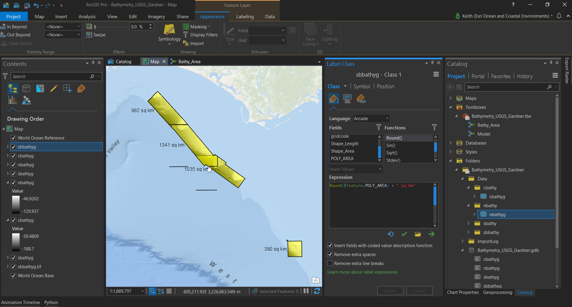
This tool reclassifies the bathymetry data and then generates polygon footprint for the areas where data exists.
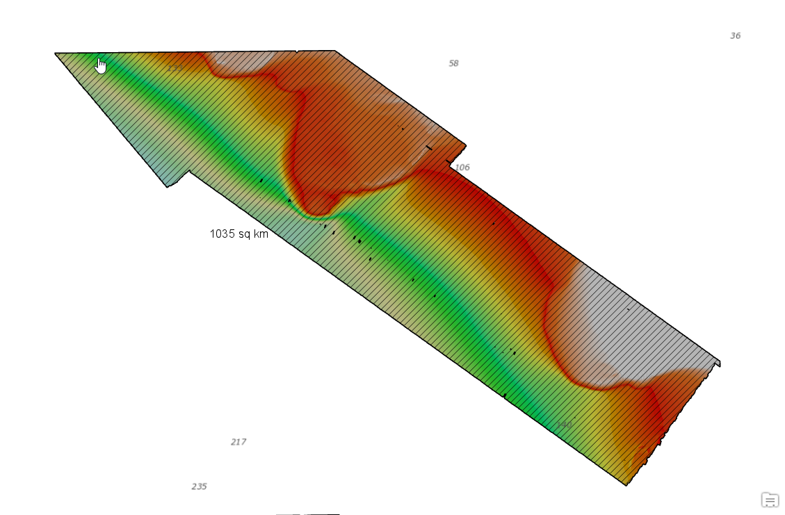
Results of tool showing labeled polygon of areas mapped.

The tool started as a model in ArcGIS Pro and is now  available as a geoprocessing package (.gpkx) so you can use it in your ArcGIS Pro projects.
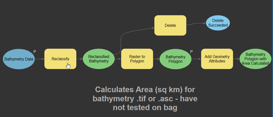
Model created in ArcGIS Pro using Model Builder

What is a geoprocessing package?

A geoprocessing package is a convenient way to share geoprocessing workflows by packaging one or more tools and the data used by the tools into a single compressed file (.gpkx). Geoprocessing packages are created from one or more successfully run geoprocessing tools.

You can add the geoprocessing package to ArcGIS Pro by downloading it and copying the file (.gpkx) to your ArcGIS Pro Project folder in windows explorer. Then browse to that location in ArcGIS Pro using your Catalog and add the tool to the current project by right clicking on it.

Try it out!
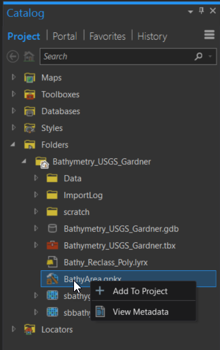
Catalog in ArcGIS Pro showing how to add geoprocessing (.gpkx) package to project.

ArcGIS Pro showing results of geoprocessing tool.

3 Comments
by Anonymous User
Not applicable

Hi Keith,

I get the following error. Any idea what causes this?

Input data is a FGDB grid, 32bit, depth as negative values.

Start Time: Thursday, 7 March 2019 08:48:27
Failed to execute. Parameters are not valid.
ERROR 000800: The value is not a member of Geodesic area | Geodesic length of perimeter | Centroid coordinates | Central point coordinates | Line start, midpoint, and end coordinates | Number of parts | Number of vertices | Extent coordinates.
Failed to execute (BathyArea).
Failed at Thursday, 7 March 2019 08:48:28 (Elapsed Time: 0.47 seconds)

Cheers,

Arne

Keith-VanGraafeiland
Esri Contributor

Hey Arne, what coordinate system are you using?  I think it might have to do something with the coordinate system.

by Anonymous User
Not applicable

Hi Keith,

After your comment I went back and tried layers with different projections. The issue seems to be (so far) with a Mercator projection (EPSG 3994 – Mercator 41), NZTM (EPSG 2193). It did work for a grid in New Zealand Continental Shelf projection (EPSG 17964) of all cases…

Best Regards,

Arne

<http://www.niwa.co.nz>

Arne Pallentin

Principal Technician - Marine Geology

T +64-4-386-0603 M +64-27-391-4377

National Institute of Water & Atmospheric Research Ltd (NIWA)

301 Evans Bay Parade, Greta Point, Wellington

Connect with NIWA: niwa.co.nz<https://www.niwa.co.nz> Facebook<https://www.facebook.com/nzniwa> Twitter<https://twitter.com/niwa_nz> LinkedIn<https://www.linkedin.com/company/niwa> Instagram<https://www.instagram.com/niwa_science>

To ensure compliance with legal requirements and to maintain cyber security standards, NIWA's IT systems are subject to ongoing monitoring, activity logging and auditing. This monitoring and auditing service may be provided by third parties. Such third parties can access information transmitted to, processed by and stored on NIWA's IT systems.

About the Author
Keith VanGraafeiland is a Principal Product Engineer with Esri in Washington D.C. He serves as the Ocean Content Lead for the ArcGIS Living Atlas of the World, a long-term projects whose emphasis is on visually appealing and useful map information products. In his role at Esri, he is responsible for curating, developing and implementing ocean related content for the GIS community. This includes maintaining a network of authoritative data providers and working with them towards nominating their layers, maps and apps for inclusion the Living Atlas of the World and working with the community to understand information needs.