Ocean Science Blog

cancel
Showing results for 
Show  only  | Search instead for 
Did you mean: 

Other Boards in This Place

Latest Activity

(81 Posts)
DawnWright
Esri Regular Contributor

Scripps Institution of Oceanography and Esri have come together for a Smart Oceans Panel at SXSW 2019, entitled Technology from Surf to Seafloor 

The demand for oceanographic data has never been greater—we need to understand how our coasts, open oceans, and coral reefs are changing if we are to preserve and efficiently utilize the ocean’s vast resources. Marine technology development must confront challenges such as turbulent waves, intense pressure at depth, and remote and (big) data transfer issues, for example. Now, more than ever, scientists and engineers need to make their complex discoveries accessible to broad audiences via high-tech data visualization and storytelling. This panel will explore innovative ways that technology development is advancing in the ocean—from the Internet-of-Things-enabled surfboard fin that aims to measure coastlines changing due to sea-level rise, ocean acidification, and more, to mapping technologies that `visualize and interpret the ocean from the sea surface to the seafloor.

The panel occurs Monday, March 11, 2019

Watch this space for a short recap.

more
2 0 716
DawnWright
Esri Regular Contributor

Next Phase of an Unprecedented Global “Digital Ocean” Project (aka Ecological Marine Units) by #Esri Chief Scientist DWright-esristaff featured in the May/June issue of Geoconnexion International http://p.ctx.ly/r/7pps   Or see attached ...

more
2 0 484
DawnWright
Esri Regular Contributor

The  Learn ArcGIS team is pleased to announce the release of a new Learn lesson featuring Ecological Marine Units data:

Predict Seagrass Habitats with Machine Learning

Seagrasses are an important ally in combatting global warming—these coastal marine plants sequester vast amounts of carbon dioxide. When compared to terrestrial tropical forests, they can store up to 100 times more CO2 per acre. In addition, seagrasses have a large economic value: they provide shelter for marine life such as invertebrates, fish and sea turtles, making them important for local fishing economies. The roots help anchor sediment to the seafloor, decreasing the impact of storms and stopping erosion from affecting coastal homes and businesses. Understanding the habitat of this species is important to drive conservation efforts and map out areas where they disappear due to human interaction.

You are a marine ecologist who wants to model suitable locations for seagrass habitats around the world. Though you only have seagrass data for a small region of Florida, luckily seagrasses tend to grow in similar ocean conditions in coastal areas around the world. Using the predictive powers of a machine learning model along with the spatial analysis capabilities of ArcGIS Pro, you’ll find suitable locations for seagrass growth globally. First, you’ll create a training dataset with all the ocean variables that influence seagrass growth. Then, you’ll put the variables into Python and use a random forest prediction model to determine where the ocean conditions support seagrass growth. Finally, you’ll save the prediction results as a feature class and import it into ArcGIS Pro to find where the highest density of growth is likely to occur.

Skills: Manipulating and cleaning data, Loading machine learning libraries into ArcGIS Pro, Enriching data to fill missing values, Transferring data between ArcGIS Pro and Python, Performing analysis in Python, Performing prediction using random forests, Using geoprocessing tools for statistical analysis.

Thanks to Orhun Aydin‌, Marjean Pobuda‌, Keith VanGraafeiland, and Kathy Cappelli for their excellent work in developing this lesson.

more
0 0 534
DawnWright
Esri Regular Contributor

Just uploaded, a video from the 2017 Esri Ocean GIS Forum on the next phase of the Ecological Marine Units project. See a demo by Esri's Sean Breyer about the incorporation of higher-resolution data to create more '"ocalized" EMUs in smaller, regional areas of interest. Also Roger Sayre of the USGS reports on the 2-day scoping meeting that took place prior to the Ocean GIS Forum to initiate the new Ecological Cosatal Units project.

Localized Ecological Marine Units + new Ecological Coastal Units - YouTube 

The specifics on the new workflow will become part of the Ecological Marine Units main web site in January 2018.

more
1 0 833
DawnWright
Esri Regular Contributor

A deep thanks again for your participation in, or remote support of, our Esri Ocean GIS Forum last week, which made it among the best ever. Please find for your enjoyment:


A Storify of the many tweets during the event, including some great photos, story maps, and videos;


A Flickr album of photos, thanks to the expert work of Esri photographer Eric Laycock;


My plenary slide deck on Your Knowledge, Our Community, the Ocean’s Resilience, including important web links therein (one with a Dec. 15th deadline);


The Ocean of Story Maps Collection;


Don’t forget that feedback is still welcome on the National Ocean Exploration Forum discussion thread on GeoNet.


Indeed, we hope to see many, if not all of you, in our Ocean Sciences GeoNet online community in order to CONTINUE the discussions and friendships of the past week.


MARK YOUR CALENDARS for November 6-8, 2018 for next year’s Esri Ocean GIS Forum, site to be determined somewhere in southern California!

more
2 0 771
DawnWright
Esri Regular Contributor

Stay tuned for more info from the Esri team on new workflows to produce local, higher-resolution 3D meshes and ultimately EMUs from NOAA data or your own data. Watch this space and the Esri Ocean GIS Forum recaps for more! We also have a growing list of exciting use cases of the EMUs for a range of scientific and resource management applications (NOAA Animal Telemetry Network, the Chesapeake Bay Program, the Orange County Sanitation District, the University of South Florida and Woods Hole as part of GEO’s Marine Biodiversity Observation Network, SCCWRP, and more).

more
2 0 696
DawnWright
Esri Regular Contributor

Our Esri Applications Prototype Lab has been experimenting with use of EMU data in their 3D Fences/Curtain tool. See some neat results on YouTube.  For more information on 3D Fences and to download the free tool, see http://esriurl.com/3dfence. And note that a new version of this tool that works with both Arcmap and ArcGIS Pro is now available.

more
0 0 680
DawnWright
Esri Regular Contributor

See our new Esri Ecological Marine Units story map with material from our many talks introducing the project, as well as from our peer-reviewed journal article in Oceanography. Thanks to KVanGraafeiland-esristaff for creating this great resource!


Visit the story map at esriurl.com/emustory or click on the image below. 

more
3 0 605
DawnWright
Esri Regular Contributor

Wednesday, May 17, 2 pm US EDT/11 am US PDT/6 pm UTC

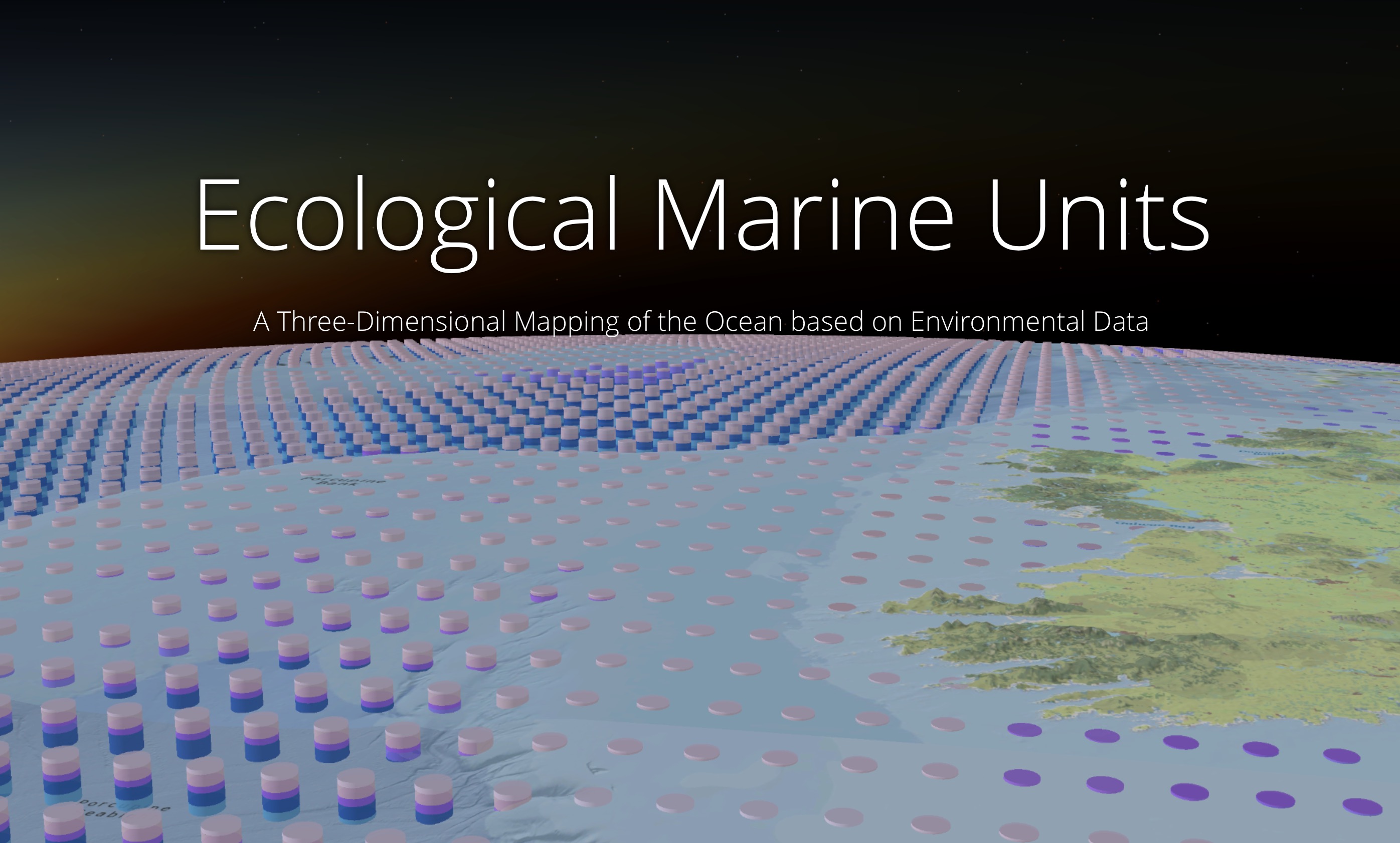
Ecological Marine Units: A 3-D Mapping of the Ocean Based on NOAA’s World Ocean Atlas (Tools Included) by Dawn Wright of Esri. This webinar reports progress on the Ecological Marine Units (EMU) project, a new undertaking commissioned by the Group on Earth Observations, to develop a standardized and practical global ecosystems classification and map for the oceans. The EMU is comprised of a global point mesh framework, created from 52,487,233 points from the NOAA World Ocean Atlas. Each point has x, y, z, as well as six attributes of chemical and physical oceanographic structure (temperature, salinity, dissolved oxygen, nitrate, silicate, phosphate) that are likely drivers of many ecosystem responses. We identify and map 37 environmentally distinct 3D regions (candidate ‘ecosystems’) within the water column. These units can be attributed according to their productivity, direction and velocity of currents, species abundance, global seafloor geomorphology, and more. A series of data products for open access will share the 3D point mesh and EMU clusters at the surface, bottom, and within the water column, as well as 2D and 3D web apps for exploration of the EMUs and the original World Ocean Atlas data. This webinar will provide an overview of the EMU project and cover recent developments and future plans for the EMUs. Webinar co-sponsored by the EBM Tools Network (co-coordinated by NatureServe and OpenChannels.org) and MEAM. 

Presented today to 140 attendees, over 300 total registrants. The (Coastal-Marine) Ecosystem Based Management Tools Network is co-coordinated by NatureServe and OpenChannels.

The recording is posted at https://www.openchannels.org/webinars/2017/ecological-marine-units-3-d-mapping-ocean-based-noaas-wor..., which includes slides and notes.

more
0 0 479
DawnWright
Esri Regular Contributor

As one of the largest geographic conferences in the world, the 2017 AAG Annual Meeting and Exhibition in Boston hosted as many as 9,500 geographers, GIS specialists, and environmental scientists from around the world.

Special Session 2411: A New Map of Global Ecological Marine Units (EMUs) - An Environmental Stratification Approach
Thursday, April 6, 1:20 p.m. - 3:00 p.m., AAG Annual Meeting, Boston
Room: 200, Hynes, Second Level

Roger Sayre (USGS), Dawn Wright (Esri), Charlie Frye (Esri)

And this special publication (technical report) was given to every conference attendee requesting a conference bag 

A New Map of Global Ecological Marine Units – An Environmental Stratification Approach

Download the free color pdf 

more
1 0 371
44 Subscribers
Labels
  • Ecological Marine Units 15