- Home
- :
- All Communities
- :
- Industries
- :
- National Statistics Organizations (NSOs)
- :
- NSOs Questions
- :
- Census Mapping
- Subscribe to RSS Feed
- Mark Topic as New
- Mark Topic as Read
- Float this Topic for Current User
- Bookmark
- Subscribe
- Mute
- Printer Friendly Page
Census Mapping
- Mark as New
- Bookmark
- Subscribe
- Mute
- Subscribe to RSS Feed
- Permalink
- Report Inappropriate Content
How do you represent households for structures that have more than 1 household in your geodatabase.
Assuming your household layer is a point layer and you have a block of flats has 6 units thus 6 households (Hse no: 6a,6b,6c,6d,6e & 6f). Do you show 6 points in your household layer within that building footprint on your map. Is this a geographic standard
- Mark as New
- Bookmark
- Subscribe
- Mute
- Subscribe to RSS Feed
- Permalink
- Report Inappropriate Content
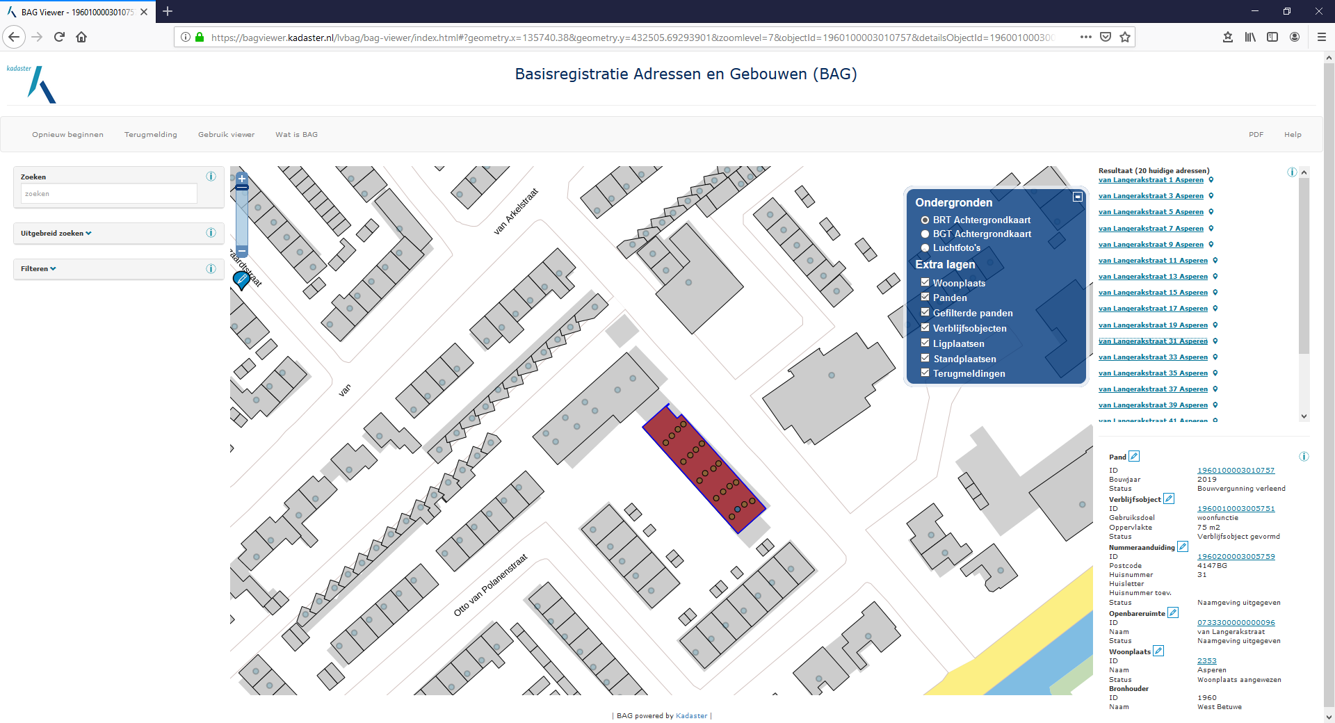
Hi Therese Gopal,
Yes, I would say: that's the way to visualize individual households within one building.
Please see the screen capture below, taken from a Registry in the Netherlands, with addresses ("Adressen") in buildings ("Gebouwen"), publicly accessible via this link BAG viewer
In the picture below, all single address dwellings (polygons) do contain a single address point. The building polygon selected in the center is, as you can see, a multi-story apartment building: 4 stories with 5 apartments each, visualized by 20 dots, neatly distributed within the polygon.
Best regards,
Egge-Jan
- Mark as New
- Bookmark
- Subscribe
- Mute
- Subscribe to RSS Feed
- Permalink
- Report Inappropriate Content
Hi Egge-Jan
Thank you for your prompt response.
I just wanted to clarify if what you mentioned in your reply is what the National Statistical Office ( NSO) Netherlands is using for their Census Mapping or is it the National Addressing System of the Netherlands.
Thank you
Therese