- Home
- :
- All Communities
- :
- Industries
- :
- Natural Resources
- :
- Mining
- :
- Mining Questions
- :
- How do I view subsurface data (mines) in a 3d scen...
- Subscribe to RSS Feed
- Mark Topic as New
- Mark Topic as Read
- Float this Topic for Current User
- Bookmark
- Subscribe
- Mute
- Printer Friendly Page
How do I view subsurface data (mines) in a 3d scene in ArcGIS Pro?
- Mark as New
- Bookmark
- Subscribe
- Mute
- Subscribe to RSS Feed
- Permalink
I have a point data for mine shafts that has depth below the surface. I would like to show this in a 3d map in ArcGIS Pro, but when I add the data and set the elevation it disappears. I have tried setting the above ground level to a negative number. It works for a bit and then moves back above ground.
Any help?
Thanks!
- Mark as New
- Bookmark
- Subscribe
- Mute
- Subscribe to RSS Feed
- Permalink
Eric,
Generally speaking, to visualize points such as mine shafts in 3D, there are two things that you need to do.
First, you need to define the height characteristics through the layer properties. You have a couple options available to you, such as the ones below:
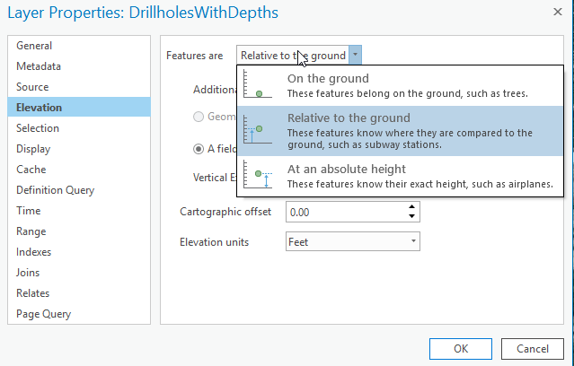
Second, since these are points that you want to represent as 3D lines, you will need to extrude the points. You will likely want to use the Base Height type of extrusion and specify a field for the depth of the mine shaft. Because it is negative, you will want to click the green X to make a custom formula. Your formula might be -1*{mine shaft depth} or something similar to that, depending on your data.

Have you tried extrusions and defining the elevation properties? Are you still having issues after working with those two properties?
- Mark as New
- Bookmark
- Subscribe
- Mute
- Subscribe to RSS Feed
- Permalink
Thanks for your help - this is great