- Home
- :
- All Communities
- :
- Industries
- :
- Natural Resources
- :
- Mining
- :
- Mining Questions
- :
- Are there any tutorials on how to import data sets...
- Subscribe to RSS Feed
- Mark Topic as New
- Mark Topic as Read
- Float this Topic for Current User
- Bookmark
- Subscribe
- Mute
- Printer Friendly Page
Are there any tutorials on how to import data sets off of public gis platforms?
- Mark as New
- Bookmark
- Subscribe
- Mute
- Subscribe to RSS Feed
- Permalink
- Report Inappropriate Content
For example, I am trying to understand how to import data sets from the Texas Railroad Commission website. See link Texas RRC - Data Sets Available for Download
- Mark as New
- Bookmark
- Subscribe
- Mute
- Subscribe to RSS Feed
- Permalink
- Report Inappropriate Content
Did you try clicking on the Hyperlink below where is says download data
- Mark as New
- Bookmark
- Subscribe
- Mute
- Subscribe to RSS Feed
- Permalink
- Report Inappropriate Content
Under where is says download. Click on the hyperlink
Say for example you click on Pipeline Layers by County.
If using Internet explorer click on the Page drop down menu and then Open FTP site in File Explorer
Or you can just click on Pipelines and you will see zipped files for each county. You can click on the zip file you need and it will download it. If you open it in File Explorer you can down load them all at one time.
- Mark as New
- Bookmark
- Subscribe
- Mute
- Subscribe to RSS Feed
- Permalink
- Report Inappropriate Content
Robert,
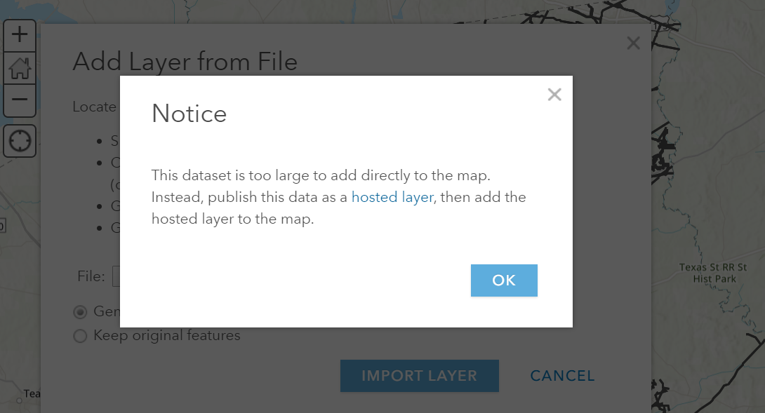
For the "Pipeline Layers" that works just fine, however if I try "Well Layers by County" I get the following message. Apologies up front as well...I am a bit new the platform. I click "hosted layers" but from there not real sure how to proceed as the zip file is made up of several different formated files
- Mark as New
- Bookmark
- Subscribe
- Mute
- Subscribe to RSS Feed
- Permalink
- Report Inappropriate Content
ArcGIS Online will only display a couple thousand features at one time. And there are probably many many thousand wells in Texas.
Do this instead. From ArcGIS Online where you go to add the data. Choose instead to search ArcGIS Online
In the search type in
TCEQ_Public_Water_System_Wells
and add them to your map. However, you may still get the error. You need to then go to setting and change the visibility scale so they are not all visible when the whole state is on screen.
If that is the wrong well layer you can just search for Texas Wells. But there are 228 layers that match that.