- Home
- :
- All Communities
- :
- Products
- :
- Imagery and Remote Sensing
- :
- Imagery Questions
- :
- Re: Raster Mosaic Does Not Show Elevation Data
- Subscribe to RSS Feed
- Mark Topic as New
- Mark Topic as Read
- Float this Topic for Current User
- Bookmark
- Subscribe
- Mute
- Printer Friendly Page
- Mark as New
- Bookmark
- Subscribe
- Mute
- Subscribe to RSS Feed
- Permalink
- Report Inappropriate Content
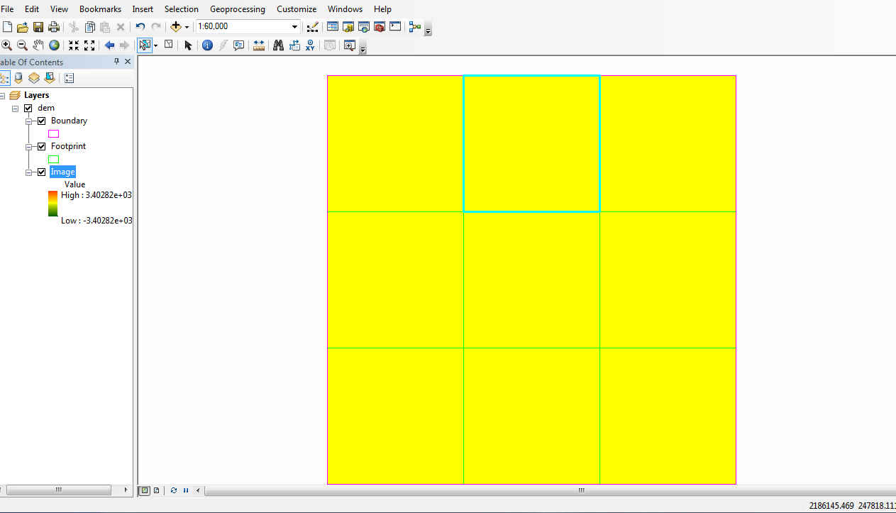
I have 6 dem files that I would like to be able to combine and then use with las file to create an ndsm. I have tried to create a mosaic and my output reveals the boundary and the footprint of the input rasters but there is no content within the boundary. The elevation data is not there.
Am I missing something? I have entered workspace and added the folder and used the sub-folder option. It looks correct except for the data. Thankyou for any help.
Natasha
Solved! Go to Solution.
Accepted Solutions
- Mark as New
- Bookmark
- Subscribe
- Mute
- Subscribe to RSS Feed
- Permalink
- Report Inappropriate Content
curious, what is your elevation range supposed to be since you symbology appears to covers a huge range ( if it is +/3e03) so it might just be a symbology issue. Can you look at the histogram or try a different classification scheme... and I assume that you have accounted for nodata values if they have them.
- Mark as New
- Bookmark
- Subscribe
- Mute
- Subscribe to RSS Feed
- Permalink
- Report Inappropriate Content
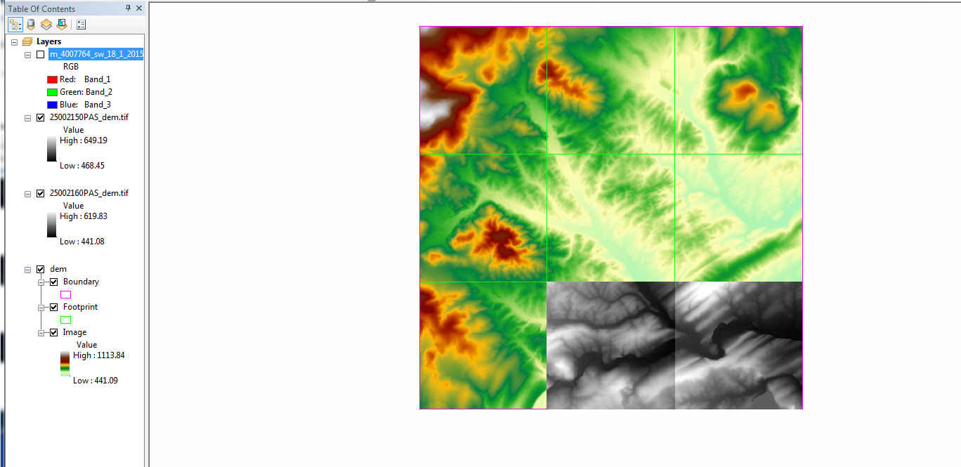
I looked at the histogram and there was none there. When I calculated the histogram using the resampled pixels option the correct range of elevation came up. Thankyou!
I'm making my way through using this elevation data and las data and am new to things so I'm grateful.
- Mark as New
- Bookmark
- Subscribe
- Mute
- Subscribe to RSS Feed
- Permalink
- Report Inappropriate Content
glad it worked Natasha... it is perhaps a good idea to calculate statistics and pyramids if given the chance from the onset. I find a lot of people dont think they are needed, I wish there was check to do this automatically given certain conditions.