- Home
- :
- All Communities
- :
- Products
- :
- Oriented Imagery
- :
- Oriented Imagery Classic
- :
- Re: Oriented Imagery WAB tools - Coverage Polygon
- Subscribe to RSS Feed
- Mark Topic as New
- Mark Topic as Read
- Float this Topic for Current User
- Bookmark
- Subscribe
- Mute
- Printer Friendly Page
Oriented Imagery WAB tools - Coverage Polygon
- Mark as New
- Bookmark
- Subscribe
- Mute
- Subscribe to RSS Feed
- Permalink
- Report Inappropriate Content
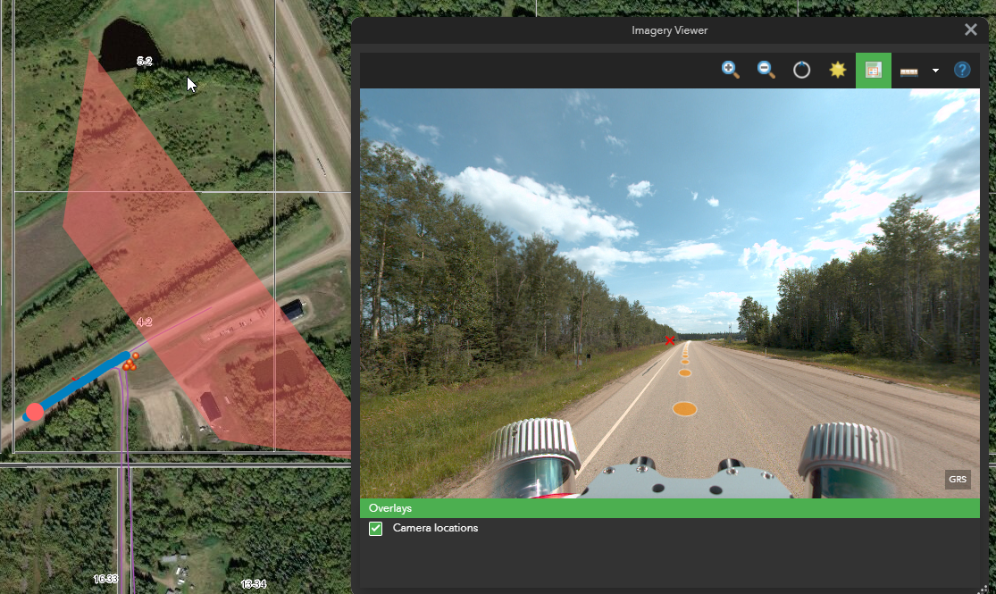
Hi - I'm using the WAB Oriented Imagery Tools and when looking at the coverage graphic in the map, when my 360 is approx level (0 pitch) the coverage area appears to be incorrect, clipped further then an the image centre than it should be.
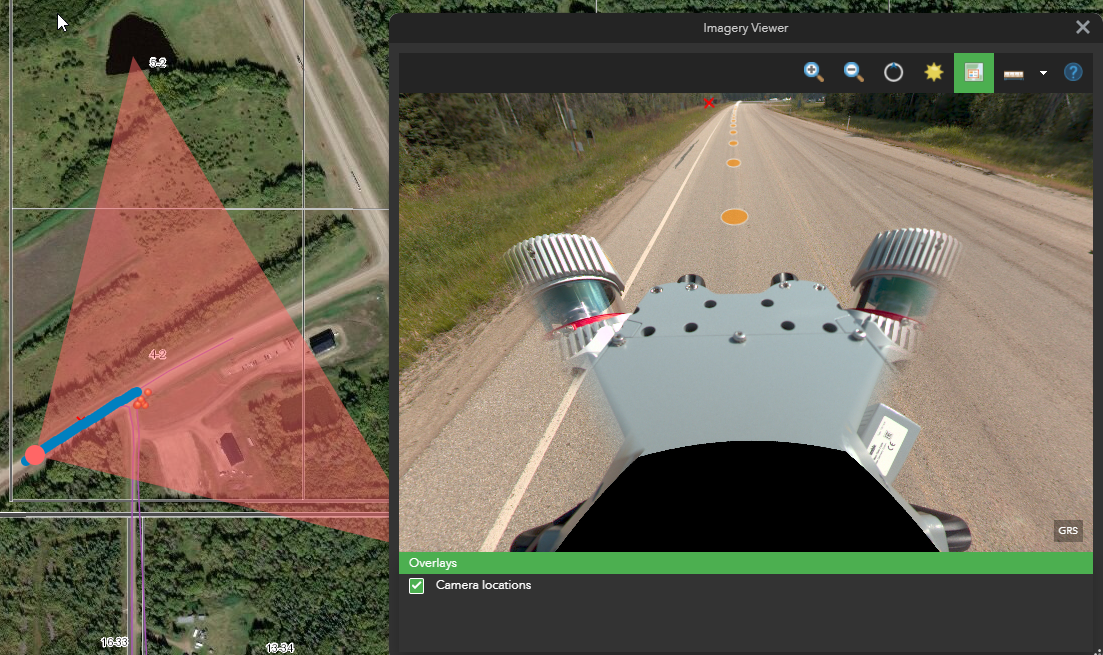
If I tilt the 360 viewer down by approx 40° then the coverage polygon appears as I believe it should in the first instance.
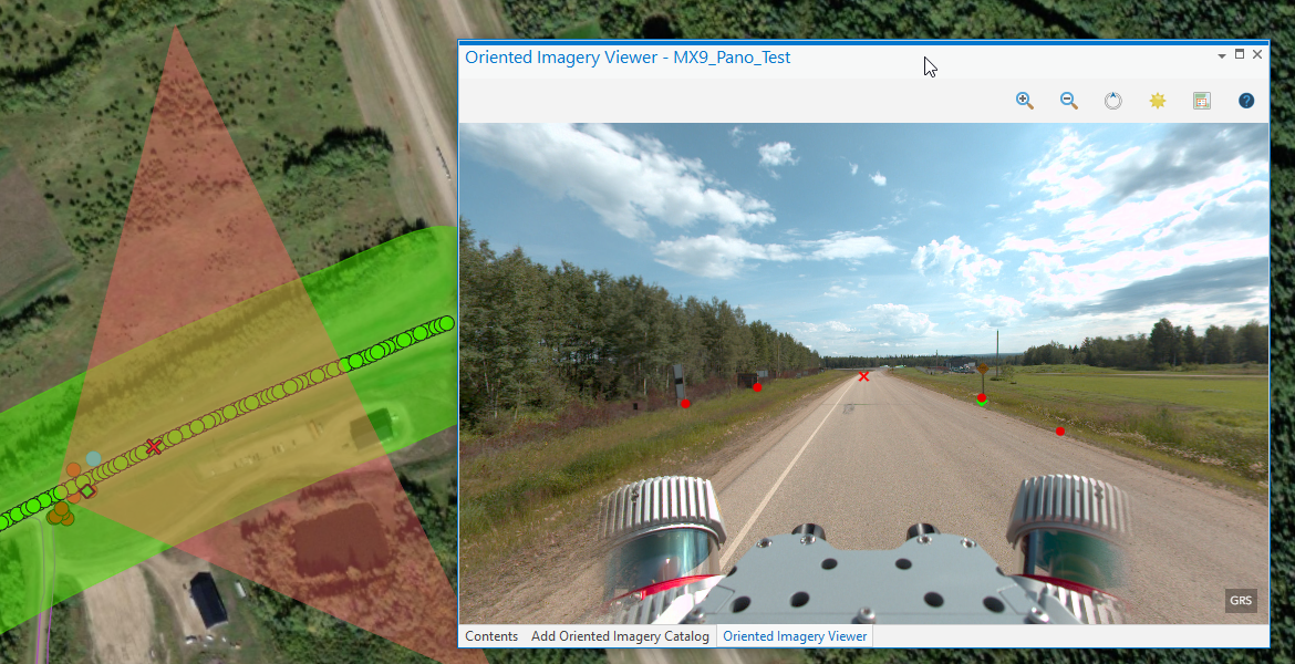
When viewed in the Pro the coverage area is correct when there view is level no pitch (lowest screen capture).
I have accurate pitch values, approx 90° for all images.
I'm wondering is the elevation service in AGOl affecting the camera height in anyway ? or is the WAB OIC widget calcing the coverage incorrectly? or something else?
- Mark as New
- Bookmark
- Subscribe
- Mute
- Subscribe to RSS Feed
- Permalink
- Report Inappropriate Content
Hard to answer this from details provided. Not sure if you have defined a DTM or are using average height above ground. Is it possible that you AvgHtAboveGround is set too large. From the image I would expect about 2.5m. That would be one explanation of why when you are looking directly forward the bottom of the view appears further away. Also check the that HFOV=360 and VFOV=180. (Possibly you have VFOV=90?)
- Mark as New
- Bookmark
- Subscribe
- Mute
- Subscribe to RSS Feed
- Permalink
- Report Inappropriate Content
Hi Peter,
thanks for the reply and apologies for the rushed original email and lack of details. I'll provide a bit more info below about the collection and processed images
- Data Collected with Trimble MX9
- Images loaded to OIC are 360 panos created from the 6 directional cameras and merged into a full equirectangular projection image using LadyBug SDK
- Image metadata take from SBET so accurate position and orientation information
- HFOV = 360 and VFOV=180
- AVgHtAG = 2.5 (Truck mounted)
- When adding Images to OIC no DEM or rendering rules were used

The confusing part, to me, is why the coverage polygons look correct when using the published OIC in Pro (screenshot 3) . But using the exact same published OIC in a 2D web map with the WAB widgets (July release) the coverage polygon appears truncated (screenshot 1).
Only when tilting the 360 image down 40° does the base extend to the exposure point of the image (screenshot 2).
This suggests to me the elevation of the image used in the web map is higher than it really is?
I'm not sure what the affect of the DEM assigned (or not) when adding images to the OIC is and whether may affect things, but again why would it be different in Pro to the AGOL web map?
Thanks,
Dave
- Mark as New
- Bookmark
- Subscribe
- Mute
- Subscribe to RSS Feed
- Permalink
- Report Inappropriate Content
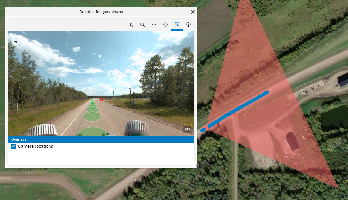
Agreed it is strange. The values in the OIC appear to be correct, else the location point on the road would be wrong. Looks more as if the ImageryViewer is not reading the view angle correct.
I just realized that the viewer you are using looks very old.
Please use the following instead:
2D app : https://oi1.img.arcgis.com/app/index.html
3D app : https://oi1.img.arcgis.com/app3D/index.html
Lets see if this fixes it.
_Peter
- Mark as New
- Bookmark
- Subscribe
- Mute
- Subscribe to RSS Feed
- Permalink
- Report Inappropriate Content
Hi Peter - yes using that app seems to make things appear as expected.
But, is this not a custom app?
I was using the latest WAB OIC widget from the Git page, which looks to have been updated in July.
This WAB widget viewer seems to have a couple of extra tools than than the one from the link above, i.e. the measurement tool. Which made me think the WAB tools were more recent?
We create most of our apps using WAB, so would be good if there's a way to log this as an issue to be updated so we can continue to use it. or get access to a newer widget if i was using an outdated one?
Thanks,
Dave