- Home
- :
- All Communities
- :
- Products
- :
- Imagery and Remote Sensing
- :
- Imagery Questions
- :
- Re: Opening Raster file (.ige extension)
- Subscribe to RSS Feed
- Mark Topic as New
- Mark Topic as Read
- Float this Topic for Current User
- Bookmark
- Subscribe
- Mute
- Printer Friendly Page
Opening Raster file (.ige extension)
- Mark as New
- Bookmark
- Subscribe
- Mute
- Subscribe to RSS Feed
- Permalink
- Report Inappropriate Content
hello, i have a geoeye satellite imagery; I tried to open this file in arcgis and ERDAS imagine without success.
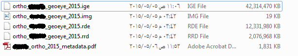
please anyone has any information how can i open this raster? following are the different type of files.
thank you,
- Mark as New
- Bookmark
- Subscribe
- Mute
- Subscribe to RSS Feed
- Permalink
- Report Inappropriate Content
For a single scene, you can simply drag the Raster Product into the map (using ArcMap). Find the Raster Product in ArcCatalog. Help is here What is a raster product?—Help | ArcGIS for Desktop
if you are working with multiple scenes, you'll want to create a Mosaic Dataset (What is a mosaic dataset?—Help | ArcGIS for Desktop ) and then when you add the images, be sure to use the GeoEye Raster Type (Satellite sensor raster types—Help | ArcGIS for Desktop)
- Mark as New
- Bookmark
- Subscribe
- Mute
- Subscribe to RSS Feed
- Permalink
- Report Inappropriate Content
The .ige file is related to the .img file. Once the .img file exceeds 4GB is size it starts a second file is then created (the .ige file).
If, you add the .img file to ArcGIS it will add the .ige file. The .img file contains a pointer to the .ige file.
- Mark as New
- Bookmark
- Subscribe
- Mute
- Subscribe to RSS Feed
- Permalink
- Report Inappropriate Content
Try opening the img file in ArcMap/Erdas Imagine.
Think Location
- Mark as New
- Bookmark
- Subscribe
- Mute
- Subscribe to RSS Feed
- Permalink
- Report Inappropriate Content
hello,
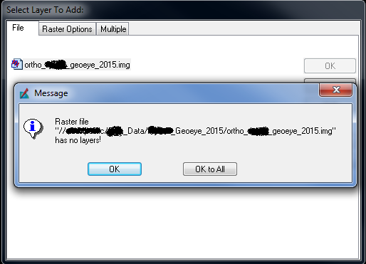
when i am trying to add the .img file in arcmap whether by add file tool or drag and drop from the location folder, i am getting the following error:


and i tried to open it it ERDAS/imagine and i got the following error:
is that mean that the raster is damaged or am i missing something?
is there any role for the PDF the metadata file assigned to the directory of the image?
because this file is damaged when trying to open it.
- Mark as New
- Bookmark
- Subscribe
- Mute
- Subscribe to RSS Feed
- Permalink
- Report Inappropriate Content
Elie
Did you try what I described above? Perhaps I was not clear that the "Raster Product" is something defined by ArcGIS to summarize the entire satellite scene. If you will read our help to understand what the Raster Product is, and then open ArcCatalog and find the Raster Product icon (looks like a raster with satellite on top of it), you can expand the Raster Product (+ sign) to find "multispectral" inside, and drag that into the map.
Either that, or as noted in my original post, learn how to create a mosaic dataset and add the Geoeye scene into it using the GeoEye raster type, then add the mosaic dataset into the map.
Note if you are not finding these options please let us know what version of ArcGIS you are using. I am assuming you have 10.3 or later? If you are using a much older version my advice may not be appropriate
- Mark as New
- Bookmark
- Subscribe
- Mute
- Subscribe to RSS Feed
- Permalink
- Report Inappropriate Content
i am using arcgis 10.1 SP1,
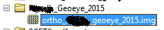
please note that i tried to do the above steps mentioned in your email with no success, noting that when clicking on the + sign to expand the raster file in arccatalog i didn't see any bands for it.and i got the warnings/errors previously highlighted if i try to preview the image in arccatalog.
thank you.
- Mark as New
- Bookmark
- Subscribe
- Mute
- Subscribe to RSS Feed
- Permalink
- Report Inappropriate Content
The data could be corrupt.
Think Location